
Talk:Golan Heights/Archive 12
| This is an archive of past discussions. Do not edit the contents of this page. If you wish to start a new discussion or revive an old one, please do so on the current talk page. |
| Archive 5 | ← | Archive 10 | Archive 11 | Archive 12 | Archive 13 | Archive 14 | Archive 15 |
Ancient faiths embodied in ancient names: or, An attempt to trace the religious belief ... of certain nations
Text from this source was added to the article, the source claims the region means "a circle, or region" from Deut. iv. 43. But Deuteronomy only has chapters to 34:[1] --Supreme Deliciousness (talk) 10:22, 15 September 2010 (UTC)
- SD, that is an interesting observation, I'm not sure what Deut. iv. 43 means. The source is pretty old (1872) and available via Google books. Any thought? AgadaUrbanit (talk) 14:23, 15 September 2010 (UTC)
- I guess the source references Deut. iv:43, Cities of Refuge: The cities were these: Bezer in the desert plateau, for the Reubenites; Ramoth in Gilead, for the Gadites; and Golan in Bashan, for the Manassites. 10x for review. AgadaUrbanit (talk) 14:53, 15 September 2010 (UTC)
- Deut. iv 43 would be Deuteronomy, chapter 4 (Roman numeral IV), line 43. ← George talk 22:18, 15 September 2010 (UTC)
- Ok, so the bible does not say "a circle, or region", it calls it a "citie", which mean that the bible speaks about the ancient city of "Golan" and not the region of the Golan heights/Golan plateau.--Supreme Deliciousness (talk) 23:57, 15 September 2010 (UTC)
- Duality of Golan toponomy as region/city is also reflected by second section ref used. I have not noticed biblical reference at first, thank you for pointing it out, SD. I guess the Deuteronomy is brought by 1st source to justify etymology and not semantics concerns. Deuteronomy does not say Golan means "a circle, or region", it is 1st source original research, however it got published so I guess we should treat it as reliable source. AgadaUrbanit (talk) 08:20, 16 September 2010 (UTC)
- Ok, so the bible does not say "a circle, or region", it calls it a "citie", which mean that the bible speaks about the ancient city of "Golan" and not the region of the Golan heights/Golan plateau.--Supreme Deliciousness (talk) 23:57, 15 September 2010 (UTC)
- Deut. iv 43 would be Deuteronomy, chapter 4 (Roman numeral IV), line 43. ← George talk 22:18, 15 September 2010 (UTC)
The historical area of the Golan Heights bears no impact on who owns the modern day area. This seems to be an attempt to revise history and deny Syria and Syrians their heritage and history. —Preceding unsigned comment added by SyrianKing (talk • contribs) 00:36, 16 September 2010 (UTC)
- Sorry did I understood correctly? You are saying we should not mention the historical area or Biblical times? This seems to be an attempt to revise history and deny Israel and Jewish people their heritage and history. LibiBamizrach (talk) 00:51, 16 September 2010 (UTC)
Many history scholars have written publications questioning the validity of the link between the modern state of Israel (and even modern day jews) and the Hebrews and Israelites of antiquity. So who is rewriting whose history? —Preceding unsigned comment added by SyrianKing (talk • contribs) 01:20, 16 September 2010 (UTC)
- Ignoring the off-topic soapboxing, I'm not sure what relation there is between the city of Golan mentioned in the Bible and the Golan Heights, aside from their names. Reading about the city of Golan, it sounds like it was close to the area of the Golan Heights, but may or may not have been within it. If I had to guess, I would say it was somewhere on the southern edge of the Heights, at a lower elevation, but that's purely my OR. I'd suggest removing mention of it unless some source linking the city of Golan to the Golan Heights can be found. ← George talk 03:43, 16 September 2010 (UTC)
- The Golan article seems to say that they just don't really know where the Biblical city was located exactly.
- Thanks for the protection template, Wgfinley! —Preceding unsigned comment added by Sol Goldstone (talk • contribs) 04:03, 16 September 2010 (UTC)
POV infobox map
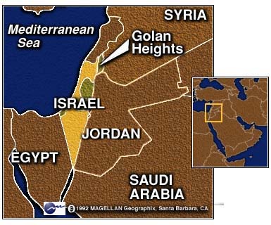
Why does the map have "SYRIA" straddling the Golan area? Chesdovi (talk) 10:21, 27 August 2010 (UTC)
- Why wouldn't a map of region in Syria have the letters "Syria" on it? --Supreme Deliciousness (talk) 10:23, 27 August 2010 (UTC)
- This one would be more appropriate File:Golan heights rel89A.jpg as the area was not part of historic Syira but part of the Palestine Galilee and was usurped by the French who got it in exchange for other land in the region. It has been part of Israel longer than it has been part of Syria. Chesdovi (talk) 10:34, 27 August 2010 (UTC)
- I thought it was explained to you before that the claim "Golan was part of Palestine" is a myth that people unaware of real history repeat. Golan was always part of Syria, before and after the mandates. During the mandates negotiations the Zionist movement pressured the negotiators to get land, so a part of north western Golan which was previously in Syria would have been ceded to the Palestine mandate, in exchange for that this region in northwestern Golan would remain in Syria, the Zionist movement got other lands in Syria, around the sea of Galilee, and other land areas in Syria and in Lebanon. Its not true what you say. Golan was not part of Palestine it was always part of Syria. This map that you link to [2] is a fake map where someone have taken a CIA map and removed the entire world view by removing the name Syria from this region in Syria. So the map is original research and not in accordance with reality. --Supreme Deliciousness (talk) 10:43, 27 August 2010 (UTC)
- And your claim that "It has been part of Israel longer than it has been part of Syria" doesn't make any sense since it has never been part of Israel and it has always been part of Syria and still is today. --Supreme Deliciousness (talk) 10:45, 27 August 2010 (UTC)
- And is Hatay also part of Syria? Before the mandate, the whole of Palestine was part of Syria. Chesdovi (talk) 12:01, 27 August 2010 (UTC)
- The region was called Ottoman Syria, but the Damascus Vilayet that Golan was part of was not part of Palestine. Right before the mandates you can also look at the Sykes-Picot agreement:[3] --Supreme Deliciousness (talk) 12:10, 27 August 2010 (UTC)
- And is Hatay also part of Syria? Before the mandate, the whole of Palestine was part of Syria. Chesdovi (talk) 12:01, 27 August 2010 (UTC)
- This one would be more appropriate File:Golan heights rel89A.jpg as the area was not part of historic Syira but part of the Palestine Galilee and was usurped by the French who got it in exchange for other land in the region. It has been part of Israel longer than it has been part of Syria. Chesdovi (talk) 10:34, 27 August 2010 (UTC)
![[2]](https://en.wikipedia.org/wiki/File:Golan_heights_rel89A.jpg)
![[3]](http://www.dartmouth.edu/~gov46/pal-sykes-picot.gif)
The SPA was a colonial attempt at creating borders. The Golan could have just as easily been put in Lebabon or Palestine. It was later revised and its borders were never defined. What about the Berthelot proposal of 1919? That includes of the Golan into Palestine. What I mean by historcially in Palesine is that the area was ruled in antiquity by those who resided in central Palestine and not by those nations living further north-east. It was part of the Galilee, (the sea does not take its name from just one side of its shore). The Damascus Vilayet has no bearing here as it was an adminastative boundary, as the whole area, including Hatay and Eilat, Beriut and Petra was part of Syria. Chesdovi (talk) 15:29, 27 August 2010 (UTC)
- And what about the Zionist movement who pressured the mandates for land in Lebanon and Syria to the Litani river and Syrian desert? You have no sources to back up anything of what you say, I can show you many sources that GH in history have been part of Syria and not Palestine. But as Nableezy says, all of this doesn't matter about the map in the infobox. --Supreme Deliciousness (talk) 15:46, 27 August 2010 (UTC)
- I dont see how any of that matters. The map is supposed to represent the present status. That specific map comes from the CIA, a RS in map-making and PD as a publication of a US federal agency. The territory is in Syria and occupied by Israel, the map shows exactly that. You wrote that the Golan "has been part of Israel longer than it has been part of Syria." That is simply not true. The Golan is not now, nor has it ever been, a "part" of Israel. It is "occupied" by Israel. nableezy - 15:40, 27 August 2010 (UTC)
- I will not fall back on SD's line of argument which would be "thw CIA map is wrong" and "who says the CIA is reliable, anyone can draw a map." The GH has been controlled by and part of Israel physically longer than it has been by S. The present stauts is OT, not S. Chesdovi (talk) 15:52, 27 August 2010 (UTC)
- No, the present status is occupied Syrian territory. "Occupied territory" implies it is not in Israel. nableezy - 16:08, 27 August 2010 (UTC)
- It not in Israel either. It's status is in limbo, as I explain below. Therefore neither country should have its name in it. Just "Golan Heights (Occupied by Israel)". I just remmebred the new version map has the bracketed info delted, which should be kept. Chesdovi (talk) 16:30, 27 August 2010 (UTC)
- Absolutely not, there is no "limbo", the entire worldview is that its Syrian land occupied by Israel. See the sources I provided above. --Supreme Deliciousness (talk) 16:39, 27 August 2010 (UTC)
- No, sources say it is Syrian territory occupied by Israel. There is no ambiguity as to the status of the Golan. nableezy - 16:31, 27 August 2010 (UTC)
- Well its not part of Syria enogh for its name to be written within the area. Ever noticed why maps always labelled what is occupied Arab Palesinte as "West Bank", and not Palestine. Country lables indicate recognised sovreignty and full control. Syria only has one of these components. Chesdovi (talk) 16:38, 27 August 2010 (UTC)
- Its your pov against the sources who say its Syria. --Supreme Deliciousness (talk) 16:40, 27 August 2010 (UTC)
- Well its not part of Syria enogh for its name to be written within the area. Ever noticed why maps always labelled what is occupied Arab Palesinte as "West Bank", and not Palestine. Country lables indicate recognised sovreignty and full control. Syria only has one of these components. Chesdovi (talk) 16:38, 27 August 2010 (UTC)
- It not in Israel either. It's status is in limbo, as I explain below. Therefore neither country should have its name in it. Just "Golan Heights (Occupied by Israel)". I just remmebred the new version map has the bracketed info delted, which should be kept. Chesdovi (talk) 16:30, 27 August 2010 (UTC)
- No, the present status is occupied Syrian territory. "Occupied territory" implies it is not in Israel. nableezy - 16:08, 27 August 2010 (UTC)
- I will not fall back on SD's line of argument which would be "thw CIA map is wrong" and "who says the CIA is reliable, anyone can draw a map." The GH has been controlled by and part of Israel physically longer than it has been by S. The present stauts is OT, not S. Chesdovi (talk) 15:52, 27 August 2010 (UTC)
"Sources"? We have many sources used on wiki and try to be responsible to provide a neutral balance. Having neither Israel or Syria written within the GH is suitable. Chesdovi (talk) 16:45, 27 August 2010 (UTC)
- Sources say all countries on earth say Golan is Syria, so how is it "suitable" or "balanced" by going against what all countries say? --Supreme Deliciousness (talk) 16:56, 27 August 2010 (UTC)
- No original research here please. Sources provided above say Golan is Syria occupied by Israel, the reliable CIA map also says that, so it will not be replaced with a false, made up map not following sources, npov and reality.--Supreme Deliciousness (talk) 15:55, 27 August 2010 (UTC)
- What about the Zionist movement? The Palestine Arab movment pressured the IC for the WB and Gaza? If you pressure enought you may get. If not, you don't. Only Syrian pressure will get them back the GH. Will it not then be truly theirs? Chesdovi (talk) 15:56, 27 August 2010 (UTC)
- That isnt really relevant. nableezy - 16:08, 27 August 2010 (UTC)
- You’re correct SD. It is Syrian territory. But can any Syrian even enter it? No. How can it "belong" to Syria then? If a farmer owns land over the WB fence and he can't get to it to till it, it is no longer part of his property. He may retain ownership and the "deeds", but it has been stolen and taken away from him. He cannot in truth view it as part of his property, even though he can still call it his, what use is it if he doesn’t control it?
- My iphone was stolen while I was on holiday. It’s still mine, but in the other guys mind, after 35 years, it really is his. I rang the police each year to remind them and they agree if they find the thief, I get it. The thief is found and he’s remodeled it, added thousands of apps and racially changed is so much it I don’t even recognise it. If he returns it, he will feel like he’s giving away something that belongs to him. Over the years I ‘’owned’’ it but it did not belong to me. It belonged to the thief, but he did not own it. The iphone is in a state of flux. Sure the law will dictate I get it. But in the interim, who’s is it?
- The Temple Mount is owned by the Jews. It is occupied by Muslims. Jews may own it, but in reality Jews can not extend their authority over it. Is it theirs? Yes! Can they include it within the Jewish quarter on maps? No! On the other hand, including the TM within the Muslim quarter would be like have the word “Israel” in the Golan, just because Israel extends its authority over it. NPOV maps show the TM as a separate entity, belonging to neither the JQ or MQ. I hope you're getting the hang of this. Chesdovi (talk) 16:22, 27 August 2010 (UTC)
- This is not a forum. Your personal opinion doesn't matter. And btw, a Palestinian farmer who owns land on the other side of the confiscation wall is still the owner of that land, and its his property. --Supreme Deliciousness (talk) 16:33, 27 August 2010 (UTC)
- Well in that case neither does your personal opinon or that of anyone else, CIA or not, matter, and I will proceed to change the map. Chesdovi (talk) 16:42, 27 August 2010 (UTC)
- Its not my personal opinion, its the entire worlds as shown through the sources. Do you have consensus for the change? --Supreme Deliciousness (talk) 16:56, 27 August 2010 (UTC)
- That map is there because it comes from a RS and has been in the article for over a year. If you want to change it you need to gain a consensus for doing so. nableezy - 16:53, 27 August 2010 (UTC)
- Well in that case neither does your personal opinon or that of anyone else, CIA or not, matter, and I will proceed to change the map. Chesdovi (talk) 16:42, 27 August 2010 (UTC)
- This is not a forum. Your personal opinion doesn't matter. And btw, a Palestinian farmer who owns land on the other side of the confiscation wall is still the owner of that land, and its his property. --Supreme Deliciousness (talk) 16:33, 27 August 2010 (UTC)
- The Temple Mount is owned by the Jews. It is occupied by Muslims. Jews may own it, but in reality Jews can not extend their authority over it. Is it theirs? Yes! Can they include it within the Jewish quarter on maps? No! On the other hand, including the TM within the Muslim quarter would be like have the word “Israel” in the Golan, just because Israel extends its authority over it. NPOV maps show the TM as a separate entity, belonging to neither the JQ or MQ. I hope you're getting the hang of this. Chesdovi (talk) 16:22, 27 August 2010 (UTC)
- As Israel is the de facto governing entity of the Golan Heights, a map giving the impression that Syria is the governing entity of the Golan does a disservice to the readers and will give them the wrong information. Remember, we are here to give the readers the information they want, not to create our own wikiality.--brewcrewer (yada, yada) 17:01, 27 August 2010 (UTC)
- The map does not give that impression, it explicitly says that Israel occupies the territory. nableezy - 17:05, 27 August 2010 (UTC)
- brewcrewer, what nableezy says is true, look at the map [4] right below Golan Heights it says "(Israeli occupied)" --Supreme Deliciousness (talk) 17:08, 27 August 2010 (UTC)
- its in small letters, far smaller then the huge Syria lettering. thus, it does little to remove the potential false implication a reader will come away with. Chesdovi's map, is far better because it does not mislead the reader. --brewcrewer (yada, yada) 17:28, 27 August 2010 (UTC)
- It would only be misleading if the Golan Heights weren't part of Syria nor occupied by Israel. Sol Goldstone (talk) 17:44, 27 August 2010 (UTC)
- i dont care about this POV. i'm not interested in sacrificing information to advance my pov wikireality. the fact is Israel is the governing entity and changing the map to the hugely lettered SYRIA will undoubtedly mislead readers to assuming that Syria is the de facto governing entity.--brewcrewer (yada, yada) 17:51, 27 August 2010 (UTC)
- Well if you don't care about the pov of the entire world you should maybe read: npov, especially this section about Due and undue weight. We haven't changed the map, the real one following npov is in the article right now and its not misleading readers, it is following the sources I posted above, the entire worldview that its Syrian territory occupied by Israel, so everyone can clearly see that Israel is controlling it. So no one is mislead. --Supreme Deliciousness (talk) 18:02, 27 August 2010 (UTC)
- I didn't say I don't care about the "pov of the entire world", or whatever that means. What I did say, and it's clear if you read the entire statement, is that it should be more important to us as editors to ensure that our POV-advancing edits do not do a disservice to the readers by misleading them.--brewcrewer (yada, yada) 18:10, 27 August 2010 (UTC)
- So what you are saying is that we are doing: "disservice to the readers by misleading them" by having a reliable map released by the CIA following the entire worldview. And to fix this "misleading and disservice" we should replace the map with a home made map not following the entire worldview. --Supreme Deliciousness (talk) 10:13, 28 August 2010 (UTC)
- I didn't say I don't care about the "pov of the entire world", or whatever that means. What I did say, and it's clear if you read the entire statement, is that it should be more important to us as editors to ensure that our POV-advancing edits do not do a disservice to the readers by misleading them.--brewcrewer (yada, yada) 18:10, 27 August 2010 (UTC)
- Although I'm encouraged to see people making efforts to avoid misleading the readers about the Golan Heights, and there is much work to be done there in other articles, in this case there isn't any misleading. The map is fine. It's from the CIA. We are lucky to have it. Sean.hoyland - talk 18:07, 27 August 2010 (UTC)
- Please explain why it is better then the other map and please explain why it is less misleading about the nature of the de facto governing entity in the Golan. I'm sorry, but just saying "it's fine" doesn't really get us anywhere.--brewcrewer (yada, yada) 18:13, 27 August 2010 (UTC)
- Because it's produced by the CIA rather than you. Sean.hoyland - talk 18:18, 27 August 2010 (UTC)
- I'm not producing any maps. Please discuss the points raised and cease making strawman arguments, or you may come across as disruptive. --brewcrewer (yada, yada) 18:23, 27 August 2010 (UTC)
- Strawman argument, that it's from an RS ? I think not. You haven't raised any points worth discussing. That is the point. That is usually the point in these discussions. We have a map. It's fit for purpose. It's produced by a reliable source. It shows the features that the reliable source decided to show. We can go with what the reliable source thinks is important or we can pretend that you are a reliable source and go with your views instead. Yes, I'm disruptive all over the place pushing reliably sourced material and such like. Shocking behavior. Sean.hoyland - talk 19:26, 27 August 2010 (UTC)
- Yes, you are creating a strawman argument by claiming that the CIA map is RS. That's because I never said that it was not a RS. By claiming that I "haven't raised any points worth discussing" you're moving from logical fallacies to WP:IDIDNOTHEARTHAT.
- If you ever choose to respond on point, please explain why a map with huge letter of SYRIA placed over the Golan Heights area will not confuse the reader into assuming that Syria is the de facto governing entity any more then a map without the huge SYRIA at the Golan Heights area.--brewcrewer (yada, yada) 22:09, 27 August 2010 (UTC)
- Ok.
- Occupied territory is still part of the country that holds title to it. See any international law source you desire. How about the GC? If occupied territory were no longer a part of the nation it is occupied from then we can consider an article on "NATO-istan".
- Israel put Golan under civilian authority in 1981 but claimed it wasn't an annexation. The international community rejected the law's validity and insist the territory is occupied.
- Even if you accept the validity of the Golan Heights law and Begin's claim that it wasn't an annexation, it's still part of Syria. Until it's annexed it is Syrian.
- In matters of annexation, international recognition determines a claim's validity. So even if you hold the non-government view that the Golan Heights has been legal annexed, the map you champion would only be valid by the standards of Micronesia and Israel.
- I'm not going to bother relinking the sources which have been covered in minute detail above. The unedited CIA map is correct. Sol Goldstone (talk) 18:47, 27 August 2010 (UTC)
- Israel is a horrible terrible occupying annexing thieving colonial country. But that's irrelevant for this issue. The point is that Israel is the de facto governing entity on the Golan Heights and by placing a map with huge letters SYRIA on the Golan Heights you are misleading readers into assuming that Syria is the de facto governing entity.--brewcrewer (yada, yada) 22:21, 27 August 2010 (UTC)
- Except that the map also says "Occupied by Israel". If it didn't I'd get where you are coming from on this. Since it does and maps show internationally recognized boundaries and not de facto governors I don't think anyone is being mislead. Sol Goldstone (talk) 02:09, 28 August 2010 (UTC)
- This seems to be more of the same in this topic area. "IT IS OCCUPIED!!!" "BUT IT FUNCTIONS AS ISRAELI!" "BLLLAAARGH!" The argument is getting old. I haven't had the chance to read the full discussion but has anyone tried seeing what most sources do? It shouldn't be that hard to find maps in other encyclopedias and tertiary sources. If it were up to me I would return to the old mp but simply fill in the dashed line between Israel and the area. The dispute is simply too complicated to handle in such an image so the reader will just have to read the article.Cptnono (talk) 02:19, 28 August 2010 (UTC)
- I'm pretty sure wikipedia rules say we should follow the reliable sources and not do what "if it was up to me" --Supreme Deliciousness (talk) 09:51, 28 August 2010 (UTC)
And what wikipedia rule was followed to alter the map in the first place? Maybe it should simply go back to how it was presented in the source originally.Oh disregard. I was not aware that the CIA version was the one being used. I was under the impression that ir was modified. I'm fine with it as is if that source did it like that. If multiple tertiary sources show versions without going into detail on the occupation then it should be reconsidered but the source used is good enough in this application.Cptnono (talk) 11:57, 28 August 2010 (UTC)
- I'm pretty sure wikipedia rules say we should follow the reliable sources and not do what "if it was up to me" --Supreme Deliciousness (talk) 09:51, 28 August 2010 (UTC)
- This seems to be more of the same in this topic area. "IT IS OCCUPIED!!!" "BUT IT FUNCTIONS AS ISRAELI!" "BLLLAAARGH!" The argument is getting old. I haven't had the chance to read the full discussion but has anyone tried seeing what most sources do? It shouldn't be that hard to find maps in other encyclopedias and tertiary sources. If it were up to me I would return to the old mp but simply fill in the dashed line between Israel and the area. The dispute is simply too complicated to handle in such an image so the reader will just have to read the article.Cptnono (talk) 02:19, 28 August 2010 (UTC)
- Except that the map also says "Occupied by Israel". If it didn't I'd get where you are coming from on this. Since it does and maps show internationally recognized boundaries and not de facto governors I don't think anyone is being mislead. Sol Goldstone (talk) 02:09, 28 August 2010 (UTC)
- Israel is a horrible terrible occupying annexing thieving colonial country. But that's irrelevant for this issue. The point is that Israel is the de facto governing entity on the Golan Heights and by placing a map with huge letters SYRIA on the Golan Heights you are misleading readers into assuming that Syria is the de facto governing entity.--brewcrewer (yada, yada) 22:21, 27 August 2010 (UTC)
- Strawman argument, that it's from an RS ? I think not. You haven't raised any points worth discussing. That is the point. That is usually the point in these discussions. We have a map. It's fit for purpose. It's produced by a reliable source. It shows the features that the reliable source decided to show. We can go with what the reliable source thinks is important or we can pretend that you are a reliable source and go with your views instead. Yes, I'm disruptive all over the place pushing reliably sourced material and such like. Shocking behavior. Sean.hoyland - talk 19:26, 27 August 2010 (UTC)
- I'm not producing any maps. Please discuss the points raised and cease making strawman arguments, or you may come across as disruptive. --brewcrewer (yada, yada) 18:23, 27 August 2010 (UTC)
- Because it's produced by the CIA rather than you. Sean.hoyland - talk 18:18, 27 August 2010 (UTC)
- Please explain why it is better then the other map and please explain why it is less misleading about the nature of the de facto governing entity in the Golan. I'm sorry, but just saying "it's fine" doesn't really get us anywhere.--brewcrewer (yada, yada) 18:13, 27 August 2010 (UTC)
- Well if you don't care about the pov of the entire world you should maybe read: npov, especially this section about Due and undue weight. We haven't changed the map, the real one following npov is in the article right now and its not misleading readers, it is following the sources I posted above, the entire worldview that its Syrian territory occupied by Israel, so everyone can clearly see that Israel is controlling it. So no one is mislead. --Supreme Deliciousness (talk) 18:02, 27 August 2010 (UTC)
- i dont care about this POV. i'm not interested in sacrificing information to advance my pov wikireality. the fact is Israel is the governing entity and changing the map to the hugely lettered SYRIA will undoubtedly mislead readers to assuming that Syria is the de facto governing entity.--brewcrewer (yada, yada) 17:51, 27 August 2010 (UTC)
- It would only be misleading if the Golan Heights weren't part of Syria nor occupied by Israel. Sol Goldstone (talk) 17:44, 27 August 2010 (UTC)
- its in small letters, far smaller then the huge Syria lettering. thus, it does little to remove the potential false implication a reader will come away with. Chesdovi's map, is far better because it does not mislead the reader. --brewcrewer (yada, yada) 17:28, 27 August 2010 (UTC)
- brewcrewer, what nableezy says is true, look at the map [4] right below Golan Heights it says "(Israeli occupied)" --Supreme Deliciousness (talk) 17:08, 27 August 2010 (UTC)
- The map does not give that impression, it explicitly says that Israel occupies the territory. nableezy - 17:05, 27 August 2010 (UTC)
![[4]](https://upload.wikimedia.org/wikipedia/commons/b/ba/Golan_Heights_proportion_map.jpg)
Why not use a map along the lines of the UN versions [5] & http://www.un.org/Depts/Cartographic/map/dpko/undof.pdf]. All must agree, notwithstanding the notion that the GH's are Syrian territory, the map should not show the word Syria within the region as doing so would not be accurate. We should remember that using the word "reliable source" here in regard to maps is a bit problematic as all such maps (CIA & UN) state they are not authoritative. Chesdovi (talk) 23:42, 28 August 2010 (UTC)
- Neither of the maps you showed are specifically focused on Golan and its delineation. The first map you provided is map of Israel, and its a big map showing several countries, so of course there is no reason to put the name "Syria" in the extreme southwestern corner of Syria, but that same map show Golan as within Syria's boundaries, not Israels and not in "limbo". The second map is a UNDOF Deployment map, its purpose is to show where soldiers are stationed. And in this conflict, only Syria is shown in that map, not Israel, so there is no reason to put Syria right over the ceasefire line to the left of the image, but here is another UN UNIFIL map of the greater region showing both Israel and Syria and it shows the name "Syria" in Golan Heights. This is a UN map of Syria, and it shows Golan as part of Syria, not Israel, and not in "limbo". Here is a BBC map specifically focused on the Golan Heights and its delineation and it is pointing out the internationally recognized borders around Golan and it shows Syria over Golan, several CIA maps [6][7] are also specifically focused on the Golan and its delineation and that's also why they have "Syria" on Golan. All other reliable official maps of the region either show the name "Syria" on Golan and/or show Golan within Syria boundaries and/or has Golan in the same color as the rest of Syria. Can you please explain what you mean by: "the map should not show the word Syria within the region as doing so would not be accurate."? There is no problem with talking about reliable sources in regards to maps. The original CIA map follows the entire worldview, you cant get more neutral and accurate then that. --Supreme Deliciousness (talk) 01:18, 29 August 2010 (UTC)
- I can't see a good reason not to use the CIA map. It's correct. It may not be palatable to everyone's political agenda but no such map exists. Sol Goldstone (talk) 04:57, 29 August 2010 (UTC)
![[6]](http://www.lib.utexas.edu/maps/middle_east_and_asia/golan_92.jpg)
![[7]](https://upload.wikimedia.org/wikipedia/commons/1/12/Golan_heights_rel89-orig.jpg)
I hope you don't mind me interrupting in this discussion. Here are some maps you could use as sources. None of them puts "Syria" over the Golan Heights: [8] [9] [10] [11] [12] (this one is an Arab-Palestinian website), [13] (a well-known British newspaper), [14] [15] [16] There are more. Generally speaking, only sites that have somekind of political view (e.g. sites of governments, political organizations etc.) write either "Syria" or "Israel" accross the Golan Heights. Nearly all other sites simply write "Golan Heights". 79.177.31.250 (talk) 07:02, 29 August 2010 (UTC)
![[8]](http://www.habeeb.com/images/lebanon.photos/maps.of.lebanon/golan.heights.map.gif)
![[9]](http://israelipalestinian.procon.org/files/IsPal%20Images/golanheights.jpg)
![[10]](http://www.maroth.nl/Golan3.jpg)
![[11]](http://www.bicom.org.uk/images/maps/Israel%20Today4.JPG)
![[12]](http://www.passia.org/palestine_facts/MAPS/newpdf/Occupied-Golan.gif)
![[13]](http://i.telegraph.co.uk/telegraph/multimedia/archive/00627/news-graphics-2006-_627299a.gif)
![[14]](http://www.mideastweb.org/rossmap_10_golan_heights_border_area.jpg)
![[15]](http://www.theepochtimes.com/n2/images/stories/large/2009/02/25/Golan_heights_rel89B.jpg)
![[16]](http://joshualandis.com/blog/wp-content/uploads/g_map-1.jpg)
I was looking at the infobox, and found some other data that are not in line with reliable sources. I reckon the Washington Post is considered rather reliable and neutral. Look at these articles: [17] [18] [19] [20], none of them suggest that the Golan is Syrian. Here is a site about wineries around the world which places the Golan in Israel [21](this is not an Israeli site), This is another interesting page that explains why the Golan is disputed, but does not suggest it is Syrian - [22], this book, by Mitchell G Bard, describes the Middle East wars and disputes in details, but does not suggest the Golan is Syrian [23] The author is Jewish, but I don't think his opionion does not count because of that, and he is expert on Middle East and American policy. —Preceding unsigned comment added by 79.177.31.250 (talk) 07:39, 29 August 2010 (UTC)
- Agree with Dovi, we're not compelled to put SYRIA over Golan Heights on this article infobox map. Some sources do it, nevertheless others don't. It is not a brainer. AgadaUrbanit (talk) 05:57, 1 September 2010 (UTC)
- That's nice. This map comes from a reliable source and is free use. Can you explain why the objections of a few random people on the internet have any impact at all on what map an encyclopedia should use? And have you noticed that the map the Encyclopedia Britannica uses (this) also says "Syria" over the region and "Israeli-occupied"? nableezy - 15:11, 1 September 2010 (UTC)
- The britannica does not seem to consider the 1949 armistice line as the international border. Why they have then gone ahead and put "Syria" within the Golan evades me. Chesdovi (talk) 16:37, 1 September 2010 (UTC)
- The current map in the info box does not reflect reality and is in fact deeply misleading. The reality is that Israel controlls and administers the Golan. The Golan was annexed in 1981 and Israeli civilian law applies. All residents of the Golan, including those who formerly belonged to Syria, are entitled to Israeli citizenship. There are numerous maps from RSs that show Israel and Syria that depict the Golan as belonging to neither country and that's the best compromise. See [24][25][26]--Jiujitsuguy (talk) 16:28, 1 September 2010 (UTC)
- How is the CIA map not reflecting reality and how is it misleading when it is internationally recognized as part of Syria occupied by Israel? What RS maps show Golan as not part of Syria? --Supreme Deliciousness (talk) 16:50, 1 September 2010 (UTC)
- By the power of Greyskull, this has gotten out of hand. Golan isn't part of Israel. It's occupied by Israel. These are not the same things. If occupied countries were shown as parts of the occupier on maps then the US was the biggest country in the Middle East for most of the past decade. Sol Goldstone (talk) 16:53, 1 September 2010 (UTC)
- How is the CIA map not reflecting reality and how is it misleading when it is internationally recognized as part of Syria occupied by Israel? What RS maps show Golan as not part of Syria? --Supreme Deliciousness (talk) 16:50, 1 September 2010 (UTC)
- The current map in the info box does not reflect reality and is in fact deeply misleading. The reality is that Israel controlls and administers the Golan. The Golan was annexed in 1981 and Israeli civilian law applies. All residents of the Golan, including those who formerly belonged to Syria, are entitled to Israeli citizenship. There are numerous maps from RSs that show Israel and Syria that depict the Golan as belonging to neither country and that's the best compromise. See [24][25][26]--Jiujitsuguy (talk) 16:28, 1 September 2010 (UTC)
- The britannica does not seem to consider the 1949 armistice line as the international border. Why they have then gone ahead and put "Syria" within the Golan evades me. Chesdovi (talk) 16:37, 1 September 2010 (UTC)
- That's nice. This map comes from a reliable source and is free use. Can you explain why the objections of a few random people on the internet have any impact at all on what map an encyclopedia should use? And have you noticed that the map the Encyclopedia Britannica uses (this) also says "Syria" over the region and "Israeli-occupied"? nableezy - 15:11, 1 September 2010 (UTC)
![[24]](https://commons.wikimedia.org/wiki/File:Israel_map-B85.png)
![[25]](https://commons.wikimedia.org/wiki/File:Golanh%C3%B8yden.PNG)
![[26]](https://commons.wikimedia.org/wiki/File:Shebaa_Farms.jpg)
The map can easily be shown this way [27] with the Golan sqarely in Israel. That's my POV but I recognize that I have to deal with the community so In the interest and spirit of compromise, I would accept this version [28]--Jiujitsuguy (talk) 17:44, 1 September 2010 (UTC)
![[27]](https://commons.wikimedia.org/wiki/File:ISR-HW98small.jpg)
![[28]](https://commons.wikimedia.org/wiki/File:Golan_heights_rel89B.jpg)
- Both those two maps are modified from the original one. --Supreme Deliciousness (talk) 18:08, 1 September 2010 (UTC)
- I am unsure why there is no compromise from the "Syrian" side. Chesdovi (talk) 17:47, 1 September 2010 (UTC)
- There is no "Syrian side" here, I'm a part of the neutral side, why would we want to compromise with neutrality? The worldview? --Supreme Deliciousness (talk) 18:16, 1 September 2010 (UTC)
- Actually this map was taken from the CIA fact book and shows the Golan as neither Syrian nor Israeli. This conclusively demonstrates that the current depiction, placing the Golan in Syria, is pure POV in the extreme--Jiujitsuguy (talk) 17:52, 1 September 2010 (UTC)
- Thats a map of Israel, and it doesn't show Golan as part of Israel. Here is a CIA map of Syria from the same source and it shows Golan as part of Syria [29] CIA maps specially focused on Golan:[30][31]. Please do not start an edit war, you know you have no consensus for the change. --Supreme Deliciousness (talk) 18:08, 1 September 2010 (UTC)
- Jiujitsuguy's argument against it has already been eviscerated many times above. I am not a Syrian-government fan but I am fond of good facts in a very confusing matter. The current map reflects the international consensus (with one abstainer) on the situation. Golan is part of Syria. It is occupied. There's no coherent reason for not using it. Political opposition to Syrian ownership isn't a good reason. Maps that reflect the way we wish the world were or sacrifice accuracy to avoid reality aren't helping anyone better understand the subject. Sol Goldstone (talk) 19:50, 1 September 2010 (UTC)
- Sol, we are not here to determine Golan ownership, just merely to agree on how to style this Wikipedia article. I personally do not know who is rightful owner and it is irrelevant. And it is a common knowledge that info boxes should burn in hell. Let's keep things in proper prospective. I just started following this article and so far I think it is pretty good. My notability research produced this apolitical map. It hits #1 image at Google for Golan Heights query and originally it was referenced by neutral secondary source. CIA map we use now ranked #2, referenced by UTexas Israel Maps/Israeli Settlements Collection. #3 is an Israeli Golan Settlements source
- I kinda liked #1 design and luckily for us #4 #4 is appropriately licensed Wiki map. I like it. Maybe some skillful contributor may use it as base inserting the area map upper-right corner. Maybe we even dare and copy 3-color design, transforming word mantras into color coding. We could and we are wordy in the body. AgadaUrbanit (talk) 13:16, 2 September 2010 (UTC)
- Sol is not determining "ownership" of Golan, we follow the sources. The worldview is that its Syrian land occupied by Israel. And I have provided many reliable sources above that shows this. You want to change what reliable sources say, so who is the one who is determining/changing "ownership" of the region? The first map you link to is a small undetailed map published in "topnews.in" by an Israeli in Tel Aviv. Its a low quality map. The name "Lebanon" isn't even in the map, does that mean Lebanon doesn't exist? And it shows the greater region, so why would the name "Syria" be put in the extreme southwest of Syria? The third one is a webpage from an Israeli settlement advocacy for occupation of Golan website, do I really have to explain why its not a reliable source? The fourth map from the CIA is undetailed, and it also shows the greater region, so why would the name "Syria" be put in the extreme southwest of Syria? and as you can see, it puts Golan in Syria's borders. As I said before: "All other reliable official maps of the region either show the name "Syria" on Golan and/or show Golan within Syria boundaries and/or has Golan in the same color as the rest of Syria." --Supreme Deliciousness (talk) 15:55, 2 September 2010 (UTC)
- SD, there is also this map, based on UN data, I've spotted in Peace process in the Israeli–Palestinian conflict. The
internationalboundary of former Palestinian mandate and armistice demarcation line clearly passes between Golan and Israel and not between Golan and Syria.No misunderstanding there.Is there UN defined Israel-Syria blue line? And UN peace keeping forces are clearly visible, which is also plus. Would it be acceptable as base for new infobox image? AgadaUrbanit (talk) 22:16, 2 September 2010 (UTC)- You keep on repeating the same things that has already been discussed over and over. Chesdovi already brought almost the exact same map here, its a map of Israel just like yours is a map of Israel, and that map of Israel you brought (that also shows Golan as part of Syria) is a modified map based on the exact same map as Chesdovi brought, look here [32] "(Original text : http://www.un.org/Depts/Cartographic/map/profile/israel.pdf (heavily modified))" So this is the original map that the one you brought is modified from: [33] and its a UN map of Israel showing Golan within Syrias borders, it also shows the greater region, there is no reason for that map to have huge letters "Syrian Arab Republic" in the extreme southwest of Syria. Here is a UN map of Syria:[34], what does it show? --Supreme Deliciousness (talk) 22:55, 2 September 2010 (UTC)
- Now we're all in sync on UN original. It is really good. Enough of imperialistic CIA POV pushing. And I hope none argues that Wikipedia is tertiary source and not elementary school text book. AgadaUrbanit (talk) 07:38, 3 September 2010 (UTC)
- You keep on repeating the same things that has already been discussed over and over. Chesdovi already brought almost the exact same map here, its a map of Israel just like yours is a map of Israel, and that map of Israel you brought (that also shows Golan as part of Syria) is a modified map based on the exact same map as Chesdovi brought, look here [32] "(Original text : http://www.un.org/Depts/Cartographic/map/profile/israel.pdf (heavily modified))" So this is the original map that the one you brought is modified from: [33] and its a UN map of Israel showing Golan within Syrias borders, it also shows the greater region, there is no reason for that map to have huge letters "Syrian Arab Republic" in the extreme southwest of Syria. Here is a UN map of Syria:[34], what does it show? --Supreme Deliciousness (talk) 22:55, 2 September 2010 (UTC)
- I admire your dedication to compromise, Agada, but all of map options so far sacrifice accuracy and detail for . . .for what exactly? As SD said, this isn't something we are deciding. The current map shows the area in good detail, denotes the boundary of the disputed territory clearly, assigns it to the internationally recognized country while acknowledging its irregular political status. Great. I don't think your proposed map is a good idea as, amongst other things, it has no Syria-Israel border which really doesn't make much sense, it's not even partisan, just bizarre. Sol Goldstone (talk) 23:02, 2 September 2010 (UTC)
- I beg to differ on accuracy. Last map, imho, is more informative defining different types of "lines" and UN presence, which can not be ignored. These are not details. Unlike imperialistic CIA last map reflects international UN. But that just "my vote". I'm going to shut up now and let others to talk. AgadaUrbanit (talk) 00:03, 3 September 2010 (UTC)
- That is a map of Israel, not a map of the Golan. And the original map from the UN (here) clearly shows the Golan as in Syria. But the map is a map of Israel and does not belong here. nableezy - 01:39, 3 September 2010 (UTC)
- CIA map is referenced by UTexas Israel Maps/Israeli Settlements Collection. I can not see any reason to push CIA map at this point. AgadaUrbanit (talk) 07:38, 3 September 2010 (UTC)
- That is a map of Israel, not a map of the Golan. And the original map from the UN (here) clearly shows the Golan as in Syria. But the map is a map of Israel and does not belong here. nableezy - 01:39, 3 September 2010 (UTC)
- I beg to differ on accuracy. Last map, imho, is more informative defining different types of "lines" and UN presence, which can not be ignored. These are not details. Unlike imperialistic CIA last map reflects international UN. But that just "my vote". I'm going to shut up now and let others to talk. AgadaUrbanit (talk) 00:03, 3 September 2010 (UTC)
- SD, there is also this map, based on UN data, I've spotted in Peace process in the Israeli–Palestinian conflict. The
- Sol is not determining "ownership" of Golan, we follow the sources. The worldview is that its Syrian land occupied by Israel. And I have provided many reliable sources above that shows this. You want to change what reliable sources say, so who is the one who is determining/changing "ownership" of the region? The first map you link to is a small undetailed map published in "topnews.in" by an Israeli in Tel Aviv. Its a low quality map. The name "Lebanon" isn't even in the map, does that mean Lebanon doesn't exist? And it shows the greater region, so why would the name "Syria" be put in the extreme southwest of Syria? The third one is a webpage from an Israeli settlement advocacy for occupation of Golan website, do I really have to explain why its not a reliable source? The fourth map from the CIA is undetailed, and it also shows the greater region, so why would the name "Syria" be put in the extreme southwest of Syria? and as you can see, it puts Golan in Syria's borders. As I said before: "All other reliable official maps of the region either show the name "Syria" on Golan and/or show Golan within Syria boundaries and/or has Golan in the same color as the rest of Syria." --Supreme Deliciousness (talk) 15:55, 2 September 2010 (UTC)
- Jiujitsuguy's argument against it has already been eviscerated many times above. I am not a Syrian-government fan but I am fond of good facts in a very confusing matter. The current map reflects the international consensus (with one abstainer) on the situation. Golan is part of Syria. It is occupied. There's no coherent reason for not using it. Political opposition to Syrian ownership isn't a good reason. Maps that reflect the way we wish the world were or sacrifice accuracy to avoid reality aren't helping anyone better understand the subject. Sol Goldstone (talk) 19:50, 1 September 2010 (UTC)
- Thats a map of Israel, and it doesn't show Golan as part of Israel. Here is a CIA map of Syria from the same source and it shows Golan as part of Syria [29] CIA maps specially focused on Golan:[30][31]. Please do not start an edit war, you know you have no consensus for the change. --Supreme Deliciousness (talk) 18:08, 1 September 2010 (UTC)
![[29]](https://www.cia.gov/library/publications/the-world-factbook/graphics/maps/large/sy-map.gif)
Clearly support Nab's provided UN map original pointed by Nab & SD, (here), as base for infobox image. Enough of CIA POV pushing. Maybe some skillful contributor could make zoom-in & crop on Golan and provide explanation for '- - -' '-.-.-' and '-..-..-' Golan boundaries/lines with all respective neighbors/owners: Syria, Israel, Lebanon and Jordan. UN positions and zoom-out on region could be also helpful. AgadaUrbanit (talk) 06:54, 3 September 2010 (UTC)
- You are not only misrepresenting what nablezzy said, but you did not reply to my post earlier explaining the UN map of Israel, and what it shows, and why it cant be used for removing the name "Syria" over Golan, [35]. It bascically shows the exact same thing as the CIA map, both are representing the entire worldview. If you want to create a homemade Golan map based on the Israel UN map, then you will end up with the name "Syria" over Golan, because that is what the Israel UN map says. --Supreme Deliciousness (talk) 08:42, 3 September 2010 (UTC)
- SD, I'm considering supporting full independence of Golan at this stage, at least from infoboxes. I'm starting to style a new flag, probably I will edit my user page accordingly. ;) AgadaUrbanit (talk) 09:10, 3 September 2010 (UTC)
- You are not only misrepresenting what nablezzy said, but you did not reply to my post earlier explaining the UN map of Israel, and what it shows, and why it cant be used for removing the name "Syria" over Golan, [35]. It bascically shows the exact same thing as the CIA map, both are representing the entire worldview. If you want to create a homemade Golan map based on the Israel UN map, then you will end up with the name "Syria" over Golan, because that is what the Israel UN map says. --Supreme Deliciousness (talk) 08:42, 3 September 2010 (UTC)
- I'm not really sure which is more ludicrous: describing a map of Israel that Nableezy said he opposed as his proposal (and subsequently supporting it), or repeatedly accusing the CIA of being "imperialistic" and therefore unusable. Do you have any arguments against the current map based on Wikipedia policy? Or any reason we should favor a less detailed, lower resolution map over a more detailed, higher resolution one? Short of some reasoned argument, I oppose your proposal. ← George talk 08:16, 3 September 2010 (UTC)
- Comment George, tough I support Nab as editor, nothing personal here, I mentioned only my map preferences. Nab mentioned that UN map reflects Syria-Golan issue accurately. I've noticed you constructive discussion participation before. I also like UN '- - -' '-.-.-' and '-..-..-', I think it is more informative, thus encyclopedic. Could you explain why CIA map is better then UN? AgadaUrbanit (talk) 09:10, 3 September 2010 (UTC)
- Uhhh, because it is a map of the Golan? nableezy - 15:21, 3 September 2010 (UTC)
- Both the UN maps of Israel [36] and Syria [37] show the same thing as the CIA map, that Golan is part of Syria. --Supreme Deliciousness (talk) 09:34, 3 September 2010 (UTC)
- Comment George, tough I support Nab as editor, nothing personal here, I mentioned only my map preferences. Nab mentioned that UN map reflects Syria-Golan issue accurately. I've noticed you constructive discussion participation before. I also like UN '- - -' '-.-.-' and '-..-..-', I think it is more informative, thus encyclopedic. Could you explain why CIA map is better then UN? AgadaUrbanit (talk) 09:10, 3 September 2010 (UTC)
- Comment - My personal vote would be to replace the current map with File:Golan heights rel89A.jpg, but not label it as a CIA map. That map was in use before, but I objected to using it while labeling it as the CIA's map. Labeling a modified version of the CIA map as the CIA map is misleading; modifying it and using the modified version, however, without attributing it to the CIA, is kosher. Insistence that the word Syria be drawn over the area of the Golan Heights is silly, and not doing so is a more neutral tone (though I have no issues with the borders showing the area as part of Syria, which is the prevailing world view, even if that means further modifying the map). ← George talk 20:16, 3 September 2010 (UTC)
- How is it more neutral to remove the name "Syria" from an area which is internationally recognized as part of Syira? --Supreme Deliciousness (talk) 20:38, 5 September 2010 (UTC)
- Indeed, this File:Golan heights rel89A.jpg image is of better resolution and shows Golan specifically. AgadaUrbanit (talk) 19:58, 5 September 2010 (UTC)
- How is it of better resolution and how does it show Golan specifically compared to the real CIA map? --Supreme Deliciousness (talk) 20:02, 5 September 2010 (UTC)
- Writing Syria over the area comes across as an attempt to prove a point. Indicating that the area is part of Syria doesn't mean you have to write Syria over it, it just means the borders have to be drawn correctly. Imagine if someone drew a map of Israel, and instead of just writing Israel in the center of Israel, wrote the word "Israel" inside every district of Israel. It's not inaccurate, but it feels pushy. I'm not disagreeing that the Golan Heights is internationally recognized as part of Syria. I agree with that, and both the article and map should reflect it. I just don't think it's necessary to write "Syria" write across the middle of the area to show that information, and when it is written like that, it comes across (to the reader) like whoever did that was trying to prove a point. ← George talk 20:40, 5 September 2010 (UTC)
- And people on internet with Wikipedia accounts removing Syria over the area does not come across as an attempt to prove a point? This is not an image of an entire country, its a closeup image of a specific region in a country next to the border with Israel. Why are you not asking why the name "Israel" is in the Galilee in the CIA map? Because accorrding to your reasoning, that would be the same as having the name "Israel" in every district in Israel instead of the center of the country. Isn't that pushy? that they have to prove a point that the Galilee is in Israel? Why are you not asking this question? Imagine if someone had a closeup UN or CIA map of South Lebanon during the Israeli occupation, and the map had the letters "Lebanon" in Southern Lebanon over the area that Israel occupied, and some Wikipedia users wanted to remove the name "Lebanon" from Southern Lebanon. Its the same thing. --Supreme Deliciousness (talk) 21:05, 5 September 2010 (UTC)
- Sorry SD, you lost me a bit, as I don't know anything about the Galilee. Regarding the modified map, I'm assuming good faith that whoever modified the CIA map did so with good intentions, rather than to prove a point. If they were trying to push a particular POV, I think if they have put the name Israel over the area instead of just moving the word Syria. That would be much more pushy. Regardless, I have no intentions to change the map myself, just weighing in that I don't object to maps that show the area as part of Syria without explicitly labeling it as "Syria" right on top of the Golan Heights. Cheers. ← George talk 21:28, 5 September 2010 (UTC)
- I disagree with using that map. The Golan is Syrian territory and allowing a set of users to demand that we not show that is what is what would be "silly". Only on Wikipedia would this even be discussed. See for example the map that the Encyclopedia Britannica uses. nableezy - 21:59, 5 September 2010 (UTC)
- Showing the Golan Heights as part of Syria and writing the word Syria directly over it are two different things; I agree with the former, and find the latter a silly point to argue about. A map can show the Golan as part of Syria (that is, within the borders of Syria) without writing "Syria" directly over it. I have no intentions to touch the map regardless, and I'm not sure that File:Golan heights rel89A.jpg is an ideal solution (based in part on SD's note below about other changes that were made to it). ← George talk 22:14, 5 September 2010 (UTC)
- I disagree with using that map. The Golan is Syrian territory and allowing a set of users to demand that we not show that is what is what would be "silly". Only on Wikipedia would this even be discussed. See for example the map that the Encyclopedia Britannica uses. nableezy - 21:59, 5 September 2010 (UTC)
- Sorry SD, you lost me a bit, as I don't know anything about the Galilee. Regarding the modified map, I'm assuming good faith that whoever modified the CIA map did so with good intentions, rather than to prove a point. If they were trying to push a particular POV, I think if they have put the name Israel over the area instead of just moving the word Syria. That would be much more pushy. Regardless, I have no intentions to change the map myself, just weighing in that I don't object to maps that show the area as part of Syria without explicitly labeling it as "Syria" right on top of the Golan Heights. Cheers. ← George talk 21:28, 5 September 2010 (UTC)
- And people on internet with Wikipedia accounts removing Syria over the area does not come across as an attempt to prove a point? This is not an image of an entire country, its a closeup image of a specific region in a country next to the border with Israel. Why are you not asking why the name "Israel" is in the Galilee in the CIA map? Because accorrding to your reasoning, that would be the same as having the name "Israel" in every district in Israel instead of the center of the country. Isn't that pushy? that they have to prove a point that the Galilee is in Israel? Why are you not asking this question? Imagine if someone had a closeup UN or CIA map of South Lebanon during the Israeli occupation, and the map had the letters "Lebanon" in Southern Lebanon over the area that Israel occupied, and some Wikipedia users wanted to remove the name "Lebanon" from Southern Lebanon. Its the same thing. --Supreme Deliciousness (talk) 21:05, 5 September 2010 (UTC)
- Writing Syria over the area comes across as an attempt to prove a point. Indicating that the area is part of Syria doesn't mean you have to write Syria over it, it just means the borders have to be drawn correctly. Imagine if someone drew a map of Israel, and instead of just writing Israel in the center of Israel, wrote the word "Israel" inside every district of Israel. It's not inaccurate, but it feels pushy. I'm not disagreeing that the Golan Heights is internationally recognized as part of Syria. I agree with that, and both the article and map should reflect it. I just don't think it's necessary to write "Syria" write across the middle of the area to show that information, and when it is written like that, it comes across (to the reader) like whoever did that was trying to prove a point. ← George talk 20:40, 5 September 2010 (UTC)
- How is it of better resolution and how does it show Golan specifically compared to the real CIA map? --Supreme Deliciousness (talk) 20:02, 5 September 2010 (UTC)
On a side note, notice that in the modified image: File:Golan heights rel89A.jpg if you look right over the Sea of Galilee, you can clearly see that the image has been tampered with, its a blurred rectangular shaped area, the DMZ and International borders are also cut out in that area and the Israeli settlement of Had Nes is also removed compared with the real image. --Supreme Deliciousness (talk) 21:46, 5 September 2010 (UTC)
- That may be a good reason to not use that map, or to at least fix it up before using it. It's interesting to note that whoever created that modified version also moved the "Israel" label away from the Golan Heights, making me think evenmoreso that they weren't intentionally pushing any particular POV, just aiming for neutrality. ← George talk 22:14, 5 September 2010 (UTC)
- There is nothing neutral about removing the name Syria from an area in southwestern Syria. And btw, I would guess that the reason why he also moved the name Israel was because when he had to type "Syria" deeper into Syria the typeface wasn't the same as for Israel, so he had to change that one to.--Supreme Deliciousness (talk) 22:24, 5 September 2010 (UTC)
- And he also removed "Israeli occupied", was that also neutral according to you? --Supreme Deliciousness (talk) 22:32, 5 September 2010 (UTC)
- Comment Here what we say about Golan_Heights#Shebaa_Farms: Israel considers the area to be inside of Syria's borders and continues to occupy the territory. The source of neutrality in this phrasing is proper WP:Attribution. AgadaUrbanit (talk) 06:14, 6 September 2010 (UTC)
- "Occupied" is already attributed several times to the international community in the article. The map that follows the worldview is attributed to the CIA. --Supreme Deliciousness (talk) 09:31, 6 September 2010 (UTC)
- I'm aware of occupied, SD. However I can not clearly see that the image has been tampered, on east Lake site, I continue to assume good faith. Do you mean Al-Hammah enclosure or control over the east shore of lake? I'm also not sure which of multiple boundaries is "international border" and which is "demarcation line" ? AgadaUrbanit (talk) 07:56, 8 September 2010 (UTC)
- By "tampered" I meant what I said in my post: [38] --Supreme Deliciousness (talk) 23:59, 10 September 2010 (UTC)
- Maybe tampered is over dramatization AgadaUrbanit (talk) 13:14, 11 September 2010 (UTC)
- By "tampered" I meant what I said in my post: [38] --Supreme Deliciousness (talk) 23:59, 10 September 2010 (UTC)
- This gets tldr, though ownership and territorial dispute were improved lately in the body. I hope this makes this article more neutral and less confusing.
- Regarding the image dispute, I find tampered argument hard to follow. I'd personally prefer UN data based image, but maybe George's line of thought makes more scene. AgadaUrbanit (talk) 06:23, 10 September 2010 (UTC)
- Okey, so you are now saying that all of this is to long and you didnt read it.. so you just kept on changing the image instead. I have read through all of it, and the outcome is that there is no consensus to change the map. --Supreme Deliciousness (talk) 23:50, 10 September 2010 (UTC)
- I've brushed through this discussion, though I can not Repeat It By Heart. I also just started following this page, so I might not be aware of all previous agreements. I'm afraid this discussion becomes too long to be constructive, hope this clarifies tldr.
- My impression is that the map currently used is being objected from multiple angles, so probably it could spark edit wars. I guess File:Golan heights rel89A.jpg was used previously, so probably it reached consensus at some point and could be used as base for more productive discussion. I personally prefer UN data based image, if it is available. AgadaUrbanit (talk) 13:14, 11 September 2010 (UTC)
- And you have no impression from the discussions above that people object to the modified map? Who object to the real map from multiple angles? Look at the arguments: Juijutisgy brought modified maps to push his pov: [39] and then replaced the real map based upon a CIA map of Israel. So his pov is that just becasue the name "Syria" is not written on every single inch of Syria, this means that the specific parts that doenst have the name "Syria" on it, is not part of Syria. The same map doesn't have the name "Jordan" in northern Jordan or the name "Lebanon" in southern Lebanon, so according to his arument, these regions are not part of Jordan and Lebanon. Here is a CIA map of Syria from the same source as Juijutisgy brought and it shows Golan as part of Syria [40] CIA maps specially focused on Golan:[41][42]. Brewcrewer claimed that because the name "Syria" is in this region, then people will think Syria controls it. Lets look at the maps: The real map has "Israeli occupied" on Golan, so people can see who controles it, while the modified map does not have "Israeli occupied", so which one of these two maps tells people who controls it? Chesdovi wanted the real map gone because he claimed that the region is part of Israel, this is not in accordance with the worldview sources here: [43]. And then repeated his claim: "the area was not part of historic Syria but part of the Palestine Galilee and was usurped by the French who got it in exchange for other land in the region." when we had already discussed that issue before and he is aware that the claim isn't true. And it really has nothign to do with the map in the infobox. And then he said that "It's status is in limbo" while not bringing any source for that. --Supreme Deliciousness (talk) 15:08, 11 September 2010 (UTC)
- Thank you for providing links, SD. tampered point still appears to be week to me. Current image is also not the original. If we reject previous consensus maybe we could look deeper into this page history. It would be funny though if we will end up with no image at all if no agreed image is found. It definitely would not be very informative. AgadaUrbanit (talk) 00:11, 12 September 2010 (UTC)
- How is the tampered point week? The modified map has border and DMZ inaccuracies. The original map is the same as the current one + that little one in the corner. The corner map is useless and should be removed, it doesn't show anything at all really. --Supreme Deliciousness (talk) 00:29, 12 September 2010 (UTC)
- WP:AGF AgadaUrbanit (talk) 00:41, 12 September 2010 (UTC)
- How is the tampered point week? The modified map has border and DMZ inaccuracies. The original map is the same as the current one + that little one in the corner. The corner map is useless and should be removed, it doesn't show anything at all really. --Supreme Deliciousness (talk) 00:29, 12 September 2010 (UTC)
- Thank you for providing links, SD. tampered point still appears to be week to me. Current image is also not the original. If we reject previous consensus maybe we could look deeper into this page history. It would be funny though if we will end up with no image at all if no agreed image is found. It definitely would not be very informative. AgadaUrbanit (talk) 00:11, 12 September 2010 (UTC)
- And you have no impression from the discussions above that people object to the modified map? Who object to the real map from multiple angles? Look at the arguments: Juijutisgy brought modified maps to push his pov: [39] and then replaced the real map based upon a CIA map of Israel. So his pov is that just becasue the name "Syria" is not written on every single inch of Syria, this means that the specific parts that doenst have the name "Syria" on it, is not part of Syria. The same map doesn't have the name "Jordan" in northern Jordan or the name "Lebanon" in southern Lebanon, so according to his arument, these regions are not part of Jordan and Lebanon. Here is a CIA map of Syria from the same source as Juijutisgy brought and it shows Golan as part of Syria [40] CIA maps specially focused on Golan:[41][42]. Brewcrewer claimed that because the name "Syria" is in this region, then people will think Syria controls it. Lets look at the maps: The real map has "Israeli occupied" on Golan, so people can see who controles it, while the modified map does not have "Israeli occupied", so which one of these two maps tells people who controls it? Chesdovi wanted the real map gone because he claimed that the region is part of Israel, this is not in accordance with the worldview sources here: [43]. And then repeated his claim: "the area was not part of historic Syria but part of the Palestine Galilee and was usurped by the French who got it in exchange for other land in the region." when we had already discussed that issue before and he is aware that the claim isn't true. And it really has nothign to do with the map in the infobox. And then he said that "It's status is in limbo" while not bringing any source for that. --Supreme Deliciousness (talk) 15:08, 11 September 2010 (UTC)
- Okey, so you are now saying that all of this is to long and you didnt read it.. so you just kept on changing the image instead. I have read through all of it, and the outcome is that there is no consensus to change the map. --Supreme Deliciousness (talk) 23:50, 10 September 2010 (UTC)
- I'm aware of occupied, SD. However I can not clearly see that the image has been tampered, on east Lake site, I continue to assume good faith. Do you mean Al-Hammah enclosure or control over the east shore of lake? I'm also not sure which of multiple boundaries is "international border" and which is "demarcation line" ? AgadaUrbanit (talk) 07:56, 8 September 2010 (UTC)
- "Occupied" is already attributed several times to the international community in the article. The map that follows the worldview is attributed to the CIA. --Supreme Deliciousness (talk) 09:31, 6 September 2010 (UTC)
- Comment Here what we say about Golan_Heights#Shebaa_Farms: Israel considers the area to be inside of Syria's borders and continues to occupy the territory. The source of neutrality in this phrasing is proper WP:Attribution. AgadaUrbanit (talk) 06:14, 6 September 2010 (UTC)
I'm getting confused over which is the corner map and what the original map was if the current one is a variation of it. Either way, the current map is more accurate than the others suggested. Does the article say Golan is part of Syria occupied by Israel? Indeed. So what's wrong with the map reflecting it? The main objection to it seems to be that Syria is too close to Golan, is that right? Sol Goldstone (talk) 01:15, 12 September 2010 (UTC)
This argument is missing the point. The point is this: there is a dispute between Wikipedia editors regarding the most accurate way to represent the identity of the Golan Heights territory. It is true that the new map comes from a reliable source, but pro-Israeli editors could easily find other maps in other reliable sources that did not explicitly identify the territory as Syrian.
It doesn't matter which side of this dispute you are on. It behooves us to try to reach a consensus about how these issues are to be represented.
The original map did not explicitly state that the Golan Heights was not in Syria - it simply begged the issue, making it possible to describe the dispute in the text of the article. By replacing this map, Supreme Deliciousness has made a political statement at the cost of inviting pointless edit warring and consequent obfuscation of the real political issues.
I am particularly upset about the change at Majdal Shams. There, after a bitter edit war over the way Majdel Shams would be presented, I worked out a compromise which held up for more than two years. Supreme Deliciousness has destroyed that compromise, and reopened the field to more pointless edit warring. Supreme, is this what you really want to do? --Ravpapa (talk) 18:55, 14 September 2010 (UTC)
- Why should a "dispute between Wikipedia editors regarding the most accurate way to represent the identity of the Golan Heights" matter? Is there a dispute between reliable sources on how to represent the Golan? I am not aware of one. This is a made up dispute, real sources dont have any problem saying the following well-documented facts: the Golan is in Syria and it is occupied by Israel. We do the same. I dont see what the problem is here except that the facts that sources report upset a few Wikipedia editors. nableezy - 19:03, 14 September 2010 (UTC)
- Here are some other maps from reliable sources:
- National Geographic: http://maps.nationalgeographic.com/maps/print-collection/middle-east-map-1991.html
- CIA (a different map also published by the CIA): http://www.lib.utexas.edu/maps/middle_east_and_asia/israel_pol_1972.jpg
- Google Maps: http://maps.google.com/?hl=en (search for Golan Heights Israel or Golan Heights Syria)
- Yahoo maps: http://maps.yahoo.com/#mvt=m&lat=33.0606&lon=35.775249&zoom=9&q1=Golan%20Heights%20Israel (Note that if you search for "Golan Heights Syria" Yahoo maps does not find the right location).
- None of these maps explicitly shows the Golan Heights as part of Syria. Neither do they show the Golan Heights as part of Israel. They maintain strict neutrality on the matter.
- Something that we at Wikipedia ought to emulate. --Ravpapa (talk) 19:46, 14 September 2010 (UTC)
- The CIA map you linked does show it being in Syria, see the border between Israel and the Golan and no border between the Golan and Syria. This NatGeo map actually shows it as a part of Israel with the note that it was occupied by Israel in 1967 and "formally annexed" in 1981, while this map shows it as occupied by Israel but not in Israel. Neither Yahoo nor Google are reliable sources. This UN map shows the territory as being in Syria. I am sure there are sources that either show the Golan as being in Israel or dont show it as being in Israel or Syria. I however do not see how either of those are "neutral". "Strict neutrality" does not mean we need to stick our heads in the sand and go "down the middle". Do you dispute either of the following: the large majority of quality sources say that the Golan is in Syria or that the large majority of quality sources say that the Golan is occupied by Israel? If not, what are talking about here? nableezy - 20:05, 14 September 2010 (UTC)
- Something that we at Wikipedia ought to emulate. --Ravpapa (talk) 19:46, 14 September 2010 (UTC)
Ravpapa, your argument with these sources is the same argument that has already been discussed before several times. Your argument is that just because the name "Syria" is not written on every single inch of Syria, this means that the specific parts that doesn't have the name "Syria" on it, is not part of Syria. This map does not have the name "Israel" in the Galilee, does that mean the Galilee is not part of Israel? --Supreme Deliciousness (talk) 20:27, 14 September 2010 (UTC)
I don't see why people want to say that this piece of Syrian land belongs to Israel. It doesn't. Its universally accepted as being land under the military occupation of Israel, with its remaining Syrian citizens living under the oppression (Defined: Unable to excercise their rights as Syrians) of a foreign military occupying power. —Preceding unsigned comment added by SyrianKing (talk • contribs) 23:55, 14 September 2010 (UTC)
- I am not arguing with the fact that vitually all reliable sources contend that the Golan is part of Syria and occupied by Israel. Nor, for those of you who are familiar with my own political bent, do I agree with those who wish to misrepresent the Golan as part of Israel.
- However, i think that this endless edit warring impinges on the overall image of reliability of Wikipedia, and would like to see consensus achieved. Since, Nableezy, you have identified numerous maps from reliable sources that are acceptable to you, I assume that you would agree to using one of those, rather than the one currently used. And Supreme Deliciousness, you are absolutely right that we don't have to write "Syria" on every inch of Syria to make this or that specific region a part of the country. Chesdovi and Agada Urbanit, why don't you look over the other maps that Nableezy has found, and select one which could be mutually agreeable to everyone? --Ravpapa (talk) 06:07, 15 September 2010 (UTC)
- Consensus is reached by the arguments, not edit warring. You said: "I am not arguing with the fact that vitually all reliable sources contend that the Golan is part of Syria and occupied by Israel.", so thats what the map should say, and the current map shows this so why would a change be needed? --Supreme Deliciousness (talk) 09:54, 15 September 2010 (UTC)
- Ravpapa, the problem is those other maps are maps of Syria or maps of the region. They are general maps not focused on the Golan. I'll look for something else, but I prefer having a map that is both from a RS and focused on the Golan. We are also restricted to using PD images for this. nableezy - 06:14, 15 September 2010 (UTC)
- Find the map. I can convert it to PD format. --Ravpapa (talk) 09:05, 15 September 2010 (UTC)
- Nab mentioned this map as accurate. Golan is not a country ( yet ), so it is true: UN does not have Golan-specific map. The image is PD compatible and includes all the relevant lines, it requires tweaking like scaling though. Syria article uses similar style infobox image, so I guess it could be appropriate. There is also this map File:UNIFIL_DEPLOYMENT_August_2010.jpg which zooms and clearly puts SYRIAN Arab Republic on Golan. The CIA map we have is dated previous millennium (beginning of 1990s?), does not reflect UNIFIL, for instance. It is pretty dated and not always accurate. CIA map is not a Golan map either, rather it is Israeli settlements on occupied Golan map and could be used in Demographics, for instance. AgadaUrbanit (talk) 22:39, 15 September 2010 (UTC)
- How about this map? Produced by PASSIA (Palestine Academic Society for the Study of International Affairs), so no one can accuse it of being pro-Israeli? --Ravpapa (talk) 07:04, 18 September 2010 (UTC)
- Why would we use that map instead of the CIA map? Is someone accusing the CIA map of being pro-Israeli? --Supreme Deliciousness (talk) 09:28, 18 September 2010 (UTC)
- Please reread the discussion. It was started by a number of editors who felt the CIA map, rightly or wrongly, distorted some aspects of the reality, and was also not up to date. We therefore set out to find a map which was mutually agreeable to everyone. Is it agreeable to you? --Ravpapa (talk) 12:20, 18 September 2010 (UTC)
- Please re read the discussion, no evidence of distortion of reality has been proven, there is no consensus to change the map. And how would it be more "up to date" or representing "reality" more to use the Passia map that doesn't show Israeli settlements built after 1973, does not show any of the Syrian villages, does not show any mountains/hills, inaccurate ceasefire boundaries (look where Quneitra is), no Syrian-Jordanian border? --Supreme Deliciousness (talk) 15:26, 18 September 2010 (UTC)
- SD, no one speaks about distortion. Maybe some image could be found which does not block Golan's view with political slogans. While there is no consensus for change the image now, we're lucky to have the current one, it is healthy to discuss article problems. Frank Herbert said: While we strive for a one-system view of this process [the inevitability of change], we are at the same time influenced by it and influence it. We peer myopically at it through screens of 'consensus reality,' which is a summation of the most popular beliefs of our time. Out of habit/illusion/conservatism, we grapple for something that changes as we touch it. AgadaUrbanit (talk) 07:36, 20 September 2010 (UTC)
- How does it block Golan's view with political slogans? --Supreme Deliciousness (talk) 20:17, 20 September 2010 (UTC)
- SD, no one speaks about distortion. Maybe some image could be found which does not block Golan's view with political slogans. While there is no consensus for change the image now, we're lucky to have the current one, it is healthy to discuss article problems. Frank Herbert said: While we strive for a one-system view of this process [the inevitability of change], we are at the same time influenced by it and influence it. We peer myopically at it through screens of 'consensus reality,' which is a summation of the most popular beliefs of our time. Out of habit/illusion/conservatism, we grapple for something that changes as we touch it. AgadaUrbanit (talk) 07:36, 20 September 2010 (UTC)
- Please re read the discussion, no evidence of distortion of reality has been proven, there is no consensus to change the map. And how would it be more "up to date" or representing "reality" more to use the Passia map that doesn't show Israeli settlements built after 1973, does not show any of the Syrian villages, does not show any mountains/hills, inaccurate ceasefire boundaries (look where Quneitra is), no Syrian-Jordanian border? --Supreme Deliciousness (talk) 15:26, 18 September 2010 (UTC)
- Please reread the discussion. It was started by a number of editors who felt the CIA map, rightly or wrongly, distorted some aspects of the reality, and was also not up to date. We therefore set out to find a map which was mutually agreeable to everyone. Is it agreeable to you? --Ravpapa (talk) 12:20, 18 September 2010 (UTC)
- Why would we use that map instead of the CIA map? Is someone accusing the CIA map of being pro-Israeli? --Supreme Deliciousness (talk) 09:28, 18 September 2010 (UTC)
- How about this map? Produced by PASSIA (Palestine Academic Society for the Study of International Affairs), so no one can accuse it of being pro-Israeli? --Ravpapa (talk) 07:04, 18 September 2010 (UTC)
- Nab mentioned this map as accurate. Golan is not a country ( yet ), so it is true: UN does not have Golan-specific map. The image is PD compatible and includes all the relevant lines, it requires tweaking like scaling though. Syria article uses similar style infobox image, so I guess it could be appropriate. There is also this map File:UNIFIL_DEPLOYMENT_August_2010.jpg which zooms and clearly puts SYRIAN Arab Republic on Golan. The CIA map we have is dated previous millennium (beginning of 1990s?), does not reflect UNIFIL, for instance. It is pretty dated and not always accurate. CIA map is not a Golan map either, rather it is Israeli settlements on occupied Golan map and could be used in Demographics, for instance. AgadaUrbanit (talk) 22:39, 15 September 2010 (UTC)
- Find the map. I can convert it to PD format. --Ravpapa (talk) 09:05, 15 September 2010 (UTC)
There is no consensus to change the map, and there is no consensus to keep it. There is no consensus, period. Since there is a dispute among editors, why to you refuse to consider replacing the map with another that is agreeable to everyone? --Ravpapa (talk) 07:33, 21 September 2010 (UTC)
- Do you have a map that is agreeable to everyone? I replied to why I thought your Passia map was bad and you didnt reply. Consensus is not based on votes but on arguments. --Supreme Deliciousness (talk) 09:31, 21 September 2010 (UTC)
"There is no consensus to change the map, and there is no consensus to keep it. There is no consensus, period. " Truth. So lets remove the map.Cptnono (talk) 09:45, 21 September 2010 (UTC)
- Do you have an argument for why there is no consensus to keep the map? --Supreme Deliciousness (talk) 09:47, 21 September 2010 (UTC)
- You can read the talk page. There is obviously a dispute. This dashed line or that dashed line, where the words are placed, what words are in it at all, what source for the map, and so on and so on... you cannot honestly say that there is not a dispute and that there is clear consensus. If you think you can you need to get out.
- So screw it. If we cannot come to some sort of agreement lets drop the map. If anything it will spur discussion to a resolution. Forget if the current map is good or not. When there is no map I guarantee you it will be easier to come to some sort of agreement.Cptnono (talk) 09:58, 21 September 2010 (UTC)
- And no map is better then a potentially wrong map or one that is so disputed that there is not consensus.Cptnono (talk) 09:59, 21 September 2010 (UTC)
- So just because someone says "this is wrong" without proving it is wrong, is that enough? All those things you mentioned have been claimed to be "wrong" by some, and those arguments have been eviscerated. Look for example at the latest argument where Ravpapa suggests the Passia map:[44], he said it was more "up to date" and representing "reality" more [45] and I replied:[46] so where is the consensus in this discussion? Was his argument that its "up to date" and representing "reality" more correct? If the map is "wrong" as you say, then it has to be proven that it is wrong first. --Supreme Deliciousness (talk) 10:13, 21 September 2010 (UTC)
- My take on this is that the CIA map is not wrong. Its 'not-wrongness' won't be increased by finding something that is agreeable to everyone. Consensus doesn't have to include everyone, just the people who make valid policy based arguments. Disputes need to actually exist in reliable sources for disputes to have any validity or else an article like Evolution wouldn't be able to maintain its featured article status. Sean.hoyland - talk 10:53, 21 September 2010 (UTC)
- Well of course it is fun arguing, Sean. Evolution should certainly be demoted if there is a dispute that enough editors say there is an issue that impacts the quality of the article and begin reverting too much. Mind not switching gears or do you want to play Socrates? On the topic at hand, this map has raised too many issues. Remove it and be done with it. I feel that the CIA map is good enough but if it is causing this much of a problem (how long is this discussion?) then it is not good enough. Are people bitching just to bitch? I don't think so. There are legitimate arguments to keep, modify, or remove. I disagree that the map is not OK but if enough others do then you can't argue "wrong" or "right" since something is not working. Cptnono (talk) 11:07, 21 September 2010 (UTC)
- You did not reply to my last post. Just because someone claims that its wrong without proving it, does not make the claim valid. How does the image impact the quality of the article? What are the issues raised with this map and how are they valid? If you or anyone are really concerned about this, there is mediation to request. --Supreme Deliciousness (talk) 12:33, 21 September 2010 (UTC)
- Ah but is it the map causing the problem or the battlegrround mentality of certain editors. Anyway I see no consensus to replace this perfectly good map that reflects the over-whelming majority view among national and international institutions. And neither have I seen a half-way convincing argument to do so.--Peter cohen (talk) 13:35, 21 September 2010 (UTC)
- Both. The map is not appropriate and I agree it should be deleted now until we can come to agreement about new better map to show. There seems to be large number of editor commenting here who agree, and have problem with that map. LibiBamizrach (talk) 15:08, 21 September 2010 (UTC)
- Do you have any policy based arguments for why the map isn't appropriate, why it should be deleted and what a "better map" is? --Supreme Deliciousness (talk) 15:19, 21 September 2010 (UTC)
- Sure, SD. The policy-compliant routing algorithm image is here. AgadaUrbanit (talk) 10:32, 22 September 2010 (UTC)
- Thats an essay, not a policy. And it has nothing to do with editors claiming that an image is "wrong" without being able to bring any policy based arguments for why its "wrong". --Supreme Deliciousness (talk) 10:44, 22 September 2010 (UTC)
- Cptnono, numerous editors having a problem with a highly contentious article like evolution and complaining over and over because it conflicts with their world view is never allowed to disrupt the article. They are excluded from consensus building because their views have nothing to do with what reliable sources say. They are referred to the FAQ or very often their postings are simply removed from the talk page within minutes. The I-P topic area is very tolerant of non-constructive discussions by comparison so I assume people just like to argue. :) The problem I have with this whole thing is that Wikipedia content can't be dependent on editor's mental maps of the Golan. I haven't really seen any legitimate arguments for modifying or removing the map although it is pretty old and it doesn't show the interesting geology in that area which is my main concern... There have been complaints about how the CIA decided to annotate the map and suggestions that it needs to be fixed for them (perhaps to be followed by proposals to fix the CIA's factbook entry for the capital of Israel) but I just can't take compaints about annotation placement etc seriously. The RS made the decision and it is what it is. Wiki editors messing with maps produced by RS in order to 'improve' them seems like a very bad idea as far as I'm concerned. For example, the map Golan_heights_rel89B.jpg seems harmless enough until you read the annotation "The previous modifications were effective in creating a neutral map by removing the names "Syria" and "Israel" from the contentious territory". It's done in good faith but it's typical of Wikipedia, tampering with sources to impose editor based wiki-reality rather than letting reliable sources speak for themselves, attribute them and trust the reader to process the info/figure things out for themselves. Ultimately I don't think this debate will go anywhere if the objective is consensus. Sean.hoyland - talk 10:43, 22 September 2010 (UTC)
- Sure, SD. The policy-compliant routing algorithm image is here. AgadaUrbanit (talk) 10:32, 22 September 2010 (UTC)
- Do you have any policy based arguments for why the map isn't appropriate, why it should be deleted and what a "better map" is? --Supreme Deliciousness (talk) 15:19, 21 September 2010 (UTC)
- Both. The map is not appropriate and I agree it should be deleted now until we can come to agreement about new better map to show. There seems to be large number of editor commenting here who agree, and have problem with that map. LibiBamizrach (talk) 15:08, 21 September 2010 (UTC)
- Well of course it is fun arguing, Sean. Evolution should certainly be demoted if there is a dispute that enough editors say there is an issue that impacts the quality of the article and begin reverting too much. Mind not switching gears or do you want to play Socrates? On the topic at hand, this map has raised too many issues. Remove it and be done with it. I feel that the CIA map is good enough but if it is causing this much of a problem (how long is this discussion?) then it is not good enough. Are people bitching just to bitch? I don't think so. There are legitimate arguments to keep, modify, or remove. I disagree that the map is not OK but if enough others do then you can't argue "wrong" or "right" since something is not working. Cptnono (talk) 11:07, 21 September 2010 (UTC)
- My take on this is that the CIA map is not wrong. Its 'not-wrongness' won't be increased by finding something that is agreeable to everyone. Consensus doesn't have to include everyone, just the people who make valid policy based arguments. Disputes need to actually exist in reliable sources for disputes to have any validity or else an article like Evolution wouldn't be able to maintain its featured article status. Sean.hoyland - talk 10:53, 21 September 2010 (UTC)
- So just because someone says "this is wrong" without proving it is wrong, is that enough? All those things you mentioned have been claimed to be "wrong" by some, and those arguments have been eviscerated. Look for example at the latest argument where Ravpapa suggests the Passia map:[44], he said it was more "up to date" and representing "reality" more [45] and I replied:[46] so where is the consensus in this discussion? Was his argument that its "up to date" and representing "reality" more correct? If the map is "wrong" as you say, then it has to be proven that it is wrong first. --Supreme Deliciousness (talk) 10:13, 21 September 2010 (UTC)
Regarding the names in the infobox, it was changed and I explained my edit before about the positions: [47], no reply was ever given to this. This Ip reverted it without commenting on the actual content of the edit [48] it also misrepresented what happened, it was the previous order that I changed it back to, if this IP thought changing the order was "such low levels" then it should discuss it before changing it. --Supreme Deliciousness (talk) 19:36, 4 October 2010 (UTC)
Arbitrary break
Sean, the concern with the map is not one of reliability but one of impression. The current map gives the impression to the uninformed reader that the way to travel to Majdal Shams is to fly to Damascus and take a taxi. If the reader were to actually try this, he would not only be disappointed, he might find himself in a Syrian jail.
It is true that in terms of international law, the Golan is part of Syria. In every other respect - economy, demography, ecology, governance, transportation, infrastructure - it is part of Israel. The only difference between this map and this one is that the word "Syria" has been moved. Even SD has conceded that this does not impinge on the accuracy of the map, since the international border is clearly marked on both. What he wrote was, "just because the name "Syria" is not written on every single inch of Syria, this means that the specific parts that doesn't have the name "Syria" on it, is not part of Syria. This map does not have the name "Israel" in the Galilee, does that mean the Galilee is not part of Israel?" So it is unclear why SD is so unwilling to compromise in the matter, aside from mere stubbornness.
But your conclusion is absolutely correct. Consensus will never be achieved in this matter, and my initial objective for joining this thread - to attempt to reach some kind of agreement - was foolish. So this will be my last post in the matter. --Ravpapa (talk) 11:06, 22 September 2010 (UTC)
- It does not give that travel impression since it clearly says "Israeli occupied" on Golan, which the modified map doesn't. So the real map tells the traveler who occupies the region while the traveler wouldn't know that from the modified map. Aspects you brought up is the Israeli occupation of southwestern Syria. It does not make it "part of Israel" as you say. --Supreme Deliciousness (talk) 11:32, 22 September 2010 (UTC)
- Excuse me for posting, after promising not to. SD is absolutely right. The words "Israel occupied" had been deleted from the edited version of the map. I have added the words back in, in bolder letters than appeared in the original. This way there can be no mistake. SD, do you still object to the map? (Silly question, I know). --Ravpapa (talk) 13:23, 22 September 2010 (UTC)
- I don't see that you have added anything, it still don't say "Israeli occupied". But it doesn't matter if it did. The modified map removed the name "Syria" from a region in southwestern Syria. My comment above that you quoted was about maps of the greater region of either entire Israel or Syria. Entire country maps were used as a an attempt to remove the name Syria from GH, which is silly because why would the name "Syria" be on every inch of Syria if the map is of the greater region? This is not a map of entire Israel or entire Syria or the greater region, its focused specifically on Golan heights. The original map shows the reader that its a region in southwestern Syria which is the entire worldview. By removing "Syria" from it, then Syria is put on the same position as Israel in regards to the Golan Heights. This is not neutral. --Supreme Deliciousness (talk) 16:02, 22 September 2010 (UTC)
- What's the rationale behind moving the word "Syria"? Does it make anything more accurate or just more palatable? Sol (talk) 13:42, 22 September 2010 (UTC)
- Excuse me for posting, after promising not to. SD is absolutely right. The words "Israel occupied" had been deleted from the edited version of the map. I have added the words back in, in bolder letters than appeared in the original. This way there can be no mistake. SD, do you still object to the map? (Silly question, I know). --Ravpapa (talk) 13:23, 22 September 2010 (UTC)
I will agree with Supreme Deliciousness on this issue. By putting Syria in the same position as Israel on the map, it is not a neutral view and in fact suggests that Wikipedia wrongly endorses the Israeli viewpoint, instead of the viewpoint of the whole entire planet and every organization on it. It has nothing to do with disputes among editors. Editors here who try to push a point of view that is at odds with the view of whole entire planet are disrupting the article and should not be allowed to continue their disruption.
- Golan Heights is SYRIAN Arab Republic territory occupied since 1967 by Israel. We discuss it in the body and even in more details. Labels on this map look silly. Maybe another image is appropriate. AgadaUrbanit (talk) 00:50, 4 October 2010 (UTC)
Two sourcing problems
Regarding the meaning of the word "Golan": Every single name of a place or person appearing in a biblical text has had a Hebrew meaning attached to it by some author, especially in the 19th century when unrestrained speculation about such things was very popular. Many of these theories have long ago been forgotten or disproved. We should try to use modern sources as much as possible. I don't think that a theory published in 1872 deserves mention here unless it is supported by a modern authority. Zerotalk 03:33, 24 September 2010 (UTC)
Regarding the derivation of "Golan" from "Golan of Bashan": I always assumed this is true, but where is a reliable source? Please don't use junky tertiary sources like "1001 facts" and "Idiots guide"; they have the reliability of a child's coloring book. I found a 1961 journal article that describes this connection as conjectural; what else is there? Zerotalk 03:33, 24 September 2010 (UTC)
We accept PhD theses as reliable sources, what about MA theses? This one has relevant material (the link is to an English summary of a Hebrew thesis). Zerotalk 03:40, 24 September 2010 (UTC)
- Hello Zero, 10x for review. Do you want to follow this to WP:RSN? I mean, not all books are reliable, but which ones? I personally do not consider Bar Ilan as "proper" university, their campus frankly sucks ;) Maybe view from Haifa University sources could be used, I guess their topologically dominating location on Carmel provides more reliable view, though PhD and higher level papers would be definitely more appropriate. Primary reliable Damascus University sources could be also fun, if available. I guess I would prefer DMZ lingo out of geography chapter, we could use it in "Dispute" section, but that is just "my vote". AgadaUrbanit (talk) 07:11, 24 September 2010 (UTC)
- Maybe this dr. william smith's dictionary By professor h.b. hackett could be used? AgadaUrbanit (talk) 07:27, 24 September 2010 (UTC)
- Unfortunately another 19th century source. What do modern experts say about the meaning of "Golan"? Zerotalk 13:14, 24 September 2010 (UTC)
- Ah, right, it seems it was recurring meme during 1800s, the same book re-printed, I found tons of refs to it, under "biblical dictionary" rubric attributed to different authors.
- Here is some 2000 year book.
- Another 2004 year book
- Don't get me wrong, I have no problem with dropping "circle, region" part, it is minor comparing to the whole topic of the Golan Heights. I'm just wondering, how do you determine whether published book is reliable or not without WP:RSN? I'm also not clear about DMZ part (1, 2), it is not found in the provided source, do we publish it under WP:CK? AgadaUrbanit (talk) 17:29, 24 September 2010 (UTC)
- So just to be clear I'm book Googling on this one, using "golan dictionary" query. On page 225, the 2004 year book says they have no idea where the place was and the meaning does not help, though the source notes the meaning is "something surrounded, hence a district". To me the book appears as secondary reliable source using citing and stuff. Are we good on this one, using 2004 year book? AgadaUrbanit (talk) 22:40, 24 September 2010 (UTC)
- You can't trust the year that Google displays with the book. Sometimes it is just a year the book was reprinted and sometimes it has no clear relationship to the book. You have to look at the copyright page of the book. The "2004" book says "reprinted from the 1898 edition". The other one (Eerdmans) is indeed 2000 and seems ok as a source for the region being named after the city, since on page 1003 it says "Gaulanitis (named after the town Golan)". Incidentally our article is missing Geshur, Maacah and other historical districts that overlapped with the present Golan. Zerotalk 00:05, 25 September 2010 (UTC)
- Zero, with all due respect, and there is a respect, it is useless to dispute books on article talk pages.
And I know Google is evil lately, though I am relived they are out of China.There is proper procedure for that. I think sourced meaning could be a fine addition to etymology section. Do you see it in2004 bookUniversity Press of the Pacific published in Honolulu, HI in year 2004. The book is reprint of 1898 with unaltered text, according to publisher something to do with authentic and price - that's why we see it in Google ;). Do you want to provide alternative meaning? AgadaUrbanit (talk) 00:56, 25 September 2010 (UTC) - Now I do see it is reprint. It hardly makes the info/source unreliable, earlier version probably mean reviewed, however if you are not sure please follow WP:RSN. Meanwhile we could attribute the info something like According to James Hastings the meaning is .... Does it sound fair? AgadaUrbanit (talk) 02:10, 25 September 2010 (UTC)
- Maybe "Some 19th century authors interpreted the word Golan as meaning..." would be ok. Personally I would not mention it at all unless a modern source is found making the same claim. There must be a reason that it is hard to find. Btw, RSN is not for all disputes, but only for those which can't be resolved on article talk pages. Zerotalk 03:05, 25 September 2010 (UTC)
- Zero, with all due respect, and there is a respect, it is useless to dispute books on article talk pages.
- You can't trust the year that Google displays with the book. Sometimes it is just a year the book was reprinted and sometimes it has no clear relationship to the book. You have to look at the copyright page of the book. The "2004" book says "reprinted from the 1898 edition". The other one (Eerdmans) is indeed 2000 and seems ok as a source for the region being named after the city, since on page 1003 it says "Gaulanitis (named after the town Golan)". Incidentally our article is missing Geshur, Maacah and other historical districts that overlapped with the present Golan. Zerotalk 00:05, 25 September 2010 (UTC)
- So just to be clear I'm book Googling on this one, using "golan dictionary" query. On page 225, the 2004 year book says they have no idea where the place was and the meaning does not help, though the source notes the meaning is "something surrounded, hence a district". To me the book appears as secondary reliable source using citing and stuff. Are we good on this one, using 2004 year book? AgadaUrbanit (talk) 22:40, 24 September 2010 (UTC)
- Unfortunately another 19th century source. What do modern experts say about the meaning of "Golan"? Zerotalk 13:14, 24 September 2010 (UTC)
Thank you, Zero, for your constructive approach, I guess According to James Hastings would be better per Wikipedia:Weasel words, reader could always click on wikilink to find out who he was. Do you want to discuss Geography edits? AgadaUrbanit (talk) 03:15, 25 September 2010 (UTC)
The reason why the claim "Golan= circle, region" is unreliable is that the sources given does not contain it. dr. william smith's dictionary By professor h.b. hackett says its in Deuteronomy, while it can not be fond it there, I have looked through every single chapter of Deuteronomy. The other book Ancient faiths embodied in ancient names: or, An attempt to trace the religious belief ... of certain nations specifically said: Deut. iv 43 and it wasn't there either. --Supreme Deliciousness (talk) 09:43, 25 September 2010 (UTC)
- SD, Generally refs I use acquired by Googling among sources considered by Wikipedia as reliable: books, scholar. For instance using query golan geography. I gave my paper books to local library, ebooks are reality ;) Please stop saying "unreliable", use WP:RSN instead, if you have concerns. AgadaUrbanit (talk) 10:17, 25 September 2010 (UTC)
- SD, there were couple of sources provided. For clarity, Zero agreed to switch to James Hastings book and use According to Hastings... Look at page 225. Any problems with that, do you want to provide alternative meaning? I have no problems with attribution, though technically if we consider Hastings book as WP:RS attribution is not required, though I see a point the meaning is archaic so better be attributed. AgadaUrbanit (talk) 10:17, 25 September 2010 (UTC)
- What information from that book do you want to ad? --Supreme Deliciousness (talk) 10:35, 25 September 2010 (UTC)
Geography: common knowledge or cited text
I'm opening this discussion per WP:EDSUM. I have concerns with this edit. Following previous discussion, I've added "about" and removed "widest" description that might be leading. I realize that we could characterize the source as "politically involved" and "an Israeli" still it is used for geographic dimensions only and usually such sources are considered reliable by Wikipedia. The difference with currently used uncited numbers (according to my gross estimations ;) ) is less than 10%, so unreliable might be over dramatization. Do we have more exact cited numbers? AgadaUrbanit (talk) 10:00, 26 September 2010 (UTC)
- Measuring a distance approximately on a map is within the limited exceptions of WP:OR, the map itself being the reliable source. You can open up the CIA map and measure it yourself. So what's the problem? The source you want to use is a childish propaganda text, nowhere near the requirements of WP:RS. It brings down the quality of the article to cite it for anything at all. If you insist on a citation for this simple information, please find one that isn't embarrassing. Zerotalk 10:51, 26 September 2010 (UTC)
- I still believe cited text is better. Current wording is not supported by source though appears like it. Though I agree we should get politics out of geography, that's why I oppose DMZ-lingo, I see no problems with using sources that appear "pro-Israeli" (or "pro-Syrian") for factual description. Hope you see what I mean. AgadaUrbanit (talk) 11:14, 26 September 2010 (UTC)
- The reason you are not correct is that even some things that appear factual and objective really are not. In this case the status of the DMZs defined in the 1949 armistice agreement is a matter of dispute. The UN position is that their status is still undetermined, subject to the armistice agreements, whereas the Israeli position is that everything west of the old mandate boundary (often inaccurately called the "international" boundary) has been part of Israel since 1948 and is not part of the Golan Heights. Propagandistic sources like "1001 facts" apply the Israeli position stealthily, without noting what they are doing. It is better to openly state what it is being measured so that readers know. When I measured the map, I adopted the Israeli position in the sense that the east-west extent is the distance from the mandate boundary to the east-most point under Israeli control. It would also be possible to include the DMZ, or to give both measurements. It isn't an option to cite a source that doesn't specify what is being measured. Zerotalk 02:33, 27 September 2010 (UTC)
- Interesting ;) I hope that Geography section could be apolitical, concentrating on, you know, Geography stuff. We have also Dispute section. I'm not saying you, Zero, did not measure right or correctly (73x26), nevertheless, on Wikipedia cited book text is better (72,5x24), than common knowledge. I personally do not know what the truth is, and strangely, per WP:WTF, it does not matter. At the end of day Golan is not square and the pesky map does not reflect that the globe is actually not flat. The threshold for inclusion in Wikipedia is verifiability, not truth. But I'm sure you know that. AgadaUrbanit (talk) 06:41, 27 September 2010 (UTC)
- Maybe we could use Israel: current issues and historical background By Edgar S. Marshall, page 32, provided by SD, According to this source: south-north is approximately 65 kilometres (40 mi), width varies from 12 kilometres (7.5 mi) to 25 kilometres (16 mi). Maybe we could put it to rest like tis. AgadaUrbanit (talk) 07:38, 27 September 2010 (UTC)
- First, you can't cite "1001 Facts" at all, per WP:RS. Please stop inserting it. Second, you can easily check for yourself that "65 km" is much too small. The north-south extent is manifestly more than 70km, showing that Marshall's book is not reliable for this datum. Please identify a policy that says a book is a more reliable source than a map; I don't believe there is one. A simple measurement on a map is an elementary calculation which does not violate WP:OR provided the map is a reliable source (see archive #34 of the talk page of WP:OR). You can also do some elementary mathematics to check that the error in ignoring the Earth's curvature over 75km is less than half a meter, so that issue doesn't exist. I just did a more accurate measurement on a large scale map and obtained 26.4 x 72.3 but I'll round it to 26 x 72 since more precision is not called for. Zerotalk 02:25, 4 October 2010 (UTC)
- Zero, you are very experienced editor and I appreciate your improvement of sources. AgadaUrbanit (talk) 20:53, 4 October 2010 (UTC)
- Zero, I don't mind dropping "1001 Facts", I guess Bard has good "Google book search SEO agent", however I'd like to note that I've checked RSN archives and generally Bard is regarded reliable by biased, our discussions produced alternatives sources and we also did not see factual unreliability. This specific book is also co-authored. I have a bad taste from discussing it again and again, when all you have to do is to raise another discussion on RSN, since "1001 Facts" query there produces no relevant results. And please no politics in Geography. AgadaUrbanit (talk) 07:18, 6 October 2010 (UTC)
- Take it to RSN yourself if you want. Everyone can see it is a light-weight tract whose main purpose is Israel advocacy. Here is a sample review in an academic journal of another of Bard's works: "The problem is that Bard and Himelfarb utterly fail to lay out anything approaching the truth. Although their prose is studded with footnotes, Myths and Facts is not a scholarly work. It fails even as propaganda. To take a few of the pamphlet's many distortions and deceptions. ..." Even the fact that Bard is Executive Director of the American-Israeli Cooperative Enterprise, a political pressure group spawned by AIPAC, means we should always seek alternative sources. Zerotalk 11:06, 6 October 2010 (UTC)
- Zero, Why are we talking about Bard? I am OK with dropping it. AgadaUrbanit (talk) 15:56, 6 October 2010 (UTC)
- A map is a reliable source. For something like this it is far more reliable than Mitchell Bard. A map has the added advantage of being verifiable by anybody. I am restoring the numbers from the map. nableezy - 13:33, 6 October 2010 (UTC)
- I'm not really sure what we are talking about, since your revert is definitely not Bard related - after all it was not included in the reverted version. I already told no problem to drop Bard, and it was dropped. And map was not used for support in neither version. Just saying... AgadaUrbanit (talk) 14:09, 6 October 2010 (UTC)
- What I am saying is that the map from the CIA is a perfectly reliable source and those numbers can and should be used. The CIA map was in fact used in the version you reverted, look at the reference. It is citing this CIA map. nableezy - 14:51, 6 October 2010 (UTC)
- Nab, you have reverted EdgarSMarshall source based wording, did not you? Anyone objected it? Is EdgarSMarshall unreliable? And I oppose use of political terms in geography, since we introduce DMZ and stuff we discuss only later in the article, so that's why I believe version you have reverted is better, from readability point of view, if we consider we're doing it for benefit of Wiki-reader. AgadaUrbanit (talk) 15:21, 6 October 2010 (UTC)
- I reverted to restore the sourced information from the map, something that anybody can verify. If another source contradicts something that you can measure yourself with a ruler you may want to reconsider whether or not you should use that source. What you oppose doesnt really matter to me. nableezy - 15:24, 6 October 2010 (UTC)
- Did not you reverted cited version? Is EdgarSMarshall unreliable? Is there agreement about using political terms in Geography, when we touch DMZ and stuff only later in the article? I am personally confused ;) AgadaUrbanit (talk) 15:51, 6 October 2010 (UTC)
- I reverted an edit that removed what was cited to the CIA map and replaced it with numbers that contradict what you or anybody else can measure for themselves. And no, there is not any agreement about "political terms". The region known as the Golan Heights has different definitions and we need to be clear what it is we are discussing. We need to say whether or not the DMZ is included in the measurements. I dont really enjoy dealing with you, so unless you ask a question that any literate person would not be able to answer by reading what has already been written in this section I probably wont be responding. nableezy - 16:05, 6 October 2010 (UTC)
- Did not you reverted cited version? Is EdgarSMarshall unreliable? Is there agreement about using political terms in Geography, when we touch DMZ and stuff only later in the article? I am personally confused ;) AgadaUrbanit (talk) 15:51, 6 October 2010 (UTC)
- I reverted to restore the sourced information from the map, something that anybody can verify. If another source contradicts something that you can measure yourself with a ruler you may want to reconsider whether or not you should use that source. What you oppose doesnt really matter to me. nableezy - 15:24, 6 October 2010 (UTC)
- Nab, you have reverted EdgarSMarshall source based wording, did not you? Anyone objected it? Is EdgarSMarshall unreliable? And I oppose use of political terms in geography, since we introduce DMZ and stuff we discuss only later in the article, so that's why I believe version you have reverted is better, from readability point of view, if we consider we're doing it for benefit of Wiki-reader. AgadaUrbanit (talk) 15:21, 6 October 2010 (UTC)
- What I am saying is that the map from the CIA is a perfectly reliable source and those numbers can and should be used. The CIA map was in fact used in the version you reverted, look at the reference. It is citing this CIA map. nableezy - 14:51, 6 October 2010 (UTC)
- I'm not really sure what we are talking about, since your revert is definitely not Bard related - after all it was not included in the reverted version. I already told no problem to drop Bard, and it was dropped. And map was not used for support in neither version. Just saying... AgadaUrbanit (talk) 14:09, 6 October 2010 (UTC)
- Take it to RSN yourself if you want. Everyone can see it is a light-weight tract whose main purpose is Israel advocacy. Here is a sample review in an academic journal of another of Bard's works: "The problem is that Bard and Himelfarb utterly fail to lay out anything approaching the truth. Although their prose is studded with footnotes, Myths and Facts is not a scholarly work. It fails even as propaganda. To take a few of the pamphlet's many distortions and deceptions. ..." Even the fact that Bard is Executive Director of the American-Israeli Cooperative Enterprise, a political pressure group spawned by AIPAC, means we should always seek alternative sources. Zerotalk 11:06, 6 October 2010 (UTC)
- First, you can't cite "1001 Facts" at all, per WP:RS. Please stop inserting it. Second, you can easily check for yourself that "65 km" is much too small. The north-south extent is manifestly more than 70km, showing that Marshall's book is not reliable for this datum. Please identify a policy that says a book is a more reliable source than a map; I don't believe there is one. A simple measurement on a map is an elementary calculation which does not violate WP:OR provided the map is a reliable source (see archive #34 of the talk page of WP:OR). You can also do some elementary mathematics to check that the error in ignoring the Earth's curvature over 75km is less than half a meter, so that issue doesn't exist. I just did a more accurate measurement on a large scale map and obtained 26.4 x 72.3 but I'll round it to 26 x 72 since more precision is not called for. Zerotalk 02:25, 4 October 2010 (UTC)
If a measurement is given, one should clearly state what is being measured. My map measurement was for a region defined by political boundaries, but in partial defence of AgadaUrbanit, it would not be out of the question to also (in addition) give a measurement for some definable geographical feature. It isn't clear to me exactly what Marshall is measuring. What I would like best is a pre-1967 source for the size of the elevated plateau; pre-1967 so that it isn't colored by politics. Can we find one? Zerotalk 16:26, 6 October 2010 (UTC)
- So I guess EdgarSMarshall is unreliable ;) I personally see no problem with CIA numbers, it is not that important. Never thought that question of geographic dimensions could produce a such a heated discussion. However using DMZ term in Geography looks silly, since it is not defined at this stage of the article, so might be confusing for the reader. DMZ which DMZ?. Just my thoughts. AgadaUrbanit (talk) 16:34, 6 October 2010 (UTC)
- I'm going to restore EdgarSMarshall wording, for clarity of reading. AgadaUrbanit (talk) 20:12, 10 October 2010 (UTC)
Lede question
1967 known by many non-Arabs as the Syrian Heights (Hebrew: הרמה הסורית (Ha-Rama Ha-Surit),[1][2][3][4]
- [1] Edgar S. Marshall book "GH - Jawlan in Arabic, called the SH by the Israelis, unclear timeframe
- [2] H. P. Willmott book "In the north Syrian intention was to clear the SH, that had been lost in the 1967", no attribution, unclear timeframe
- [3] Reuven Pedatzur in haartetz, cites June 19, 1967 Menahem Begin government attributed document using "Syrian heights"
- [4] Efraim Inbar book cites maybe Yitzhak Rabin addressing Knesset and saying "GH which were then called SH", unclear timeframe
Thoughts? AgadaUrbanit (talk) 01:14, 3 October 2010 (UTC)
- The cited sentence does not follow sources, in accordance with Wikipedia standards. The sources are definitely reliable, but mis-presented. AgadaUrbanit (talk) 20:32, 3 October 2010 (UTC)
- I enjoyed your edit summary. No one can accuse of not following protocol so don;t worry about it if no one responds. Good form by bringing up the change here and giving it some time before changing.Cptnono (talk) 21:41, 3 October 2010 (UTC)
- Why did you remove that it has been called "Syrian Heights" ? that is in the sources, the other stuff about "1967 known by many non-Arabs" and the hebrew translation is un sourced. --Supreme Deliciousness (talk) 23:06, 3 October 2010 (UTC)
- many non-Arabs? I'm going to sleep now, let me know when you find it. AgadaUrbanit (talk) 00:25, 4 October 2010 (UTC)
- Baruch Kimmerling source [49] also supports that the name "Syrian Heights" has been used, therefore I added it. --Supreme Deliciousness (talk) 19:55, 4 October 2010 (UTC)
- SD, Why did you change the wording without discussion 1 2? Could you quote relevant part from [5], for clarity? I guess with addition of Baruch Kimmerling source the picture is might be more clear or not. Why do we need all 5 sources? And there is fascinating discussion Northern Ireland isn't a country...., COUNTY ANTRIM is in IRELAND see Black Bush bottle ;) AgadaUrbanit (talk) 23:37, 5 October 2010 (UTC)
- I did discuss it, you removed that it had been called Syrian heights when the sources show that it has been called that. What the sources do not say is "until 1967 known by many non-Arabs as the". --Supreme Deliciousness (talk) 01:07, 6 October 2010 (UTC)
- SD, Do not combine material from multiple sources to reach or imply a conclusion not explicitly stated by any of the sources, per WP:OR. AgadaUrbanit (talk) 07:07, 6 October 2010 (UTC)
- I'm not combining any sources, some of the sources say that "Syrian heights" has been used as its name, some of them only mention the name "Syrian Heights". --Supreme Deliciousness (talk) 09:23, 6 October 2010 (UTC)
- SD, Do not combine material from multiple sources to reach or imply a conclusion not explicitly stated by any of the sources, per WP:OR. AgadaUrbanit (talk) 07:07, 6 October 2010 (UTC)
- I did discuss it, you removed that it had been called Syrian heights when the sources show that it has been called that. What the sources do not say is "until 1967 known by many non-Arabs as the". --Supreme Deliciousness (talk) 01:07, 6 October 2010 (UTC)
- SD, Why did you change the wording without discussion 1 2? Could you quote relevant part from [5], for clarity? I guess with addition of Baruch Kimmerling source the picture is might be more clear or not. Why do we need all 5 sources? And there is fascinating discussion Northern Ireland isn't a country...., COUNTY ANTRIM is in IRELAND see Black Bush bottle ;) AgadaUrbanit (talk) 23:37, 5 October 2010 (UTC)
- Baruch Kimmerling source [49] also supports that the name "Syrian Heights" has been used, therefore I added it. --Supreme Deliciousness (talk) 19:55, 4 October 2010 (UTC)
- many non-Arabs? I'm going to sleep now, let me know when you find it. AgadaUrbanit (talk) 00:25, 4 October 2010 (UTC)
- Why did you remove that it has been called "Syrian Heights" ? that is in the sources, the other stuff about "1967 known by many non-Arabs" and the hebrew translation is un sourced. --Supreme Deliciousness (talk) 23:06, 3 October 2010 (UTC)
- I enjoyed your edit summary. No one can accuse of not following protocol so don;t worry about it if no one responds. Good form by bringing up the change here and giving it some time before changing.Cptnono (talk) 21:41, 3 October 2010 (UTC)
.jpg)
- According to [1] we could say something like "Israelis call the region SH"
- According to [2] we can not say a lot, since it misses attribution and timeframe
- According to [3] we can say that "Begin used the term"
- According to [4] we can say that "Rabin told that Israelis called the region SH"
- According to [5] we can say that "According to ABK, SH was renamed GH"
SD, I have no problem with SH, however previous wording was clear original research, since no "non-Arabs" was mentioned by neither of the sources. I'm not sure how we get "previously" - I've added to this article Syria/UN source using the SH term also these days. So maybe it is better to break the 5-some gorup into specific sources and attribute it fairly. AgadaUrbanit (talk) 15:26, 6 October 2010 (UTC)
- Previously= Rabin and Israel's national security: "which were then called, "the Syrian Heights"", Politicide: Ariel Sharon's war against the Palestinians "Syrian Heights, lately renamed Golan heights" --Supreme Deliciousness (talk) 19:12, 6 October 2010 (UTC)
- OK, We could say "Rabin said this at that", see According to [4] above. Is ABK in [5] attributing those words to Ariel Sharon? I probably just missed it. In that case, we could say "Sharon said this and that". Please do not reach or imply a conclusion not explicitly stated by any of the sources. It is much easier if you consider one source at the time and attribute claims fairly. AgadaUrbanit (talk) 22:35, 6 October 2010 (UTC)
- As far as I can tell the two of you are arguing whether the Golan Heights was called the Syrian Heights at one point, and by whom. A quick Google books search shows about 1,580 results using the term, almost all within the correct context (referring to this area), ranging from the 1960s to the present day. Why not just state the lead with: "The Golan Heights, also known as the Syrian Heights, form a rocky plateau..." I'm not sure why we should identify who uses the term, as it seems pretty common, or when, as it seems to have a sizable history of usage. ← George talk 22:52, 6 October 2010 (UTC)
- P.S. Instead of "also known as", a phrasing like "sometimes referred to as" might be better, as the name is quite a bit less common than the term Golan Heights. ← George talk 22:56, 6 October 2010 (UTC)
- Sounds good to me, I prefer the second one, referred as... Thank you George. AgadaUrbanit (talk) 22:57, 6 October 2010 (UTC)
- OK, We could say "Rabin said this at that", see According to [4] above. Is ABK in [5] attributing those words to Ariel Sharon? I probably just missed it. In that case, we could say "Sharon said this and that". Please do not reach or imply a conclusion not explicitly stated by any of the sources. It is much easier if you consider one source at the time and attribute claims fairly. AgadaUrbanit (talk) 22:35, 6 October 2010 (UTC)
Etymology and Geography
Those two sections are pretty good and informative. However Etymology is unreferenced. Geography has only boundary with Jordan and Israel's water supply referenced, using common knowledge for the rest. Any thoughts? AgadaUrbanit (talk) 22:55, 12 September 2010 (UTC)
- "One thousand one facts everyone should know about Israel" is an unreliable source. It is authored by Mitchell Geoffrey Bard who is the director of the Jewish Virtual Library [50] His book repeats the myth that "Golan was part of Palestine mandate", it talks about "Syrian snipers "and "artillery attacks" up to 1967 while not mentioning the provocations. I have replaced the text with text from a better source. Also, why was only one part from Byzantine history mentioned in the etymology section? It was presented as if the region was only part of "Palaestina Secunda" and "Trans Jordan Holy land" ? This source show Gaulanitis was annexed to Roman Syria. This source shows at points where Susita-Hippos was part of Syria Palaestina while Baniyas was part of Phoenicia Prima, which itself was part of Syria Secunda: [51]. Why only mention one instance from Byzantine history and put it in the etymology section presenting it in a clearly inaccurate and non neutral manner? --Supreme Deliciousness (talk) 16:40, 26 September 2010 (UTC)
- SD, I love both new Moshe Sharon and E. A. Myers sources you have added to Etymology, keep up the good work. I also glad to see there is no contradiction between Bard and Myers about etymological questions. Aramaic roots are important. Maybe we should expand, per Myers about period when Golan was separate administrative unit. I have doubts though about UN as etymological authority, looks irrelevant linguistically. AgadaUrbanit (talk) 20:01, 26 September 2010 (UTC)
- How is "occupied Syrian Golan" not part of its etymology? Its a part of the historical development of its linguistic form, representing terminology supported by the international community. I looked at the source for "Arab cartographers of the period referred to the area as jabal..." the source did not contain it. The text you added about Byzantine periods is incorrect in several different ways, it is not presenting the entire picture of entire Byzantine rule, and what does it have to do with etymology? And why did you re ad the source from Mitchell Geoffrey Bard when I showed above that its unreliable? [52] The source doesn't even support the text you added. --Supreme Deliciousness (talk) 15:58, 28 September 2010 (UTC)
- Interesting ;) Golan is part of SYRIAN Arab Republic. This is why we have Arabic first. This is edit where page number was added and this is UN rational. Etymology is not about politics it is about roots. Hope it helps, AgadaUrbanit (talk) 16:29, 28 September 2010 (UTC)
- And the pages does not support the texts you added. Etymology: "The origin and historical development of a linguistic form as shown by determining its basic elements, earliest known use, and changes in form and meaning" [53]. "occupied Syrian Golan" is a "historical development of a linguistic form" and: "and changes in form and meaning". --Supreme Deliciousness (talk) 17:42, 28 September 2010 (UTC)
- Do you have problems accessing the Irfan Shahîd book, page 87? Nice etymology definition ref, I agree with it. I still maintain that UN is not etymological authority but that is just "my vote". Maybe other editors would like to express their opinion.AgadaUrbanit (talk) 18:14, 28 September 2010 (UTC)
- Didn't see the footnote. "One thousand one facts everyone should know about Israel" does not say anyhitng about lenght or dimension of the area. The text in the article didn't say that it was "etymological authority", it was specifically presented as terminology used by UN resolutions and organs. --Supreme Deliciousness (talk) 20:57, 28 September 2010 (UTC)
- OK, I've found the Mitchell Bard, never heard of him before. Where are you going with it? AgadaUrbanit (talk) 21:44, 28 September 2010 (UTC)
- AgadaUrbanit, can you explain what Byzantine periods, Perea and Bashan incorporated into Batanea has to do with etymology/toponomy? --Supreme Deliciousness (talk) 23:14, 3 October 2010 (UTC)
- Now you have problem with multiple reliables sources? Did you see the book about toponomy, discussing Golan Height and commenting on Perea? Try to read provided sources. AgadaUrbanit (talk) 23:46, 5 October 2010 (UTC)
- Nothing of it has anything to do with etymology or toponomy, and I asked you twice for an explanation. --Supreme Deliciousness (talk) 01:07, 6 October 2010 (UTC)
- SD, sorry I have work, wife, kids, sport activities all that comes first before Wikipedia on my TODO list. Don't feel ignored if I lag with my answer, I might be just too busy with the "real world". However the answer was given number of times. I don't mind repeating myself. According to sources provided, for instance Irfan Shahîd book, Byzantine period is important since it was time when Golan was separate administrative unit. We talk about it also in other sections of the article, like History. Meaning also in Byzantine time they might also have separate article for Golan Heights, like we have now. I'm not a big expert on toponomy, but my impression of the provided sources consider the period important. 07:03, 6 October 2010 (UTC)
- Once again you did not address how the text you added had anything to do with etymology or toponomy. --Supreme Deliciousness (talk) 09:25, 6 October 2010 (UTC)
- According to sources provided, for instance Irfan Shahîd book, Byzantine period is important for toponomy since it was time when Golan was separate administrative unit. AgadaUrbanit (talk) 14:49, 6 October 2010 (UTC)
- What page in that book says Byzantine period is important for toponomy? --Supreme Deliciousness (talk) 19:06, 6 October 2010 (UTC)
- According to sources provided, for instance Irfan Shahîd book, Byzantine period is important for toponomy since it was time when Golan was separate administrative unit. AgadaUrbanit (talk) 14:49, 6 October 2010 (UTC)
- Once again you did not address how the text you added had anything to do with etymology or toponomy. --Supreme Deliciousness (talk) 09:25, 6 October 2010 (UTC)
- SD, sorry I have work, wife, kids, sport activities all that comes first before Wikipedia on my TODO list. Don't feel ignored if I lag with my answer, I might be just too busy with the "real world". However the answer was given number of times. I don't mind repeating myself. According to sources provided, for instance Irfan Shahîd book, Byzantine period is important since it was time when Golan was separate administrative unit. We talk about it also in other sections of the article, like History. Meaning also in Byzantine time they might also have separate article for Golan Heights, like we have now. I'm not a big expert on toponomy, but my impression of the provided sources consider the period important. 07:03, 6 October 2010 (UTC)
- Nothing of it has anything to do with etymology or toponomy, and I asked you twice for an explanation. --Supreme Deliciousness (talk) 01:07, 6 October 2010 (UTC)
- Now you have problem with multiple reliables sources? Did you see the book about toponomy, discussing Golan Height and commenting on Perea? Try to read provided sources. AgadaUrbanit (talk) 23:46, 5 October 2010 (UTC)
- AgadaUrbanit, can you explain what Byzantine periods, Perea and Bashan incorporated into Batanea has to do with etymology/toponomy? --Supreme Deliciousness (talk) 23:14, 3 October 2010 (UTC)
- OK, I've found the Mitchell Bard, never heard of him before. Where are you going with it? AgadaUrbanit (talk) 21:44, 28 September 2010 (UTC)
- Didn't see the footnote. "One thousand one facts everyone should know about Israel" does not say anyhitng about lenght or dimension of the area. The text in the article didn't say that it was "etymological authority", it was specifically presented as terminology used by UN resolutions and organs. --Supreme Deliciousness (talk) 20:57, 28 September 2010 (UTC)
- Do you have problems accessing the Irfan Shahîd book, page 87? Nice etymology definition ref, I agree with it. I still maintain that UN is not etymological authority but that is just "my vote". Maybe other editors would like to express their opinion.AgadaUrbanit (talk) 18:14, 28 September 2010 (UTC)
- And the pages does not support the texts you added. Etymology: "The origin and historical development of a linguistic form as shown by determining its basic elements, earliest known use, and changes in form and meaning" [53]. "occupied Syrian Golan" is a "historical development of a linguistic form" and: "and changes in form and meaning". --Supreme Deliciousness (talk) 17:42, 28 September 2010 (UTC)
- Interesting ;) Golan is part of SYRIAN Arab Republic. This is why we have Arabic first. This is edit where page number was added and this is UN rational. Etymology is not about politics it is about roots. Hope it helps, AgadaUrbanit (talk) 16:29, 28 September 2010 (UTC)
- How is "occupied Syrian Golan" not part of its etymology? Its a part of the historical development of its linguistic form, representing terminology supported by the international community. I looked at the source for "Arab cartographers of the period referred to the area as jabal..." the source did not contain it. The text you added about Byzantine periods is incorrect in several different ways, it is not presenting the entire picture of entire Byzantine rule, and what does it have to do with etymology? And why did you re ad the source from Mitchell Geoffrey Bard when I showed above that its unreliable? [52] The source doesn't even support the text you added. --Supreme Deliciousness (talk) 15:58, 28 September 2010 (UTC)
- SD, I love both new Moshe Sharon and E. A. Myers sources you have added to Etymology, keep up the good work. I also glad to see there is no contradiction between Bard and Myers about etymological questions. Aramaic roots are important. Maybe we should expand, per Myers about period when Golan was separate administrative unit. I have doubts though about UN as etymological authority, looks irrelevant linguistically. AgadaUrbanit (talk) 20:01, 26 September 2010 (UTC)
SD, did you try to access the provided refs and read them, before removing them? The sources talk about Golan's toponomy in context of Ghassanids, Arab Christians kingdom, part of Byzantine empire. Their capital was on the Golan and named Jabiyah. The book says was the first time Golan became separately administrative unit, which is notable. Enjoy reading. AgadaUrbanit (talk) 22:29, 6 October 2010 (UTC)
- If the sources talks about toponomy in the context of Ghassanids, Arab Christians kingdom, part of Byzantine empire, then how come nothing of the text you added had anything to do with toponomy in those regards?. --Supreme Deliciousness (talk) 10:59, 7 October 2010 (UTC)
- Because we talk about it in Ancient history verbosely. I guess in Etymology and toponomy, though those topics are kind of historical, it is better to concentrate on roots and place names. I especially like Perea (Holy Land), since:
- it is mentioned by sources in toponomy context
- the topic is notable by Wikipedia
- reader who is curious and decides to follow would see Gauliantis on the map
- I think wikilinks are cool. AgadaUrbanit (talk) 10:48, 8 October 2010 (UTC)
- The text in the ancient history section is the same as the text you added to the etymology and toponomy section, why does this same text have to be twice in the article? Specially considering that you were concerned about the length of the article that you removed one sentence:[54] What sources talks about all of this that you added here [55] in toponomy context to the Golan Heights? --Supreme Deliciousness (talk) 15:47, 9 October 2010 (UTC)
- Because we talk about it in Ancient history verbosely. I guess in Etymology and toponomy, though those topics are kind of historical, it is better to concentrate on roots and place names. I especially like Perea (Holy Land), since:
AgadaUrbanit, you said above that the UN is not etymological authority and I explained that the text in the article didn't say that it was "etymological authority", but that it was specifically presented as terminology used by UN resolutions and organs, so why do you keep on deleting it? —Preceding unsigned comment added by Supreme Deliciousness (talk • contribs) 10:40, 9 October 2010
- I guess now we have two additional discussions here and here. SD, Please see etymology and toponomy definitions. And I know those are not reliable sources, just Wikipedia ;) AgadaUrbanit (talk) 10:48, 9 October 2010 (UTC)
- Respond to this: [56], or you don't revert it one more time. --Supreme Deliciousness (talk) 11:00, 9 October 2010 (UTC)
- I already did, but I don't mind repeating myself. Scholars have found that toponyms provide valuable insight into the historical geography of a particular region. It would be interesting to see a WP:RS making connection between UN political definition and the science of toponomy. And btw we talk about current status also in the lede and in the body verbosely. I hope we have no additional question about Byzantine period. AgadaUrbanit (talk) 11:13, 9 October 2010 (UTC)
- Please do not put together this conversation I started here related to UN with the other conversation about Byzantine as they are two separate subjects. What source says that toponomy is only about insight into the historical geography of a particular region? --Supreme Deliciousness (talk) 11:30, 9 October 2010 (UTC)
- Maybe it is worth using Outdent template. I guess we're discussing the article generally, at this stage. My concern is that this article would not become unreadable pile of sources, and would remain readable, dispute its huge length. I have serious concerns that some readers would not be able to finish the article and might fall asleep in the middle. Generally everything is interconnected. Do you have comments regarding style? I'd like to hear about it. AgadaUrbanit (talk) 11:42, 9 October 2010 (UTC)
- Length has been discussed before, its half the size of what the biggest size should be, and the text you removed was one sentence, if you want to remove text based on that the article is to long and fix the length by removing one sentence, then start a new conversation about that, and then after agreement, you can remove the text in question. What source says that toponomy is only about insight into the historical geography of a particular region? --Supreme Deliciousness (talk) 12:07, 9 October 2010 (UTC)
- Indeed we're jumping from issue to issue in this and other discussions. This is my understanding of etymology and toponomy, I reviewed your sources, those are irrelevant to this particular section. Do you want to discuss additional sources? Maybe other editors would like to comment. AgadaUrbanit (talk) 12:18, 9 October 2010 (UTC)
- You said, "Scholars have found that toponyms provide valuable insight into the historical geography of a particular region.", can you show the source that says that this is the only thing that toponomy is? Here is a source that says about etymology: "The origin and historical development of a linguistic form as shown by determining its basic elements, earliest known use, and changes in form and meaning", so how is "occupied Syrian Golan" not part of this when its a "historical development of a linguistic form" that happened after the occupation: "changes in form and meaning", that was presented as used by the united nations? --Supreme Deliciousness (talk) 12:38, 9 October 2010 (UTC)
- Oh great Shai Hulud ;) I already explain number of times, above. Do you want to bring some sources with tie occupation with toponomy? I'd be glad to discuss. Maybe other editors would like to comment. AgadaUrbanit (talk) 13:00, 9 October 2010 (UTC)
- You have never explained what source says: "Scholars have found that toponyms provide valuable insight into the historical geography of a particular region.", and I have shown you twice this source expalining etymology: [57], you first response was that your personal believe was that "UN is not etymological authority", and then I explained to you that the text in the article didn't say that it was "etymological authority", it was specifically presented as terminology used by UN resolutions and organs. You then linked to two Wikipedia articles, neither of those support exclusion of "Occupied Syrian Golan". You have not shown me one single source that contradicts this etymology source [58]. --Supreme Deliciousness (talk) 14:47, 9 October 2010 (UTC)
- Oh great Shai Hulud ;) I already explain number of times, above. Do you want to bring some sources with tie occupation with toponomy? I'd be glad to discuss. Maybe other editors would like to comment. AgadaUrbanit (talk) 13:00, 9 October 2010 (UTC)
- You said, "Scholars have found that toponyms provide valuable insight into the historical geography of a particular region.", can you show the source that says that this is the only thing that toponomy is? Here is a source that says about etymology: "The origin and historical development of a linguistic form as shown by determining its basic elements, earliest known use, and changes in form and meaning", so how is "occupied Syrian Golan" not part of this when its a "historical development of a linguistic form" that happened after the occupation: "changes in form and meaning", that was presented as used by the united nations? --Supreme Deliciousness (talk) 12:38, 9 October 2010 (UTC)
- Indeed we're jumping from issue to issue in this and other discussions. This is my understanding of etymology and toponomy, I reviewed your sources, those are irrelevant to this particular section. Do you want to discuss additional sources? Maybe other editors would like to comment. AgadaUrbanit (talk) 12:18, 9 October 2010 (UTC)
- Length has been discussed before, its half the size of what the biggest size should be, and the text you removed was one sentence, if you want to remove text based on that the article is to long and fix the length by removing one sentence, then start a new conversation about that, and then after agreement, you can remove the text in question. What source says that toponomy is only about insight into the historical geography of a particular region? --Supreme Deliciousness (talk) 12:07, 9 October 2010 (UTC)
- Maybe it is worth using Outdent template. I guess we're discussing the article generally, at this stage. My concern is that this article would not become unreadable pile of sources, and would remain readable, dispute its huge length. I have serious concerns that some readers would not be able to finish the article and might fall asleep in the middle. Generally everything is interconnected. Do you have comments regarding style? I'd like to hear about it. AgadaUrbanit (talk) 11:42, 9 October 2010 (UTC)
- Please do not put together this conversation I started here related to UN with the other conversation about Byzantine as they are two separate subjects. What source says that toponomy is only about insight into the historical geography of a particular region? --Supreme Deliciousness (talk) 11:30, 9 October 2010 (UTC)
- I already did, but I don't mind repeating myself. Scholars have found that toponyms provide valuable insight into the historical geography of a particular region. It would be interesting to see a WP:RS making connection between UN political definition and the science of toponomy. And btw we talk about current status also in the lede and in the body verbosely. I hope we have no additional question about Byzantine period. AgadaUrbanit (talk) 11:13, 9 October 2010 (UTC)
- Respond to this: [56], or you don't revert it one more time. --Supreme Deliciousness (talk) 11:00, 9 October 2010 (UTC)
I've already told you, I agree with AvJudith H. Anderson. We note about modern Golan Heights, per EdgarSMarshall: The name Golan Heights was not used before the 19th century CE, though connecting "occupied" adj to toponomy might be challenging. Don't you want to hear what other editors would like to add? After all Wiki is about collaboration. AgadaUrbanit (talk) 15:35, 9 October 2010 (UTC)
- I'm not connecting "occupied" to toponomy, I'm connecting a name used by the United Nations, presented as a name used by the United Nations to etymology, per what etymology is. --Supreme Deliciousness (talk) 15:47, 9 October 2010 (UTC)
- Despite this topic is certainly of tl;dr type, I read it. Twice. And still I don't get it. So, can we please have a brief summary of the positions or even the proposed content, if it's not too much to ask? --ElComandanteChe (talk) 22:11, 9 October 2010 (UTC)
- Ok, here it is, I believe: 1: Administrative divisions within the Byzantine era has nothing to do with etymology or toponomy and should be removed from that section. The text in question is already in the ancient history section and does not need to be repeated in the irrelevant etymology and topology section. 2. The name used by the United Nations was presented as a name used by the United Nations and it should be in the etymology section as it is a historical development of a name and its meaning has changed since it was occupied, this is relevant for etymology, see this dictionary:[59]. --Supreme Deliciousness (talk) 22:37, 9 October 2010 (UTC)
- Great. Let me make sure I get it right:
- from the etymological point of view we need to cover the development of the word "Golan" over the history (including UN definition, disputed).
- from the toponymical point of view, we need to list the names of the place over the history (not including larger areas, disputed).
- --ElComandanteChe (talk) 23:09, 9 October 2010 (UTC)
- First is right I think, second not really since the text Agada added has nothing to do with names of Golan. --Supreme Deliciousness (talk) 23:16, 9 October 2010 (UTC)
- I beg your pardon, may be I wasn't clear enough. I'm not asking who added or removed what, I'm trying to find a guideline to resolve this dispute. If you disagree with (2), please define, as general as possible, what needs to be covered from the toponymical perspective. --ElComandanteChe (talk) 23:34, 9 October 2010 (UTC)
- Sorry, I thought you asked for if that was the dispute. Yes, I agree with both those two points of yours. --Supreme Deliciousness (talk) 23:38, 9 October 2010 (UTC)
- Great, thank you. Now if Agada can agree on this too, may be we can work something out. --ElComandanteChe (talk) 23:43, 9 October 2010 (UTC)
- Sounds a bit vague but both (1) & (2) appear like a decent basis for discussion. AgadaUrbanit (talk) 20:04, 10 October 2010 (UTC)
- Wonderful. Let's deal with (1) first. The etymology of the word "Golan" definitely includes the historical names ("Jawlān", "Gablān", etc.). Does it include the names currently used by intl. and government papers, and why? —Preceding unsigned comment added by ElComandanteChe (talk • contribs) 22:27, 10 October 2010 (UTC)
- It includes the name of the United Nations because this is the worlds biggest international organ and the name it uses should be mentioned as a name used by the UN. Dictionary says about etymology: "The origin and historical development of a linguistic form as shown by determining its basic elements, earliest known use, and changes in form and meaning". The name of the region was for the UN transformed to the "occupied Syrian Golan", dictionary says: "historical development of a linguistic form", the name was born as a result of the occupation: dictionary says: "changes in form and meaning", this is relevant. --Supreme Deliciousness (talk) 22:37, 10 October 2010 (UTC)
- Thank you. I can see here some valid points, but some weak points too. Agada? --ElComandanteChe (talk) 22:44, 10 October 2010 (UTC)
- No doubt, UN is the biggest international organ. If we include UN view we might include also Syria, Jordan, Lebanon, Israel (Golan district or whatever they call it) and also other major international players like China. However occupied is adjective, like beautiful or nice, linguistically it is not part of name, rather a description. AgadaUrbanit (talk) 23:19, 10 October 2010 (UTC)
- Thank you. So the positions are:
- SD: UN is unique, thus notable; "occupied Syrian Golan" is the name per UN.
- AU: NPOV requires more versions by other notable authorities; "occupied" is not a part of the stable linguistic form.
- I'll try to figure out the way to consensus and reply tomorrow. Meanwhile, I'd suggest reading this to Agada. --ElComandanteChe (talk) 23:37, 10 October 2010 (UTC)
- Oh, I guess my last reply wasn't clear enough: I can see strong and weak points in Agada's position too. Please let me sum my thoughts and then we will discuss them later. Hope I will be able to help. --ElComandanteChe (talk) 23:55, 10 October 2010 (UTC)
- Thank you. So the positions are:
- No doubt, UN is the biggest international organ. If we include UN view we might include also Syria, Jordan, Lebanon, Israel (Golan district or whatever they call it) and also other major international players like China. However occupied is adjective, like beautiful or nice, linguistically it is not part of name, rather a description. AgadaUrbanit (talk) 23:19, 10 October 2010 (UTC)
- Thank you. I can see here some valid points, but some weak points too. Agada? --ElComandanteChe (talk) 22:44, 10 October 2010 (UTC)
- It includes the name of the United Nations because this is the worlds biggest international organ and the name it uses should be mentioned as a name used by the UN. Dictionary says about etymology: "The origin and historical development of a linguistic form as shown by determining its basic elements, earliest known use, and changes in form and meaning". The name of the region was for the UN transformed to the "occupied Syrian Golan", dictionary says: "historical development of a linguistic form", the name was born as a result of the occupation: dictionary says: "changes in form and meaning", this is relevant. --Supreme Deliciousness (talk) 22:37, 10 October 2010 (UTC)
- Wonderful. Let's deal with (1) first. The etymology of the word "Golan" definitely includes the historical names ("Jawlān", "Gablān", etc.). Does it include the names currently used by intl. and government papers, and why? —Preceding unsigned comment added by ElComandanteChe (talk • contribs) 22:27, 10 October 2010 (UTC)
- Sounds a bit vague but both (1) & (2) appear like a decent basis for discussion. AgadaUrbanit (talk) 20:04, 10 October 2010 (UTC)
- Great, thank you. Now if Agada can agree on this too, may be we can work something out. --ElComandanteChe (talk) 23:43, 9 October 2010 (UTC)
- Sorry, I thought you asked for if that was the dispute. Yes, I agree with both those two points of yours. --Supreme Deliciousness (talk) 23:38, 9 October 2010 (UTC)
- I beg your pardon, may be I wasn't clear enough. I'm not asking who added or removed what, I'm trying to find a guideline to resolve this dispute. If you disagree with (2), please define, as general as possible, what needs to be covered from the toponymical perspective. --ElComandanteChe (talk) 23:34, 9 October 2010 (UTC)
- First is right I think, second not really since the text Agada added has nothing to do with names of Golan. --Supreme Deliciousness (talk) 23:16, 9 October 2010 (UTC)
- Great. Let me make sure I get it right:
- Ok, here it is, I believe: 1: Administrative divisions within the Byzantine era has nothing to do with etymology or toponomy and should be removed from that section. The text in question is already in the ancient history section and does not need to be repeated in the irrelevant etymology and topology section. 2. The name used by the United Nations was presented as a name used by the United Nations and it should be in the etymology section as it is a historical development of a name and its meaning has changed since it was occupied, this is relevant for etymology, see this dictionary:[59]. --Supreme Deliciousness (talk) 22:37, 9 October 2010 (UTC)
- Despite this topic is certainly of tl;dr type, I read it. Twice. And still I don't get it. So, can we please have a brief summary of the positions or even the proposed content, if it's not too much to ask? --ElComandanteChe (talk) 22:11, 9 October 2010 (UTC)
I did my best analyzing the arguments. The summary contains a consensus proposal and it's implications. If the sides can accept it, we can move on to toponymy.
- 1. Inclusion of neologism in etymological perspective is possible, given a good reason. Notability is a good reason, so compromise and consensus.
- 2. Occupied Syrian Golan is a lexical form, no matter the syntactic role of its components. My dictionary says that lexical form is
A meaningful unit of language, such as an affix, a word, a phrase, or a sentence
- 3. Occupied Syrian Golan is a widely used form, says Google (query).
- 4. Laying occupied Syrian Golan as the primary term used by UN requires secondary RS. Also, I wasn't able to verify it on my own by searching Google books:
- 5. UN terminology is important, and can be included. So the terminology used by other important involved bodies, like Arab League, superpowers, Syria, Israel.
Summary:
- Given a secondary RS (WP:NEO doesn't apply here, but gives an idea of sourcing neologisms), occupied Syrian Golan can be included, but then other terms will find their way into this section.
- I believe that in this case the section will stabilize on something like this (which, being properly sourced, is pretty cool, if you ask me).
Today the area is called occupied Syrian Golan and Golan Heights by UN, Syrian Heights in Syria and by Arab League, Golan Heights in US, Golan Heights and Golan in Israel, Golan by Israeli settlers and Jablan by local Druze population
- Another option is no neologisms in etymological review.
If this is acceptable, SD and AU have to agree on a single point: are neologisms in or out. --ElComandanteChe (talk) 22:02, 11 October 2010 (UTC)
ElComandanteChe, the last link of yours where you state that "Golan Heights" has 1870 hits used by the UN is incorrect, if you look at the texts you can see that it says: "occupied Syrian" or "Syrian" infront of the "Golan Heights". Where is the source that says that Syria and the Arab league calls it "Syrian heights" ? The arabic name is Jawlan and its in the etymology section. "Golan" and "Golan Heights" are already in the etymology section and is used by many, not only the United States, Israel and its settlers. Do you have any sources for any of these suggestions you brought up of who uses what name? --Supreme Deliciousness (talk) 23:11, 11 October 2010 (UTC)
- I see. Let me address it separately.
- The purpose of the provided links is to show that other terms are used too, and that in order to to avoid WP:OR we need a secondary WP:RS stating that occupied Syrian Golan is the default UN term.
- Regarding the search result numbers, please read the line just below the table.
- The quotation in the summary is my wild guess of how the article will more or less look like, if neologisms are accepted, not a content proposal.
- All right? --ElComandanteChe (talk) 23:42, 11 October 2010 (UTC)
- I disagree with your "quotation in the summary" because all the names used by those countries (except china) are already in the etymology section, and to mention for example what US, Jordan, Lebanon, China "calls it" is completely irrelevant, so they will never be added. Who calls it "Golan" or "GH" is irrelevant because these are the most common names, that would be like we mention the hundreds of countries that call "falafel" by that name in its article. We can change the wording of the sentence to: "United Nations organs and resolutions have also referred to the area by the names: "occupied Syrian Golan", "occupied Syrian Golan Heights" and "The Syrian Golan". This is not original research. --Supreme Deliciousness (talk) 10:28, 12 October 2010 (UTC)
- SD, I'd like the participants of this discussion to answer this question: are notable sourced neologisms can be added to this section?. --ElComandanteChe (talk) 11:21, 12 October 2010 (UTC)
- What source says new names can not be in the section? And how are the words neologisms?, "occupied Syrian Golan Heights" has been used for a long time, UNSC 497 29 years ago: [60]. --Supreme Deliciousness (talk) 15:51, 12 October 2010 (UTC)
- SD, if my analysis, starting from the words "I did my best" is not satisfactory, please provide one of your own, addressing all the points I missed or you disagree with, in a single reply. I have no intension of being dragged into the content dispute instead of helping to resolve it. --ElComandanteChe (talk) 16:47, 12 October 2010 (UTC)
- So far no source has been provided that names in a lexical, neologism or in description form cant be a name. My reply to your "quotation in the summary" about "other terms that will find their way into the section" was:[61]. Is there something that I havent replied to? --Supreme Deliciousness (talk) 18:21, 12 October 2010 (UTC)
- We have sometimes referred to as the Syrian Heights in the first sentence of this article. We also talk about occupation and political status generally in the lede. Those are important issues so the prominence appears appropriate to me. Agree with SD, neologism classification, while common scene also could be applied here, is still at this point, an original research, we would need secondary reliable sources first saying so. Likewise, UN is very important primary source, still for etymology questions, we would need secondary source reflecting on UN in toponymy context. AgadaUrbanit (talk) 17:29, 12 October 2010 (UTC)
- How is this original research?: "United Nations organs and resolutions have also referred to the area by: "occupied Syrian Golan", "occupied Syrian Golan Heights" and "The Syrian Golan". --Supreme Deliciousness (talk) 18:21, 12 October 2010 (UTC)
- AU, do you agree with my analysis? If not, what have I missed or misanalysed?
- SD, regarding your points:
- I agree, name can be in any form, even a pictogram :)
- Inclusion of other terms, believe me or not, will happen. I don't know what they will be, how relevant they will be, but people will add something under the banner of NPOV. And the first neologism (or "new name", if you wish) added to the article will set the notability and sourcing standard for future additions.
- My feeling is that it's the "best deal" you may get on this, given the arguments you and AU have presented. Be realistic.
- --ElComandanteChe (talk) 20:07, 12 October 2010 (UTC)
- ElComandanteChe, Arabic, Hebrew and all ancient names are in the article now, having the names used by the worlds biggest organ, which also has soldiers and observers on the land is relevant. I don't believe people will ad the name people use in China or the Ukraine or other irrelevant names if we ad the UN name. But, if it happens we can deal with the problem if and when it happens, ok? are we in agreement? --Supreme Deliciousness (talk) 21:32, 12 October 2010 (UTC)
- SD, We need to cite Arabic, Hebrew and all ancient names since we need to be neutral and also because Wiki is encyclopedia. There is concern about occupation, but it does not belong to this specific section. AgadaUrbanit (talk) 21:50, 12 October 2010 (UTC)
- Your post did not address anything of the discussion. How is presenting the names used by the UN as from the UN not neutral? And how is it non encyclopedic? I have now lost count on how many different reasons you have shifted to for not having the quote, first it was "UN is not etymological authority", then it was "Scholars have found that toponyms provide valuable insight into the historical geography of a particular region." then it was "adjective", then it was "original research" and now its "not neutral" and "Wiki is encyclopedia" --Supreme Deliciousness (talk) 22:20, 12 October 2010 (UTC)
- SD, We need to cite Arabic, Hebrew and all ancient names since we need to be neutral and also because Wiki is encyclopedia. There is concern about occupation, but it does not belong to this specific section. AgadaUrbanit (talk) 21:50, 12 October 2010 (UTC)
- ElComandanteChe, Arabic, Hebrew and all ancient names are in the article now, having the names used by the worlds biggest organ, which also has soldiers and observers on the land is relevant. I don't believe people will ad the name people use in China or the Ukraine or other irrelevant names if we ad the UN name. But, if it happens we can deal with the problem if and when it happens, ok? are we in agreement? --Supreme Deliciousness (talk) 21:32, 12 October 2010 (UTC)
- AU, do you agree with my analysis? If not, what have I missed or misanalysed?
- How is this original research?: "United Nations organs and resolutions have also referred to the area by: "occupied Syrian Golan", "occupied Syrian Golan Heights" and "The Syrian Golan". --Supreme Deliciousness (talk) 18:21, 12 October 2010 (UTC)
- SD, if my analysis, starting from the words "I did my best" is not satisfactory, please provide one of your own, addressing all the points I missed or you disagree with, in a single reply. I have no intension of being dragged into the content dispute instead of helping to resolve it. --ElComandanteChe (talk) 16:47, 12 October 2010 (UTC)
- What source says new names can not be in the section? And how are the words neologisms?, "occupied Syrian Golan Heights" has been used for a long time, UNSC 497 29 years ago: [60]. --Supreme Deliciousness (talk) 15:51, 12 October 2010 (UTC)
- SD, I'd like the participants of this discussion to answer this question: are notable sourced neologisms can be added to this section?. --ElComandanteChe (talk) 11:21, 12 October 2010 (UTC)
- I disagree with your "quotation in the summary" because all the names used by those countries (except china) are already in the etymology section, and to mention for example what US, Jordan, Lebanon, China "calls it" is completely irrelevant, so they will never be added. Who calls it "Golan" or "GH" is irrelevant because these are the most common names, that would be like we mention the hundreds of countries that call "falafel" by that name in its article. We can change the wording of the sentence to: "United Nations organs and resolutions have also referred to the area by the names: "occupied Syrian Golan", "occupied Syrian Golan Heights" and "The Syrian Golan". This is not original research. --Supreme Deliciousness (talk) 10:28, 12 October 2010 (UTC)
SD, every additional term to be discussed separately, that's right and it's how it works. AU, could you please expand your opinion, instead of stonewalling arguments? --ElComandanteChe (talk) 22:43, 12 October 2010 (UTC)
- ElComandanteChe, so can we ad the UN names and if someone wants to ad other, we can discuss that when it happens, Ok? --Supreme Deliciousness (talk) 18:36, 13 October 2010 (UTC)
- Generally I have doubts about etymological notability of legal terminology used by any specific organization, without disputing the importance of UN particularly. In addition it is not the primary term used by UN, which is GH. In any case Google statistics analysis is an original research and not an appropriate reason for inclusion. Making any conclusion in this field, considering its political implications, might be a violation of neutrality. The etymological notability is not obvious considering common knowledge. So in order to include this term, a secondary source ( authority in linguistic field ) noting this significance is required. AgadaUrbanit (talk) 23:27, 12 October 2010 (UTC)
- What is wrong with this?: "United Nations organs and resolutions have also referred to the area by the names: "occupied Syrian Golan", "occupied Syrian Golan Heights" and "The Syrian Golan" --Supreme Deliciousness (talk) 20:55, 14 October 2010 (UTC)
- SD, we talk openly and verbosely about current political status. I am feeling though that occupied is not part of etymology. I have no problem with referred as Syrian Golan/Syrian Heights per WP:CK, but we have this also in the first article sentence. We also do not want the other side to go and push for "Israeli district" kind of phrasing. Let's just put it to rest like tis. Does it sound fair? AgadaUrbanit (talk) 21:19, 14 October 2010 (UTC)
- SD, I'm not taking sides in this dispute, it's you and AU are the ones that have to agree on something. Also, I'll replay on AU points later. --ElComandanteChe (talk) 00:35, 14 October 2010 (UTC)
- Well, I see Agada's point. Given the fact that the term occupied Syrain Golan refers the currently unresolved political and military conflict, it's neutrality can easily be questioned. As such, it's inclusion requires a better reasoning then "the second frequent term in UN books per Google". So far so good, NPOV+OR+RS is bulletproof. There are 3 ways out of this: 1) don't include, 2) balance with something else that will make "NPOV knights" happy (usually it works), 3) find a source supporting the idea that this is a notable part of etymological development of the name of the region. Sounds good? --ElComandanteChe (talk) 21:20, 14 October 2010 (UTC)
How come its neutrality can easily be questioned? is it non neutral to say that "United Nations organs and resolutions have also referred to the area by the names..." ? is there some source that say that they do not call the area by these names? I never supported inclusion based on "the second frequent term in UN books per Google", a Google search means nothing as I showed above, you misrepresented the Google search as the "Golan Heights" had "Syrian" or "Syrian occupied" before the quote search, and I don't think you went through every single hit and looked at what source says what. There is not gonna be any consensus about this, for several reasons. Lets close it as no consensus for removing the UN name from the etymology section. ElComandanteChe, you want to go through the administrative divisions of the Byzantine era in the etymology and toponymy section? --Supreme Deliciousness (talk) 21:41, 14 October 2010 (UTC)
- Well, at least we tried. Yeah, let's do the Byzantine stuff. My view here is simple: list all political entities that contained the GH over the history, or list none. --ElComandanteChe (talk) 22:31, 14 October 2010 (UTC)
- Why would political entities that contained the GH be in the etymology and toponymy section? --Supreme Deliciousness (talk) 22:38, 14 October 2010 (UTC)
- Ok then. Preferably not at all. Agada? --ElComandanteChe (talk) 22:47, 14 October 2010 (UTC)
- We are two who agree that it shouldn't be in the etymology and toponymy section, that's the majority, I didn't understand what Agada was talking about before about this subject and he hasn't objected now to its removal. Agada explain your position. --Supreme Deliciousness (talk) 22:04, 17 October 2010 (UTC)
- I'm not sure I'm following, could you clarify which specific change you two would like to make. 10x. AgadaUrbanit (talk) 15:58, 18 October 2010 (UTC)
- We want to remove Byzantine divisions that contained the GH from the etymology and toponymy section. Explain your position about this. --Supreme Deliciousness (talk) 18:32, 18 October 2010 (UTC)
- I'm not sure I'm following, could you clarify which specific change you two would like to make. 10x. AgadaUrbanit (talk) 15:58, 18 October 2010 (UTC)
- We are two who agree that it shouldn't be in the etymology and toponymy section, that's the majority, I didn't understand what Agada was talking about before about this subject and he hasn't objected now to its removal. Agada explain your position. --Supreme Deliciousness (talk) 22:04, 17 October 2010 (UTC)
- Ok then. Preferably not at all. Agada? --ElComandanteChe (talk) 22:47, 14 October 2010 (UTC)
- Why would political entities that contained the GH be in the etymology and toponymy section? --Supreme Deliciousness (talk) 22:38, 14 October 2010 (UTC)
Sorry, SD, I like both Gaulanitis (Greek: Γαυλανῖτις) and Jabal. I can not support removal of cited material, per I don't like it. AgadaUrbanit (talk) 12:43, 19 October 2010 (UTC)
- No one has said that they don't like Byzantine divisions, I have said it has nothing to do with etymology and toponymy and you have not proven that it does. Is your "I like it" sufficient to keep it in the etymology and toponymy section? --Supreme Deliciousness (talk) 13:36, 19 October 2010 (UTC)
- I've argued verbosely why Byzantine period is important according to the provided sources above in this long discussion. We even had (1) (2) (3) points. Did you disagree with those? I'm not sure how we're back to Byzantine topic again or why it should be excluded from Etymology and toponymy section. I still maintain that the provided rationale is valid. See for instance Irfan Shahîd book used as ref. I'm going to shut up now and let other editors to express their opinion, since I'm not convincing you, anyway. AgadaUrbanit (talk) 16:29, 19 October 2010 (UTC)
- The very same sentence is repeated in the history section. Also, I don't really see how the information about GH inclusion in larger administrative divisions add to the etymology/toponymy perspective. Please elaborate --ElComandanteChe (talk) 16:17, 20 October 2010 (UTC)
- That is a good point Che, I did not notice it before, we definitely do not want repetitions as readability goes. Greek/Byzantine period is usually discussed in context of Golan toponym. It is easy to verify, see this source] for instance. Just search for "golan toponym". So I guess fair reflection of Byzantine period is due, according to sources. AgadaUrbanit (talk) 17:34, 20 October 2010 (UTC)
- The very same sentence is repeated in the history section. Also, I don't really see how the information about GH inclusion in larger administrative divisions add to the etymology/toponymy perspective. Please elaborate --ElComandanteChe (talk) 16:17, 20 October 2010 (UTC)
- I've argued verbosely why Byzantine period is important according to the provided sources above in this long discussion. We even had (1) (2) (3) points. Did you disagree with those? I'm not sure how we're back to Byzantine topic again or why it should be excluded from Etymology and toponymy section. I still maintain that the provided rationale is valid. See for instance Irfan Shahîd book used as ref. I'm going to shut up now and let other editors to express their opinion, since I'm not convincing you, anyway. AgadaUrbanit (talk) 16:29, 19 October 2010 (UTC)
Gentlemen, we are done: [62]! That's the true spirit of respect and cooperation, and I'm expecting everyone here to keep it in their future contributions :P --ElComandanteChe (talk) 22:17, 20 October 2010 (UTC)
1RR Probation Reminder
Just a reminder, this article is still under 1RR probation which means editors only get one revert per 24 hours and are required to explain reversions. It's at the top of this page and it's in the edit notice for the page, please adhere to it. --WGFinley (talk) 02:59, 9 October 2010 (UTC)
- Martis II makes a bunch of highly-POV reversions without explaining them on the talk page. Nableezy reverts without a talk page explanation reversions which have been made without a talk page explanation, returning the article to its previous state. Nableezy gets a 24 hour block. Martis II appears not to have been sanctioned. Is that sensible or fair? ← ZScarpia 11:45, 9 October 2010 (UTC) [redacted: 15:47, 9 October 2010 (UTC)]
- Wgfinleys block was totally unjustified, the edits in question has been discussed many times before, and I'm sure nableezy was part of those discussions. And then Martis II didn't receive a block. --Supreme Deliciousness (talk) 11:52, 9 October 2010 (UTC)
Martis did not violate the 1RR restrictions on this page, the rules are here, they are hard and fast on this article and they appear whenever you edit this page. You are required to explain reversions on this talk page, no exceptions. Nobody gets special treatment here and no, I do not look at the content of the edits being done or undone lest I get roped in to being called "involved" by one of the partisan factions editing this page. This partisan back and forth on this article needs to come to an end and if you don't follow the sanctions on the article you are going to be blocked or you will be banned from the article and, if need be, the topic. --WGFinley (talk) 17:02, 10 October 2010 (UTC)
- If you believe a user has violated the restriction you should at least give them enough time to defend themselves before you impose the block, and Martis did violate the restriction as he made a revert without discussing it at the talkpage. Martis removal of "Israeli settlements", "Israeli-occupied area" and "Israeli occupied part" in the map caption are reverts:[63]-[64] --Supreme Deliciousness (talk) 17:33, 10 October 2010 (UTC)
- As far as I can see, Martis didn't explain his change on the talk page as required, the reason given for sanctioning Nableezy. To clarify what I was saying above, I wasn't claiming that Martis broke the 1RR rule on the article. He made a number of reversions, but, of course, they were contiguous and so only count as one reversion as far as the rules are concerned. ← ZScarpia 23:29, 10 October 2010 (UTC)
- Whatever yall, who cares. Just make sure to say on the talk page when you revert some ridiculous nonsense. nableezy - 23:42, 10 October 2010 (UTC)
- Unless I'm being blind (which is quite possible - maybe I missed something when I looked at Martis's contribution history and the version history of this talk page), Wgfinley isn't living up to his no exceptions promise. I have no wish to see anyone sanctioned and think that it would have been better to have posted a reminder before exercising a firm hand. On the other hand, it would be nice to see some semblance of consistency. ← ZScarpia 23:51, 10 October 2010 (UTC)
- I think the line "I do not look at the content of the edits being done or undone" is much more troubling than any lack of consistency. But Ill say one nice thing before going in to that. I thing WG's view is that the edit made by this supposedly new editor was not a revert. That is why that editor did not have to explain the edit. The problem is that this view is likely connected to the problematic line about not looking at the content. This is the same nonsense routinely pushed by a number of seemingly "new" accounts or IP addresses. The word "occupied" is routinely removed from the article. As is the word "settlement". These removals are little more than vandalism as many of them intentionally introduce factual errors (the ones that just remove the word occupied, leaving the wording as "the Israeli portion of the Golan"). With WG not looking at the content of the edits he allows edits that may not technically be "reverts" but are certainly "vandalism" or approach that level to be treated as not as "bad" as reverts of those edits. It is almost as if ignorance is treated as a virtue. I for one would much rather have a partisan but informed admin deal with these topics than an ignorant but supposedly "neutral" one do so. But I would like WG to please comment on whether or not reversions of vandalism count as a "revert" under this 1RR and whether or not the edits I reverted qualify as "vandalism". nableezy - 19:24, 11 October 2010 (UTC)
- Unless I'm being blind (which is quite possible - maybe I missed something when I looked at Martis's contribution history and the version history of this talk page), Wgfinley isn't living up to his no exceptions promise. I have no wish to see anyone sanctioned and think that it would have been better to have posted a reminder before exercising a firm hand. On the other hand, it would be nice to see some semblance of consistency. ← ZScarpia 23:51, 10 October 2010 (UTC)
- Whatever yall, who cares. Just make sure to say on the talk page when you revert some ridiculous nonsense. nableezy - 23:42, 10 October 2010 (UTC)
Book in the Etymology section
There's a picture of a book in the Etymology section labelled "Eleventh century book in Syriac Serto". What does this book have to do with the Golan Heights? I tend to think it should be removed, but I'll wait to see if anyone has a reason to keep it. ← George talk 03:23, 10 October 2010 (UTC)
- The picture has nothing to do with Etymology of the Golan Heights. --Supreme Deliciousness (talk) 09:01, 10 October 2010 (UTC)
- I went ahead and removed it. I don't see how it's related to that section, or this article in general. ← George talk 17:10, 10 October 2010 (UTC)
- The only connection was Aramaic, I will not protest removal. 10x for review, George. Your only weapons are the ordinary ones - the Sword of Reversion, the Shield of Neutrality and the Helmet of References. AgadaUrbanit (talk) 20:10, 10 October 2010 (UTC)
- I went ahead and removed it. I don't see how it's related to that section, or this article in general. ← George talk 17:10, 10 October 2010 (UTC)
Golan Heights (Israeli sub-district)
Hi, just alerting editors of this page that a new editor has created the page Golan Heights (Israeli sub-district) which appears partially duplicate some of the material on this page. I've noticed that they've adjusted links in other pages such as Demographics of Israel to redirect to the new page rather than this one. As these articles are often delicately balanced, it may be worth some experienced editors reviewing the changes that have been made. Regards Clovis Sangrail (talk) 14:18, 10 October 2010 (UTC)
- It is both a POV fork and an article created by a banned user. nableezy - 17:45, 10 October 2010 (UTC)
"Territorial claims" section
This entire section really needs a rewrite, its not even a dispute. But I have removed the claim that France got "primarily in exchange for French concessions in the oil rich areas of Iraq", this is identified as being false in History and Myths: Revisiting Two Zionist Myths by Adam garfinkle. Palestine got lands in Syria and Lebanon (including the entire sea of Galilee) for the triangle. --Supreme Deliciousness (talk) 10:07, 28 October 2010 (UTC)
- You're substituting one source that you don't like for a reference that is not available for viewing. The source that you reverted is an RS and you have the burden of proving otherwise.--Jiujitsuguy (talk) 23:14, 11 November 2010 (UTC)
- Its not about a source "I don't like", its about a factually incorrect source that repeats a false myth. Your source is not a reliable source about what happened in the borders during the mandates, its mentioning something in one passing (incorrect) sentence. There is no research specifically devoted to this. You can not compare it to History and Myths: Revisiting Two Zionist Myths which half its publication is specially devoted to what happened in the borders between the Syria and Palestine mandates. It also goes into the details of this "myth" that "Golan was part of Palestine and was ceded for oil in Iraq", which is debunked and it is shown in details exactly what happened in the borders. The source you used: "The Oslo syndrome: delusions of a people under siege, Volume 2004", says: "Britain also detached the Golan Heights from the Mandate and ceded it to the French mandate of Syria", this sentence is by itself factually incorrect, all you have to do is to look at the 1920 proposed border, besides "History and Myths: Revisiting Two Zionist Myths" where the border is described, the 1920 line is also described in: "Israel: current issues and historical background By Edgar S. Marshall" p 35, specifically identifies the area as a triangle in north western Golan, and you can also look into another book which has sections specifically devoted to what happened in the borders between Syria and Palestine mandate: The boundaries of modern Palestine, 1840-1947 - Page 136: "In exchange for this part of the Golan Heights, which would remain in Syria, Palestine would receive all of the Sea of Galilee (as mentioned before, the lake was supposed to be split according to the 1920 agreement)" So how can someone say "detached the Golan Heights from the Mandate", when we are talking about a smaller portion, a triangle in the north western Golan while the majority of Golan including land all the way to the Sea of Galilee would have been in Syria within the 1920 proposed border? Does this sound like someone who knows what he is talking about? Your source is cherry picking one instance from history, and then twists it into something that didn't happen by claiming a portion of NW Golan is "the Golan heights" (entire GH), and then at the same time not mentioning that Palestine received lands in Syria and Lebanon, no your source is not reliable.--Supreme Deliciousness (talk) 23:18, 16 November 2010 (UTC)
Maps
Just throwing out some maps I have recently found as maybe they will be useful in current and/or future discussions about how to display Golan Heights related geographic imagery. SD had some good links to maps housed on the University of Texas's server as well, and I've included them here too.
- http://www.icrc.org/eng/resources/documents/map/map-israel.htm International Committee of the Red Cross
- http://www.icrc.org/eng/resources/documents/map/map-syria.htm International Committee of the Red Cross
- http://www.flickr.com/photos/22153808@N00/5164537168/in/photostream/ National Geographic Magazine, July 1985
- http://www.flickr.com/photos/22153808@N00/5166557607/in/photostream/ National Geographic Atlas of the World - 6th Ed.
- http://www.flickr.com/photos/22153808@N00/5167159256/in/photostream/ Reader's Digest Illustrated Great World Atlas
- http://www.flickr.com/photos/22153808@N00/5168564226/ Lonely Planet Travel Book - Israel Article - (Small map, hard to read, but seems to include GH in Israel)
- http://www.flickr.com/photos/22153808@N00/5167963215/in/photostream/ Lonely Planet Travel Book - Syria Article (Small map, hard to read, but seems to exclude GH as part of Syria)
Maps on the University of Texas server (supplied by SD):
- http://www.lib.utexas.edu/maps/middle_east_and_asia/syria_pol_2007.jpg
- http://www.lib.utexas.edu/maps/middle_east_and_asia/syria_pol90.jpg
- http://www.lib.utexas.edu/maps/middle_east_and_asia/syria_pol_1976.jpg
- http://www.lib.utexas.edu/maps/atlas_middle_east/syria_map.jpg
- http://www.lib.utexas.edu/maps/middle_east_and_asia/syria_rel90.jpg
- http://www.lib.utexas.edu/maps/cia10/syria_sm_2010.gif
- http://www.lib.utexas.edu/maps/middle_east_and_asia/syria_wall_2004.jpg
- http://www.lib.utexas.edu/maps/middle_east_and_asia/syria_admin_2007.jpg
- http://www.lib.utexas.edu/maps/atlas_middle_east/syria_divisions.jpg
- http://www.lib.utexas.edu/maps/atlas_middle_east/syria_econ.jpg
- http://www.un.org/Depts/Cartographic/map/profile/syria.pdf
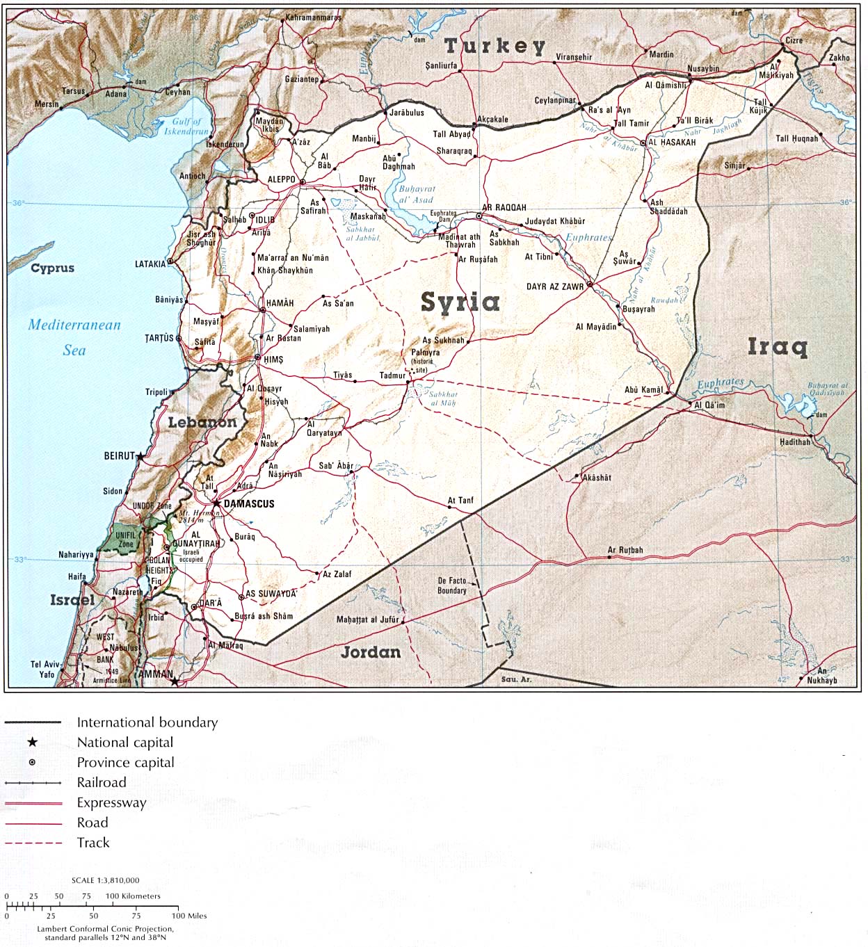
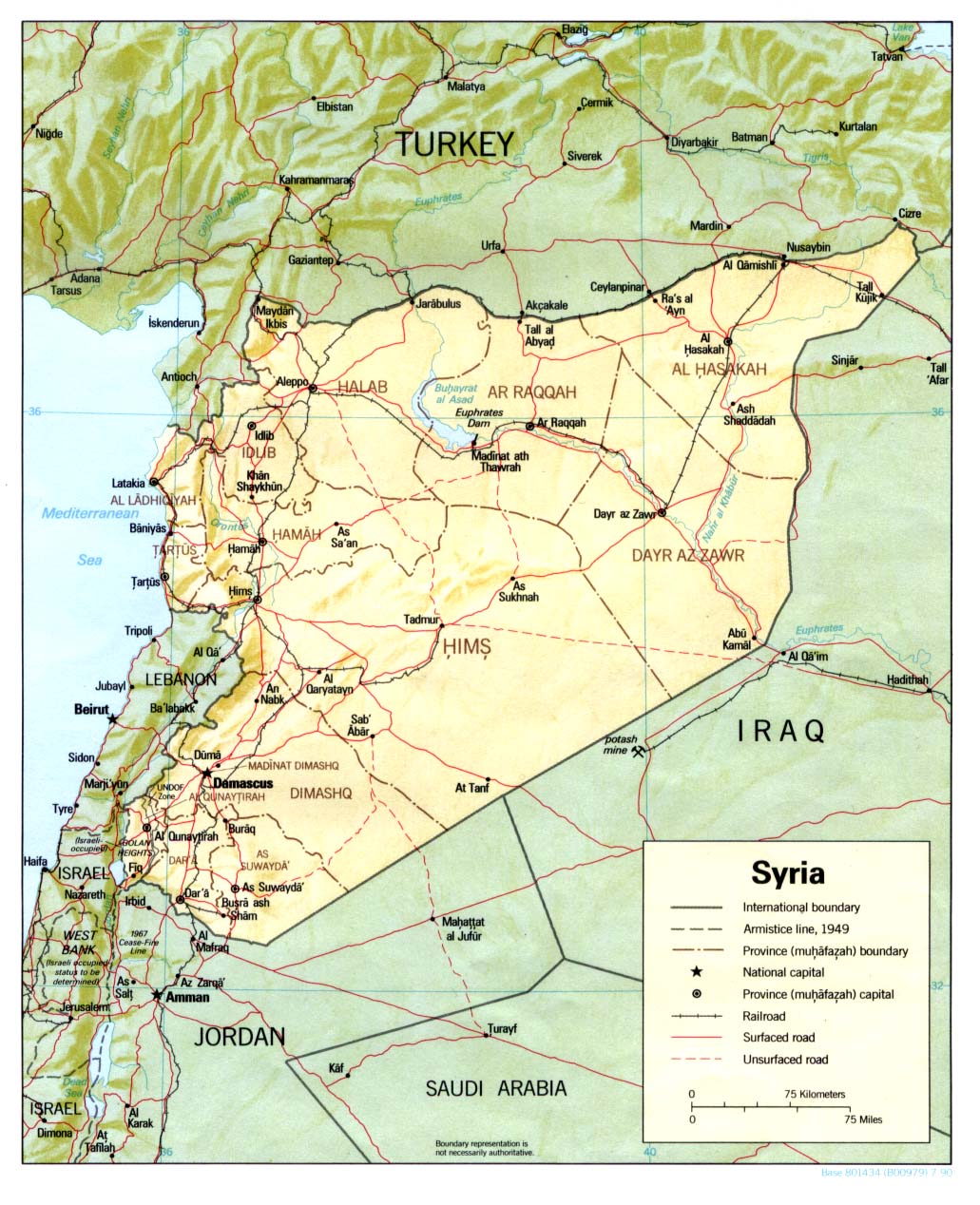
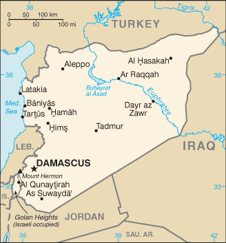
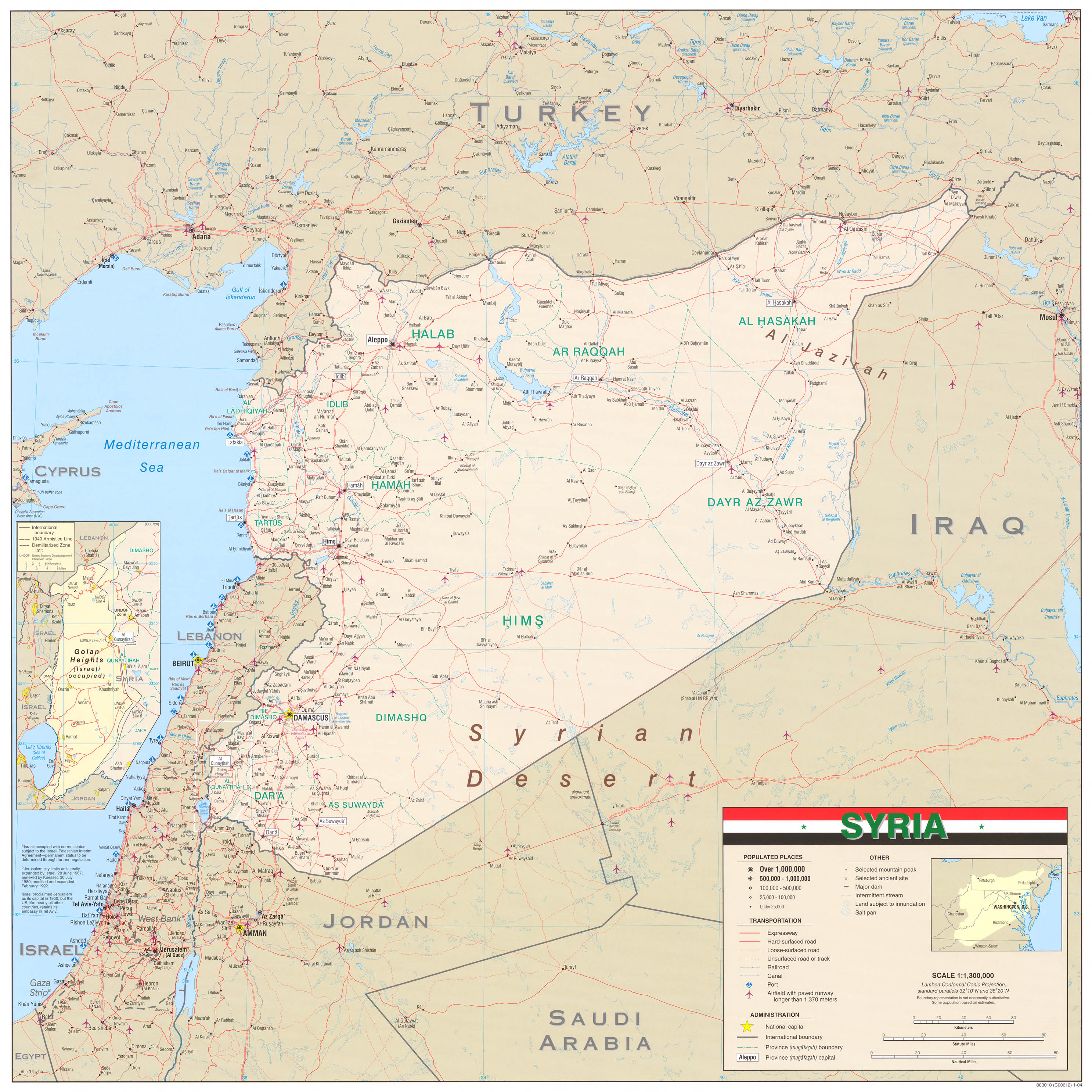
Happy editing. --nsaum75¡שיחת! 04:00, 12 November 2010 (UTC)
- Some of the first group ones are useful, particularly the National Geographic (though I think you are linking to copyvio, prolly should replace them with the originals like 1991, undated and 1989). The 1989 one includes a note:
This says that the National Geographic regards the Golan Heights Law as being an act of "formal annexation", which the Israeli government denied at the time, and that this act makes the internationally recognized border the "border claimed by Syria" as the undated map puts it. The ICRC map of Israel is a map of "Israel and the occupied territories" with a solid line between Israel and the Golan and each of the other occupied territories. Im not sure what you want though, do you say that we should have a map that places the Golan in Israel as the map for the article? There are certainly sources that do so, but they are very much in the minority. nableezy - 04:21, 12 November 2010 (UTC)The Golan Heights region in southwestern Syria was occupied by Israel during the 1967 war. A disengagement agreement with Syria in 1974 set aside an eastern strip under United Nations supervision. In December 1981 Israel formally annexed the Golan Heights.
- I'm sure they're copy-vios and the images themselves couldn't be used in Wiki article, but they at least give editors a place to look for them for consultation (if they cant find the original in a library). If you note, I included maps that showed several different statuses with regard to the Golan Heights, not just one particular view (e.g.: not just GH as part of Israel or GH as part of Syria). So, no, I'm not asking for any change at this time; I am putting them out there since in the past I recall there seemed to be a limited variety of maps available for editors to view. --nsaum75¡שיחת! 05:01, 12 November 2010 (UTC)
nsaum75, many of these maps that you have brought are representing a minority view. Many of them are undetailed and unreliable, Readers digest, maps.com, lonely planet, world atlas.biz are not reliable sources for this, several of those maps even show Golan as an occupied territory, not part of Israel but part of Syria. One map is just bizarre:[65] it shows Golan as part of Syria while at the same time shows it outside of Syria. Although there are some maps that are located in a reliable website, the National geographic is of course a reliable source, the maps at that website is against the view of the entire world. National geographic show Golan as part of Israel, no ceasefire line or occupied territory, so there we have a reliable source that is following the Israeli pov against the entire world view, I'm sure you are aware of that and that I can go and find many reliable sources and maps for this. We cant cherry pick from what appears to be a reliable source when all the other reliable sources clearly show that the National Geographic is wrong in this case. --Supreme Deliciousness (talk) 11:10, 12 November 2010 (UTC)
- My intent was to provide other sources available for editors, not to attempt to establish the Golan Heights as part of Israel. If you will note, inaddition to the National Geographic maps, several of the maps I brought forward showed the Golan as part of Syria, as well as some showing the GH as a separate shade from both of the countries. Anyhow, Wikipedia does not take sides (For example: most Golan Height's articles are in a related Golan Heights category, are subcategories of both respective Syria and Israel parent categories). --nsaum75¡שיחת! 12:55, 12 November 2010 (UTC)
- Its not a "side" to follow the view of all countries on earth and international organs, except one country. Those who claim "the earth is flat" aren't given the same weight as those who say "the earth is round". Present category's are wrong and should be fixed, you can not put the country it is internationally recognized as part of in the same position as a country it is not part of, there is nothing neutral about that. --Supreme Deliciousness (talk) 13:05, 12 November 2010 (UTC)
- I'm glad you mentioned the round earth/flat earth issue. The earth is not flat in any way, but for 40 years the Golan has been subject to the laws and government of Israel. So while the international community says one thing, the defacto is another. The international community could say the world is flat, but we have photos of the earth being round. Which wins? Again, like I said, WP does not take sides in disputes, much like many non-governmental organizations choose not to take sides in disputes. Anyhow, I am not here to debate the merits of categories etc. Happy editing. --nsaum75¡שיחת! 13:23, 12 November 2010 (UTC)
- You already know that whatever laws Israel has proclaimed has no real or authoritative effect and is not valid, I can show UN resolutions about this. Israels control is shown as it says "Israeli occupied" in the map so the reader can see that Israel controls it. The international community does not say "the world is flat", so I don't understand what you mean there. I already responded to your claim of "taking side" above.--Supreme Deliciousness (talk) 13:39, 12 November 2010 (UTC)
- SD, it all boils down to what being "part" of a country means. Is it its political sense or "on the ground" sense? Surley both, thats why there's this compromise. Chesdovi (talk) 13:28, 12 November 2010 (UTC)
- All countries recognizes it as part of Syria and not part of Israel, the Israeli occupation is shown in the image as it says over the area "Israeli occupied", this is following the exact view of the entire world, so how is your suggestion a "compromise" ? compromise for what? --Supreme Deliciousness (talk) 13:43, 12 November 2010 (UTC)
- I'm glad you mentioned the round earth/flat earth issue. The earth is not flat in any way, but for 40 years the Golan has been subject to the laws and government of Israel. So while the international community says one thing, the defacto is another. The international community could say the world is flat, but we have photos of the earth being round. Which wins? Again, like I said, WP does not take sides in disputes, much like many non-governmental organizations choose not to take sides in disputes. Anyhow, I am not here to debate the merits of categories etc. Happy editing. --nsaum75¡שיחת! 13:23, 12 November 2010 (UTC)
- Its not a "side" to follow the view of all countries on earth and international organs, except one country. Those who claim "the earth is flat" aren't given the same weight as those who say "the earth is round". Present category's are wrong and should be fixed, you can not put the country it is internationally recognized as part of in the same position as a country it is not part of, there is nothing neutral about that. --Supreme Deliciousness (talk) 13:05, 12 November 2010 (UTC)
I was referring to the cats. || The map may say IO, but it does not go far enough, esp. as those words cannot be seen unless you open the actual image. Chesdovi (talk) 14:00, 12 November 2010 (UTC)
Nsaum, the "facts on the ground" are covered by saying the territory is occupied by Israel. nableezy - 14:06, 12 November 2010 (UTC)
- Like I said. I brought maps I found for future reference by editors, since in the past the maps have been limited. I also said I wasn't trying to change the status at this time. I don't care to feed the well-documented battlefield mentality that some editors on both sides of the issue respond with when whenever anything is brought up that may or may not agree with the POV they support. I'm done now, and going back to my happy land of improving North & Central American-related articles. Saludos --nsaum75¡שיחת! 21:42, 12 November 2010 (UTC)
New shaded-relief map available

I stumbled into this article while following wikilinks on a Sunday afternoon, and was a little surprised that there was no relief map that depicts the heights of the Golan Heights. Without glancing at this discussion page, and therefore without seeing the list of maps linked above, I went ahead and created a map of my own, which is shown here to the right. Rather than sticking it right into the article, I'll give editors who are more familiar with this article the chance to decide where (or whether) to incorporate it.
I'm no expert on this subject matter, and I'm rather at the mercy of the accuracy of the GIS data cited on the image description page. I'd be happy to entertain suggestions on how to improve this map. I am bound by the availability of GIS data for the area, as well as my intent for the map -- I fully intended it to be more physical than cultural. An overlay of many town, highways, railroads, ephemeral boundaries, etc., would tend to obscure what I wanted to see here. --Kbh3rdtalk 04:13, 24 January 2011 (UTC)
- It is clearer than the one in the infobox so I think it would be great there.Cptnono (talk) 04:19, 24 January 2011 (UTC)
Current map problematic
The map currently used in the infobox, supposedly an improvment to the previous map, still has issues. I propose colouring the GH in a different shade. At the monment, the area, being white, looks as if its still part of Syria. Very misleading. Chesdovi (talk) 13:06, 12 November 2010 (UTC)
- Actually the current map was changed by Agadaurbanit without consensus, so if its going to be changed then it should be changed back to the original image as there was never consensus to change it. The present map is acceptable as it shows the occupied region in the same color as the rest of the country it is internationally recognized as part of. Your claim that it is not part of Syria is your own personal pov against the view of all countries on earth and international organs. --Supreme Deliciousness (talk) 13:11, 12 November 2010 (UTC)
- There are political views and good maps try to show these views in a simple and accurate fashion. Proper maps show the area as distinct from Syria, usually with diagonal lines, variant shading or the like, to show that it is under Israeli control. The current map very misleading. Previous map also misleading as had the word "Syria" straddling the GH area! Chesdovi (talk) 13:22, 12 November 2010 (UTC)
- Well the CIA map is a proper map and it is a "good" map, and it shows it in an accurate fashion. What are the "proper" and "good" maps you are talking about that shows it "distinct from Syria"? The current map says "Israeli occupied" to show that Israel occupies it. Your suggestion for how the map should look like is based on your personal believe of what country you yourself believe it is part of or not part of. --Supreme Deliciousness (talk) 13:31, 12 November 2010 (UTC)
- The CIA was good, in the sense that the GH area was shown shaded in a different colour to that of I and S. It was not proper as it had the word Syria inside it. A proper map would have just "GH IO". Chesdovi (talk) 14:03, 12 November 2010 (UTC)
- You claim of what a "proper map" should be would then not show that it is internationally recognized as part of Syria, so how would that be "proper" ? --Supreme Deliciousness (talk) 14:14, 12 November 2010 (UTC)
- The Golan Heights is Syrian territory. This is the super-majority view, and it is the view that NPOV requires Wikipedia to take. More than enough sources have been provided saying exactly this. No country except for Israrl says that the Golan is not in Syria. nableezy - 14:05, 12 November 2010 (UTC)
- We saw in the past, reliable maps using 3-color design, showing the GH as a separate color from both of Israel and Syria. Clear color-coding would be good. Wikipedia does not take sides, being neutral. AgadaUrbanit (talk) 22:49, 12 November 2010 (UTC)
- What maps? What "side" is the current or previous CIA map taking? Going by what you just said, you should maybe also go to the Haifa article and remove that its a city in Israel since Hamas claim its part of Palestine, "Wikipedia does not take sides, being neutral." --Supreme Deliciousness (talk) 23:04, 12 November 2010 (UTC)
- For instance this apolitical map designed by MAGELLAN Geographix from California, which hits #1 at Google for GH query. It is unusable because of license nevertheless it was mentioned in the archives, though we could reflect on neutrality of this image color-coding also today. AgadaUrbanit (talk) 23:41, 12 November 2010 (UTC)
- That map and maps like it have already been discussed before, and why they cant be used as an argument for what you want to do, and there was no consensus to change it based on that, do you have anything new to ad to the conversation or do you want to repeat the same conversation one more time? --Supreme Deliciousness (talk) 00:41, 13 November 2010 (UTC)
- SD, I probably was unclear. I'm happy with current map, since it is of very high resolution, it needed scaling down by order of magnitude just to get digested by Wiki servers. We're lucky to have this image and it was pointed by Nab, initially. If we reflect on neutrality, which is "non-negotiable" policy, 3-color map design would be preferable, might be an interesting discussion subject on neutrality noticeboard. However this is purely theoretical, so I am moving on. AgadaUrbanit (talk) 19:31, 13 November 2010 (UTC)
- If what you are saying is "neutral", then why aren't you removing that Haifa is in Israel in the Haifa article? And why aren't you replacing the map of Israel in the Israel article to one that says that all of Israel is disputed? Why don't you want to be "neutral" at those articles? --Supreme Deliciousness (talk) 22:52, 16 November 2010 (UTC)
- I'm okay with the current map but I would prefer a map that shows the Golan under Israeli sovereignty as that would more accurately reflect the realpolitik--Jiujitsuguy (talk) 16:32, 16 November 2010 (UTC)
- It is not under Israeli sovereignty, it is under Israeli occupation and the map says that. --Supreme Deliciousness (talk) 16:35, 16 November 2010 (UTC)
- SD, I probably was unclear. I'm happy with current map, since it is of very high resolution, it needed scaling down by order of magnitude just to get digested by Wiki servers. We're lucky to have this image and it was pointed by Nab, initially. If we reflect on neutrality, which is "non-negotiable" policy, 3-color map design would be preferable, might be an interesting discussion subject on neutrality noticeboard. However this is purely theoretical, so I am moving on. AgadaUrbanit (talk) 19:31, 13 November 2010 (UTC)
- That map and maps like it have already been discussed before, and why they cant be used as an argument for what you want to do, and there was no consensus to change it based on that, do you have anything new to ad to the conversation or do you want to repeat the same conversation one more time? --Supreme Deliciousness (talk) 00:41, 13 November 2010 (UTC)
- For instance this apolitical map designed by MAGELLAN Geographix from California, which hits #1 at Google for GH query. It is unusable because of license nevertheless it was mentioned in the archives, though we could reflect on neutrality of this image color-coding also today. AgadaUrbanit (talk) 23:41, 12 November 2010 (UTC)
- What maps? What "side" is the current or previous CIA map taking? Going by what you just said, you should maybe also go to the Haifa article and remove that its a city in Israel since Hamas claim its part of Palestine, "Wikipedia does not take sides, being neutral." --Supreme Deliciousness (talk) 23:04, 12 November 2010 (UTC)
- We saw in the past, reliable maps using 3-color design, showing the GH as a separate color from both of Israel and Syria. Clear color-coding would be good. Wikipedia does not take sides, being neutral. AgadaUrbanit (talk) 22:49, 12 November 2010 (UTC)
- The CIA was good, in the sense that the GH area was shown shaded in a different colour to that of I and S. It was not proper as it had the word Syria inside it. A proper map would have just "GH IO". Chesdovi (talk) 14:03, 12 November 2010 (UTC)
- Well the CIA map is a proper map and it is a "good" map, and it shows it in an accurate fashion. What are the "proper" and "good" maps you are talking about that shows it "distinct from Syria"? The current map says "Israeli occupied" to show that Israel occupies it. Your suggestion for how the map should look like is based on your personal believe of what country you yourself believe it is part of or not part of. --Supreme Deliciousness (talk) 13:31, 12 November 2010 (UTC)
- There are political views and good maps try to show these views in a simple and accurate fashion. Proper maps show the area as distinct from Syria, usually with diagonal lines, variant shading or the like, to show that it is under Israeli control. The current map very misleading. Previous map also misleading as had the word "Syria" straddling the GH area! Chesdovi (talk) 13:22, 12 November 2010 (UTC)
I agree with AgadaUrbanit. I think the current map is a big improvement, and I am glad that everyone has given (at least grudging) agreement. --Ravpapa (talk) 17:20, 16 November 2010 (UTC)
- I would add in concurrence with Chesdovi in that the GH should be shaded a different color to denote its disputed status.--Jiujitsuguy (talk) 22:13, 16 November 2010 (UTC)
- The other CIA map had the GH in a different color: [66] it can be changed back to that one if people want a map that highlights the area. --Supreme Deliciousness (talk) 22:20, 16 November 2010 (UTC)
- That map is not acceptable as it does not reflect realpolitik.--Jiujitsuguy (talk) 22:27, 16 November 2010 (UTC)
- Yes it does. It follows the entire worldview and facts on the ground. Btw since you said above that the GH should be shaded in a different color to "denote its disputed status", don't you think the map of Israel in the Israel article should also be shaded and have the text "disputed territory" ? Since you want GH to be shaded based on the believe of one nation, shouldn't the map of Israel also show that the entire land of Israel is disputed since that's the believe of around 20 countries? --Supreme Deliciousness (talk) 22:43, 16 November 2010 (UTC)
- The article should be reflecting what reliable sources say; the opinions of individual editors regarding realpolitiks are immaterial as far as the contents of the article are concerned. ← ZScarpia 23:52, 16 November 2010 (UTC)
- That map is not acceptable as it does not reflect realpolitik.--Jiujitsuguy (talk) 22:27, 16 November 2010 (UTC)
- The other CIA map had the GH in a different color: [66] it can be changed back to that one if people want a map that highlights the area. --Supreme Deliciousness (talk) 22:20, 16 November 2010 (UTC)
![[66]](https://en.wikipedia.org/wiki/File:Golan_heights_rel89-orig.jpg)
Supreme Deliciousness, regardless of their status, for purely pedagogical reasons it makes sense to color or shade in the Golan Heights - simply because they are the region that this article is about. I can't help getting the feeling that you're sacrificing Wikipedia's raison d'etre of educating its readers on the altar of your personal political agenda. —Preceding unsigned comment added by 132.64.188.36 (talk) 15:37, 26 December 2010 (UTC)
- So we will use this map and your concerns are taken care of: [67] --Supreme Deliciousness (talk) 17:39, 26 December 2010 (UTC)
- My guess is you're waxing tongue-in-cheek with that suggestion. Otherwise, yes, it would, for the reasons I laid out earlier, indeed be an improvement over the map that's currently being displayed. Again, the region the article's about should be clearly defined for the viewer - not with vague lines but with colors, shading, diagonal stripes, or the like. If you were earnestly committed to the spirit of Wikipedia, you would embrace that logic.132.64.208.150 (talk) 15:03, 29 December 2010 (UTC)
Explanation
I removed the united "Demographics" and "Towns, villages and settlements" sections and all the text inside of them where the Syrian population and villages were mixed with the Israeli settlements and settlers. They are not the same, they are two separate things, Syrian, pre-1967 Syrian, Israeli settlements. I also re added some of the previous pre-1967 information and images as they were removed without agreement or even discussion, including the Quenitra section. I also removed: "By 1971, villages in the Israeli-held territory were being bulldozed as "they had become a health hazard and provided refuge for stray dogs, cats and fedayeen." as its one soldiers saying this, not an official Israeli announcement. The 1989 numbers for the Syrian population is also non notable so I removed it. Majdal Shams population nr doesn't belong here. The Al-Ahram source says there are 32 Israeli settlements, not 34. The Israeli settlers should be called settlers as it identifies their status there and its what they are called in general. I also removed this sentence: "The current population of the entire area numbers around 120,000 and consists mainly of Druze (many of who regards themselves as Syrian) and Israeli Jews.", based on the same reasoning as above, why would we count the Syrian population of both sides of the ceasefire line together with the Israeli settlers? Its also false to claim that the majority of the 120 000 are Israeli Jews and Druze since Syria do not count its population in religion, so there are no numbers for the religion of the people in the Syrian controlled side. Also previously the Dayan quote was removed without consensus, I am not re adding it but adding a summary of the quote, the "similar claims" in the article is not presenting it correctly. Also removed the Hasmonean Kingdom map as it has been uncensored for a very long time. --Supreme Deliciousness (talk) 23:09, 26 December 2010 (UTC)
Jabal al Druze is not Golan, its another region in Suwayda gov. --Supreme Deliciousness (talk) 23:15, 26 December 2010 (UTC)
- I am obliged to revert. You made huge changes to the article, most of which you did not explain in your above comment. Among the unexplained changes you made was a revert of the Dayan quote, wholly inconsistent with the consensus wording above. As this is a contentious article, a far more constructive approach would be to make piecemeal changes while explaining each of them fully on the talk page. best, --brewcrewer (yada, yada) 23:25, 26 December 2010 (UTC)
- No I explained all changes, including the Dayan summary, when you reverted me a message popped up saying: "In accordance with Wikipedia:Requests for arbitration/Palestine-Israel articles#Discretionary sanctions, editors of this article are restricted to 1 revert per 24 hours and MUST explain the revert on the talk page. Violations of this restriction will lead to blocks." Are you going to self revert? --Supreme Deliciousness (talk) 23:33, 26 December 2010 (UTC)
- I tried to be as collegial as possible in my reasonable request to you regarding your mass unilateral changes to the article, and it's unfortunate that you could not reciprocate. There is a consensus that Dayan's quote is inconsistent with UNDUE. Your argument for removing demographics mentioning Jews-that Syria does not count its citizens by religion- does not appear to make sense, as Israel is currently the governing entity of the Golan Heights. Again, it would be far more constructive if you make piecemeal changes to this contentious article. Best, --brewcrewer (yada, yada) 23:41, 26 December 2010 (UTC)
- No there is not a consensus for that, as can be seen in the archive when it was discussed, and as I explained I did not even ad the quote, but a summary of it. I did not remove demographics mentioning Jews, what are you talking about? --Supreme Deliciousness (talk) 23:49, 26 December 2010 (UTC)
- this is exactly why its best that you make piecemeal changes. you removed an entire sentence about the demographics of the Jews in the GH, in the lede of all places, yet you don't know what i am "talking about."--brewcrewer (yada, yada) 00:46, 27 December 2010 (UTC)
- "I also removed this sentence: "The current population of the entire area numbers around 120,000 and consists mainly of Druze (many of who regards themselves as Syrian) and Israeli Jews.", based on the same reasoning as above, why would we count the Syrian population of both sides of the ceasefire line together with the Israeli settlers? Its also false to claim that the majority of the 120 000 are Israeli Jews and Druze since Syria do not count its population in religion,so there are no numbers for the religion of the people in the Syrian controlled side.", the sentence is factually incorrect, the numbers for Syrians and Israeli settlers are elsewhere in the article. You didn't look at my edits and you didn't read what I said above, I explained the entire edit above, so you cant just revert everything like you did. --Supreme Deliciousness (talk) 01:05, 27 December 2010 (UTC)
- please clarify what exactly you are talking about. counting syrians on the israeli side? what are you talking about?--brewcrewer (yada, yada) 05:27, 27 December 2010 (UTC)
- This is the sentence that I removed: "The current population of the entire area numbers around 120,000 and consists mainly of Druze (many of who regards themselves as Syrian) and Israeli Jews.", the only sources for these 120 000 people we have about their religion are for one third/40 000 of these peoples. The other two thirds/80 000 people, we don't know what religion they have, they might be sunnis or something else. So how can we say that the majority of these 120 000 peoples are Israeli Jews and Druze? Even if we had information about the religion of all 120 000 people, there is no reason to put together the Syrian population with the Israeli settlers and presenting them as one number. They are not the same thing and they're presence in Golan is not the same. The numbers for Israeli settlers and Syrians are elsewhere in the article, and this incorrect sentence does not need to be in the lead. There can be information about the population in the lead but it has to be presented as Syrians (both sides of the ceasefire line) and Israeli settlers as separate numbers. --Supreme Deliciousness (talk) 10:55, 27 December 2010 (UTC)
- please clarify what exactly you are talking about. counting syrians on the israeli side? what are you talking about?--brewcrewer (yada, yada) 05:27, 27 December 2010 (UTC)
- "I also removed this sentence: "The current population of the entire area numbers around 120,000 and consists mainly of Druze (many of who regards themselves as Syrian) and Israeli Jews.", based on the same reasoning as above, why would we count the Syrian population of both sides of the ceasefire line together with the Israeli settlers? Its also false to claim that the majority of the 120 000 are Israeli Jews and Druze since Syria do not count its population in religion,so there are no numbers for the religion of the people in the Syrian controlled side.", the sentence is factually incorrect, the numbers for Syrians and Israeli settlers are elsewhere in the article. You didn't look at my edits and you didn't read what I said above, I explained the entire edit above, so you cant just revert everything like you did. --Supreme Deliciousness (talk) 01:05, 27 December 2010 (UTC)
- this is exactly why its best that you make piecemeal changes. you removed an entire sentence about the demographics of the Jews in the GH, in the lede of all places, yet you don't know what i am "talking about."--brewcrewer (yada, yada) 00:46, 27 December 2010 (UTC)
- No there is not a consensus for that, as can be seen in the archive when it was discussed, and as I explained I did not even ad the quote, but a summary of it. I did not remove demographics mentioning Jews, what are you talking about? --Supreme Deliciousness (talk) 23:49, 26 December 2010 (UTC)
- I tried to be as collegial as possible in my reasonable request to you regarding your mass unilateral changes to the article, and it's unfortunate that you could not reciprocate. There is a consensus that Dayan's quote is inconsistent with UNDUE. Your argument for removing demographics mentioning Jews-that Syria does not count its citizens by religion- does not appear to make sense, as Israel is currently the governing entity of the Golan Heights. Again, it would be far more constructive if you make piecemeal changes to this contentious article. Best, --brewcrewer (yada, yada) 23:41, 26 December 2010 (UTC)
- No I explained all changes, including the Dayan summary, when you reverted me a message popped up saying: "In accordance with Wikipedia:Requests for arbitration/Palestine-Israel articles#Discretionary sanctions, editors of this article are restricted to 1 revert per 24 hours and MUST explain the revert on the talk page. Violations of this restriction will lead to blocks." Are you going to self revert? --Supreme Deliciousness (talk) 23:33, 26 December 2010 (UTC)
We need to rely on sources which gives details about the population, (this does not necessarily have to stem from a government census). We also need to acertain what area the GH applies to. Once we have both these clear, we can write how many people live in the GH and what religion they are. Chesdovi (talk) 01:23, 27 December 2010 (UTC)
- I believe the demographic data should be presented as cold numbers without words like "most", "majority" and "minority". This info has a very strong impact on the subject and should be there. TFighterPilot (talk) 10:20, 30 January 2011 (UTC)