
Faridkot, India
Faridkot
ਫ਼ਰੀਦਕੋਟ | |
|---|---|
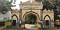
    Clockwise from top: Government Brijindra College in Faridkot, House in faridkot, Investiture Gate, Military Station | |
 | |
 Faridkot  Faridkot | |
| Coordinates: 30°40′N 74°46′E / 30.67°N 74.76°E | |
| Country | |
| State | Punjab |
| District | Faridkot |
| Founded by | Raja Mokalsi |
| Government | |
| • Type | Municipal Council |
| • Deputy Commissioner | Vineet Kumar, IAS |
| Area | |
| • Total | 18.14 km2 (7.00 sq mi) |
| Elevation | 196 m (643 ft) |
| Population (2011) | |
| • Total | 87,695 |
| • Density | 4,842/km2 (12,540/sq mi) |
| Demonym | Faridkotian |
| Languages | |
| • Official | Punjabi |
| Time zone | UTC+5:30 (IST) |
| PIN | 151203 |
| Telephone code | +91-1639 |
| Vehicle registration | PB-04 |
| Sex ratio | 1000/890 ♂/♀ |
| Literacy | 72% |
| Website | www |
Faridkot is a city in the South-western part of state of Punjab, India. It serves as the headquarters for both, the Faridkot district. as well as the Faridkot Division. The division was established in 1995 at Faridkot which includes Faridkot, Bathinda, and Mansa districts.
Etymology[edit]
The city is named in the honor of Baba Farid, a revered 13th century Sufi saint whose shrine is located in Pakpattan, Pakistan. The town of Faridkot was founded during this century as Mokalhar by Raja Mokalsi, the grandson of Rai Munj, a Bhatti Chief of Bhatnair, Rajasthan. According to a popular folklore, the Raja renamed Mokalhar to Faridkot after Baba Farid paid a visit to the town. It remained the capital during the reign of Mokalsi's son Jairsi and Wairsi.
History[edit]
The historic fort of Quila Mubarak exists since the times of Baba Farid. However, the foundation of the modern city as a princely state was laid in 1763 by Hamir Singh.Beginning in 1807, the city was briefly under the rule of Maharaja Ranjit Singh till 1809. It was restored to the reigning Brar family through British intervention. The city continued as the capital of Faridkot State under British suzerainty till 1947. Later, it became a part of the Patiala & East Punjab States Union (PEPSU) in 1948. Faridkot was carved out as a separate district on 7 August 1972 out of the areas of erstwhile Bathinda District (Faridkot Tehsil) and Ferozepur District (Moga and Muktsar Tehsils). Further, in November 1995 the Faridkot District was trifurcated when two of its sub divisions viz. Muktsar and Moga were given the status of independent districts under the leadership of CM Harcharan Singh Brar of Muktsar
Government body[edit]
The Municipal Council Faridkot came into existence in the year 1948 and now has a Class -I status. Uma Grover is the current President of the council and Kushaldeep Singh Dhillon of Indian National Congress is the member of Legislative Assembly from the town elected in 2017.
Geography[edit]
The average elevation is 196 metres (643 ft). The town is located on the Punjab Plains, which in a macro regional context forms a part of greater Satluj Ganga plain. It is a low-lying flat area. The surface of the district is depositional plain which was formed by alleviation by the rivers flowing in these plains. Sirhind Feeder and Indira Gandhi Canal pass through the district. The topography of the district is plain, with only 1.4% of its area under forest cover.
Demographics[edit]
As of 2011[update] India census,[1] Faridkot had a population of 618,008 which constitute about 2% of the total population of Punjab. Males constitute 327,121 of the population and females 290,887.The population density in this district is 424 persons per km2. Faridkot has an average literacy rate of 70.6%: male literacy is 75.9%, and female literacy is 64.8%.
| Religious group |
1881[3][4]: 520 [5]: 250 | 1901[6]: 44 [7]: 26 | 1911[8]: 23 [9]: 19 | 1921[10]: 25 [11]: 21 | 1931[12]: 26 | 1941[2]: 32 | 2011[13] | |||||||
|---|---|---|---|---|---|---|---|---|---|---|---|---|---|---|
| Pop. | % | Pop. | % | Pop. | % | Pop. | % | Pop. | % | Pop. | % | Pop. | % | |
| Islam |
3,241 | 49.16% | 5,109 | 49.1% | 5,464 | 46.81% | 6,261 | 50.89% | 8,605 | 51.35% | 10,228 | 50.2% | 470 | 0.54% |
| Hinduism |
1,862 | 28.24% | 3,358 | 32.27% | 4,027 | 34.5% | 3,649 | 29.66% | 3,830[b] | 22.85% | 4,742[b] | 23.27% | 43,112 | 49.16% |
| Sikhism |
1,226 | 18.6% | 1,626 | 15.63% | 1,854 | 15.88% | 2,024 | 16.45% | 3,865 | 23.06% | 4,608 | 22.62% | 42,652 | 48.64% |
| Jainism |
264 | 4% | 306 | 2.94% | 327 | 2.8% | 354 | 2.88% | 434 | 2.59% | 740 | 3.63% | 741 | 0.84% |
| Christianity |
— | — | 6 | 0.06% | 1 | 0.01% | 16 | 0.13% | 25 | 0.15% | 50 | 0.25% | 415 | 0.47% |
| Buddhism |
— | — | 0 | 0% | 0 | 0% | 0 | 0% | 0 | 0% | — | — | 65 | 0.07% |
| Others | 0 | 0% | 0 | 0% | 0 | 0% | 0 | 0% | 0 | 0% | 7 | 0.03% | 240 | 0.27% |
| Total population | 6,593 | 100% | 10,405 | 100% | 11,673 | 100% | 12,304 | 100% | 16,759 | 100% | 20,375 | 100% | 87,695 | 100% |
Transport[edit]
Faridkot city is well connected by road through National Highway 54. Faridkot railway station, located in the city lies on Bhatinda - Firozpur line. Many trains connect Faridkot to other major cities in Punjab and other states. The nearest airport, Bathinda Airport is located near Bathinda.[14]
Climate[edit]
The climate of Faridkot is mostly dry, characterized by a very hot summer, a short rainy season and a bracing winter. The cold season is from November to March. it is followed by the summer season which lasts up to the end of June. The period from July to the middle of September constitutes the southwest monsoon season. The later half of September and October is the post-monsoon or transition period. The temperature increases rapidly beginning with the end of March till June, which is the hottest month, with the mean daily minimum temperature about 41 °C or 105.8 °F and the mean daily minimum about 26.5 °C or 79.7 °F. The temperature is intensively hot during this period. The maximum temperature can go beyond 47 °C or 116.6 °F on some days. With the onset of the monsoon by the end of June or early July, there is an appreciable drop in the day temperature. After October, both the day and night temperatures decrease rapidly till January which is the coolest month. The mean daily maximum temperature in January is about 20 °C or 68 °F and the mean daily minimum about 4.5 °C or 40.1 °F.
The average annual rainfall in the district is 433 millimetres or 17 inches ; about 71 percent of the annual rainfall in the district is received during the monsoon months July to September. Some rainfall occurs during the pre-monsoon months, mostly in the form of thundershowers. Weather is moderately cloudy during the monsoon season. During the rest of the year the skies are mostly clear. Wind speed is normally slow and flows in north to northwest, some times in southeast direction, throughout the year.
Festival (Aagman Purab)[edit]
Every year, a festival is held to commemorate the arrival of Baba Farid in Faridkot. The festival is held for 3 days every year from 21–23 September. On 23 September, a grand parade departs from Tilla Baba Farid (Sikh Temple) and reaches Godari Sahib (Sikh Temple).
Education[edit]
The city houses Baba Farid University of Health Sciences, which is the premier medical university of Punjab. Guru Gobind Singh Medical College and Hospital was established in the year 1978.Dasmesh Institute of Research & Dental Sciences is another medical school in the city. Government Brajindra College was set-up in 1942 and Desh Bhagat Pandit Chetan Dev Government College of Education[15] established in 1945 by the Faridkot Royalty. Dasmesh Public School ,Faridkot, Baba Farid Public School, St. Mary's Convent School, Mount Litera Zee School, Dashmesh Global School, Baba Farid Law College, Delhi International School, Balbir School and Dr. Mohinder Brar Sambhi Government Girls Sr. Sec. School are prominent schools in the town besides several other educational institutes. Kendriya Vidyalaya and New Model Sen. Sec School is also located in the town. Adesh institute of engineering and technology is also situated in the city.
There are 96 private English language schools in the city.[16]
Hospitals[edit]
- Guru Gobind Singh Medical College, Faridkot
- Sant Baba Karnail Dass Medical Charitable Hospital, Vivek Ashram
- Dasmesh Institute of Research & Dental Sciences, Faridkot
- Civil Hospital, Faridkot
- Madhu Nursing Home,Faridkot
- Balbir Hospital, Faridkot
- Preet Hospital, Faridkot
- Sukhmani hospital and heart care centre
Notable people[edit]
- Giani Zail Singh, a former President of India
- Sukhbir Singh Badal, a former Deputy Chief Minister of Punjab
- Muhammad Sadiq, a Member of Parliament (Lok Sabha)
- Sadhu Singh, a Member of Parliament (Lok Sabha)
- Kushaldeep Singh Dhillon, a former MLA
- Mantar Singh Brar, a former MLA
- Rupinder Pal Singh, a hockey player
- Ihana Dhillon, an actress
-
 Entrance of Farmer's House Faridkot
 -
 Foundation Stone of Harindra - Civil Hospital Faridkot
 -
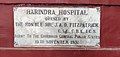 Foundation Stone of Harindra - Civil Hospital Faridkot
 -
 Foundation stone of Govt. School of Bargari (Faridkot)
 -
 Entrance of District Court Faridkot
 -
 Foundation Stone of Davies Model Agricultural Farm and Farmers's House Faridkot
 -
 Govt. Brijindra College Faridkot
 -
 Govt.Brijindra College Faridkot


Notes[edit]
- ^ 1881-1941: Data for the entirety of the town of Faridkot, which included Faridkot Municipality.[2]: 32
- ^ a b 1931-1941: Including Ad-Dharmis
References[edit]
- ^ "Census of India 2001: Data from the 2001 Census, including cities, villages and towns (Provisional)". Census Commission of India. Archived from the original on 16 June 2004. Retrieved 1 November 2008.
- ^ a b "CENSUS OF INDIA, 1941 VOLUME VI PUNJAB". Retrieved 9 January 2024.
- ^ "Census of India, 1881 Report on the Census of the Panjáb Taken on the 17th of February 1881, vol. I." 1881. JSTOR saoa.crl.25057656. Retrieved 14 January 2024.
- ^ "Census of India, 1881 Report on the Census of the Panjáb Taken on the 17th of February 1881, vol. II". 1881. JSTOR saoa.crl.25057657. Retrieved 14 January 2024.
- ^ "Census of India, 1881 Report on the Census of the Panjáb Taken on the 17th of February 1881, vol. III". 1881. JSTOR saoa.crl.25057658. Retrieved 20 January 2024.
- ^ "Census of India 1901. Vol. 1A, India. Pt. 2, Tables". 1901. JSTOR saoa.crl.25352838. Retrieved 9 January 2024.
- ^ "Census of India 1901. [Vol. 17A]. Imperial tables, I-VIII, X-XV, XVII and XVIII for the Punjab, with the native states under the political control of the Punjab Government, and for the North-west Frontier Province". 1901. JSTOR saoa.crl.25363739. Retrieved 9 January 2024.
- ^ Edward Albert Gait, Sir; India Census Commissioner (1911). "Census of India, 1911. Vol. 1., Pt. 2, Tables". Calcutta, Supt. Govt. Print., India, 1913. JSTOR saoa.crl.25393779. Retrieved 9 January 2024.
- ^ "Census of India 1911. Vol. 14, Punjab. Pt. 2, Tables". 1911. JSTOR saoa.crl.25393788. Retrieved 9 January 2024.
- ^ "Census of India 1921. Vol. 1, India. Pt. 2, Tables". 1921. JSTOR saoa.crl.25394121. Retrieved 9 January 2024.
- ^ "Census of India 1921. Vol. 15, Punjab and Delhi. Pt. 2, Tables". 1921. JSTOR saoa.crl.25430165. Retrieved 9 January 2024.
- ^ "CENSUS OF INDIA, 1931 VOLUME XVII PUNJAB PART II TABLES". Retrieved 9 January 2024.
- ^ "C -1 POPULATION BY RELIGIOUS COMMUNITY - 2011". census.gov.in. Retrieved 20 January 2024.
- ^ "How to reach Faridkot". Faridkot district official website. Retrieved 25 August 2020.
- ^ Cited May 2022 http://www.northhilleducation.com/college/punjab/faridkot/44775-desh-bhagat-pandit-chetan-dev-govt-college-dbpcdgc/department-of-education
- ^ Salopek, Paul (12 July 2018). "Walking Through a Youthful Exodus in India". National Geographic Society.
Faridcot has a battered three-star hotel called the Trump Plaza and 96 private English language schools.
External links[edit]
- Official website Archived 16 January 2021 at the Wayback Machine
- Faridkot district
- Baba Farid University of Health Sciences,Faridkot
- Govt. Brijindra college Archived 25 June 2019 at the Wayback Machine
- Dasmesh Institute Of Research And Dental Sciences, Faridkot
- GOVT. INDUSTRIAL TRAINING INSTITUTE, FARIDKOT
- BABA FARID LAW COLLEGE, FARIDKOT
Places adjacent to Faridkot, India | |
|---|---|
| Topics |  | |
|---|---|---|
| Administration | ||
| Culture |
| |
| Divisions |
| |
| Districts | ||
| Major cities | ||
| International | |
|---|---|
| National | |